Arrowe Country Park

Last updated

Arrowe Country Park
Arrowe Park - DSC04040.JPG
Arrowe Country Park
Arrowe Country Park
TypeCountry park
Location Arrowe Park
Coordinates 53°22′03″N3°06′03″W / 53.3674°N 3.1009°W / 53.3674; -3.1009
Area250 acres (1.0 km2)
Created1926
Operated by Metropolitan Borough of Wirral
OpenAll year

Arrowe Country Park is a country park in Arrowe Park, Wirral, England, adjacent to the Woodchurch housing estate. [1] The estate upon which the park lies was founded and shaped by John Shaw, a former Mayor of Liverpool who made his wealth from the slave trade. [2] When he died the estate passed to his great nephew John "Ralph" Shaw, who built Arrowe Hall, an Elizabethan-style mansion, and laid out the grounds and gardens. Ralph Shaw was a magistrate who dissuaded people from trespassing on his land with traps including spring-loaded shotguns.

Contents

In 1926 the estate was bought by the Birkenhead Corporation who turned it over to public recreation. The park's facilities include nature walks, meadows, a lake, an eighteen hole golf course and it is a Site of Biological Interest.

History

The estate upon which the country park now sits was founded by John Shaw, a merchant shipping owner, who made much of his wealth from the shipping of slaves between Africa and Jamaica. He was also the Mayor of Liverpool from 1794–95 and 1800–01, being noted for his charity to the poor and needy. [3] John Shaw retired to the Wirral and purchased Arrowe House Farm, a now-demolished mansion, and continued to buy land in the Arrowe area. In 1829 he died, leaving the estate to this great nephew John "Ralph" Shaw. In 1840 John Wright purchased land owned by Warrington grammar school and sold it on to Ralph Shaw, who now owned 748 out of 752 acres of Arrowe township. [4]

The mansion house upon the estate, Arrowe Hall, was built in 1835 by Ralph Shaw. During this time he landscaped the park; he also changed the course of Arrowe Brook and dammed it to create Arrowe Lake and a waterfall. Ralph Shaw, a magistrate, was very tough on trespassers and poachers in court. On his estate he installed mantraps and spring-loaded shotguns to dissuade poachers and trespassers from straying onto his land. [5]

In the early 1900s Arrowe Estate was bought by Major McCalmont, but as he was in the army he rented it to John Williamson, the shipping magnate who created the Williamson Art Gallery and Museum. In 1917 the estate was sold to Lord Leverhulme. It was sold again in 1926, to the Birkenhead Corporation who converted it to public recreation. Between 29 July and 12 August 1929, the 3rd World Scout Jamboree was held at Arrowe Park. In the 1930s the golf course, tennis courts and bowling greens were built, brass bands played on the hall lawn and some of the hall was used as a cafe. At the beginning of World War II the Hall was an army headquarters. After returning from Dunkirk many French soldiers were stationed in huts on the park; the park was also used for tank training. [6]

Arrowe Hall

Arrowe Hall was built by John Ralph Shaw between 1835 and 1844 in an Elizabethan style, the hall was extended between 1864 and 1876 with a billiards room and a conservatory being built. The hall had servants quarters, a study, library, dining room, withdrawing room, kitchen, washhouse, laundry area, cellar, a school room and nurseries. The grounds had well-maintained lawns with shrubs, an orchard, a stable and a coach house for guests. [7] Arrowe Hall was grade II listed with Historic England in 1974. [8] The hall has passed through a number of owners and has been converted into a care home for adults with disabilities. [9]

Facilities

There is an 18-hole municipal golf course, a 9 hole pitch and putt golf course, footgolf, a children's play area, an outdoor gym, tennis courts, open parkland, ponds, deciduous forest, a crown green bowling area, a fishing lake, orienteering, woodland walks, dog walking, cycling, a cafe, toilets and picnic areas. Arrowe Brook flows along the western edge of the park, from south to north, alongside a path. The brook also incorporates Arrowe Park Lake. The park has an area of 250 acres (1.0 km2) and is open all year. [1]

Nature

Arrowe Country Park contains a Site of Biological Importance which covers Nicholson’s Plantation, Gorse Covert, the golf course, the hay meadow, Arrowe Brook, Arrowe lake and the trees near Arrowe Hall which are bat roosts. [10] A variety of bird life can be found which include nuthatches, treecreepers and woodpeckers. The wildflower meadows attract butterflies such as small heath, skipper and the speckled wood. The ponds in the park are habitats for frogs, damsel flies and dragonflies. [11]

Related Research Articles

<span class="mw-page-title-main">Merseyside</span> County of England

Merseyside is a ceremonial and metropolitan county in North West England. It borders Lancashire to the north, Greater Manchester to the east, Cheshire to the south, the Welsh county of Flintshire across the Dee Estuary to the southwest, and the Irish Sea to the west. The largest settlement is the city of Liverpool.

<span class="mw-page-title-main">Birkenhead</span> Town in Wirral, Merseyside, England

Birkenhead is a town in the Metropolitan Borough of Wirral, Merseyside, England; historically, it was part of Cheshire until 1974. The town is on the Wirral Peninsula, along the west bank of the River Mersey, opposite Liverpool. At the 2011 census, it had a population of 88,818.

<span class="mw-page-title-main">Bidston</span> Village in Wirral, Merseyside, England

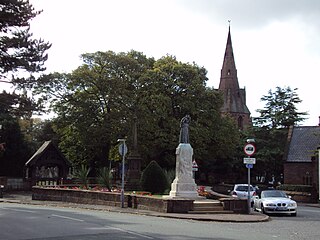
Bidston is a village and civil parish in the Metropolitan Borough of Wirral in Merseyside, England.

<span class="mw-page-title-main">Eastham, Merseyside</span> Village in England

Eastham is a village and an electoral ward of the Metropolitan Borough of Wirral, in Merseyside, England. Historically, it was part of Cheshire. It is situated on the Wirral Peninsula, to the south of Bromborough and to the east of Willaston.

<span class="mw-page-title-main">Moreton, Merseyside</span> Town in Merseyside, England

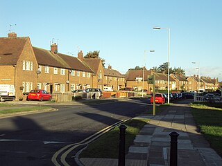
Moreton is a town in the Metropolitan Borough of Wirral in Merseyside, England. It is located approximately 3 mi (4.8 km) to the west of Wallasey. Historically part of Cheshire, it is now within the Metropolitan Borough of Wirral. The town was divided in 2004 between the local government wards of Leasowe & Moreton East and Moreton West & Saughall Massie. Moreton is also part of the parliamentary constituency of Wallasey.

<span class="mw-page-title-main">Tranmere, Merseyside</span> Human settlement in England

Tranmere is a suburb of Birkenhead, on the Wirral Peninsula, England. Administratively, it is within the Birkenhead and Tranmere Ward of the Metropolitan Borough of Wirral, in Merseyside. Before local government reorganisation on 1 April 1974, it was part of the County Borough of Birkenhead, within the geographical county of Cheshire.

<span class="mw-page-title-main">Upton, Merseyside</span> Village in England

Upton is a village in the northern part of the Wirral Peninsula, England, and is situated within 4 miles (6.4 km) of Birkenhead, 4 miles (6.4 km) of the Dee Estuary, a similar distance from the River Mersey, and 2 miles (3.2 km) from Liverpool Bay. The village is a ward of the Metropolitan Borough of Wirral in the metropolitan county of Merseyside. Upton was in the traditional county of Cheshire. At the 2011 census, the population was 16,130.

<span class="mw-page-title-main">Wallasey</span> Town in Merseyside, England

Wallasey is a town in the Metropolitan Borough of Wirral, Merseyside, England. Within the boundaries of the historic county of Cheshire, it is at the mouth of the River Mersey, on the north-eastern corner of the Wirral Peninsula. At the 2011 Census, the population was 60,284.

<span class="mw-page-title-main">Wirral Peninsula</span> Peninsula in North West England

The Wirral Peninsula, known locally as the Wirral, is a peninsula in North West England. The roughly rectangular peninsula is about 15 miles (24 km) long and 7 miles (11 km) wide, and is bounded by the Dee Estuary to the west, the Mersey Estuary to the east, and Liverpool Bay to the north.

<span class="mw-page-title-main">Greasby</span> Town in Wirral, England

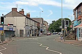
Greasby is a large village on the Wirral Peninsula, Merseyside, England. A predominantly residential area, it is contiguous with Upton to the east and Saughall Massie to the north. The small village of Frankby is to the immediate west. Historically within the county of Cheshire, it is part of the Greasby, Frankby and Irby Ward of the Metropolitan Borough of Wirral and is in the parliamentary constituency of Wirral West.

<span class="mw-page-title-main">Birkenhead Park</span> Public park in Birkenhead, Wirral, England

Birkenhead Park is a major public park located in the centre of Birkenhead, Merseyside, England. It was designed by Joseph Paxton and opened on 5 April 1847.

<span class="mw-page-title-main">Woodchurch, Merseyside</span> Village in England

Woodchurch is an area of Birkenhead on the Wirral Peninsula, in England. Administratively, Woodchurch is within the Metropolitan Borough of Wirral, its parliamentary constituency is Wirral West, and its local council ward is Upton. At the 2001 Census, it had a population of 8,400. Woodchurch is dominated by a large housing development, known as the Woodchurch Estate. The district is served by several schools and has the major Arrowe Park Hospital just outside its boundary, which was built on 15 acres (61,000 m2) of the park itself and opened in 1982.

<span class="mw-page-title-main">Saughall Massie</span> Village on the Wirral Peninsula, Merseyside, England

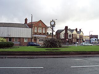
Saughall Massie is a village on the Wirral Peninsula, Merseyside, England. It is part of the Moreton West & Saughall Massie Ward of the Metropolitan Borough of Wirral and the parliamentary constituency of Wallasey. A small village primarily made up of large fields owned by local farmers, it is bordered by Greasby, Meols, Moreton and Upton. At the 2001 census Saughall Massie had a population of 1,260.

<span class="mw-page-title-main">Arrowe Park</span> Area of Wirral, England

Arrowe Park is an area 6.5 km (4.0 mi) to the west of Birkenhead, within the Metropolitan Borough of Wirral, Merseyside, England. It is situated on the Wirral Peninsula, adjacent to the Woodchurch housing estate and to the south of the large village of Upton. The location has two landmarks: Arrowe Park Hospital and Arrowe Country Park, along with a number of residences.

<span class="mw-page-title-main">Meadow Brook Hall</span> United States historic place

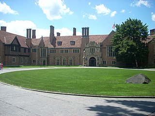
Meadow Brook Hall is a Tudor revival style mansion located at 350 Estate Drive in Rochester Hills, Michigan. It was built between 1926 and 1929 by the heiress to the Dodge automaker fortune, Matilda Dodge Wilson and her second husband, lumber baron, Alfred Wilson. Covering 88,000 square feet (8,200 m2) with 110 rooms, the structure is the fourth largest historic mansion museum in the United States, and is classified as one of America's Castles. In 1957, the mansion and the surrounding property and buildings were donated to the state of Michigan in order to fund Michigan State University–Oakland, now known as Oakland University. The structure was named a National Historic Landmark in 2012.

<span class="mw-page-title-main">High Elms Country Park</span>

High Elms Country Park is an extensive 250-acre (100 ha) public park on the North Downs in Farnborough in the London Borough of Bromley. It is a Local Nature Reserve, and together with the neighbouring Downe Bank, a Site of Special Scientific Interest. The park surrounds High Elms Golf Course, and has extensive woodland, chiefly oak and beech, chalk meadows and formal gardens. It also has a cafe, a visitor centre, nature and history trails and car parks.

<span class="mw-page-title-main">Birkenhead General Hospital</span> Former hospital in Birkenhead, Wirral, England

Birkenhead General Hospital was a hospital situated on Park Road North, between Prince Edward Street and Livingstone Street, in Birkenhead, England.

<span class="mw-page-title-main">Lamorbey Park</span>

Lamorbey Park is a 57-hectare (140-acre) park in Lamorbey, in the London Borough of Bexley, set around a Grade II listed mansion, Lamorbey House. The original 17th century estate consisted of 119 hectares, but over time sections of the estate have been separated for other uses, including two secondary schools, Rose Bruford College, and Sidcup Golf Club. The area of the park still in public ownership includes The Glade, a 7.4-hectare (18-acre) area of historic landscape laid in the 1920s with a large lake. The park was added to the Register of Historic Parks and Gardens of special historic interest in 1988.

John Shaw (1751-1830) was a slave trader and the former Mayor of Liverpool. Shaw was responsible for at least 33 slave voyages. Over half of his slaves were kidnapped from the Bight of Biafra.

References

  1. 1 2 Wirral Council. "Arrowe Country Park".
  2. Wirral Council, Parks and Countryside Service. "Arrowe Country Park: Management Plan & Security Audit" (PDF). p. 5.
  3. Arrowe Park Golf Club. "Arrowe Hall and Park" (PDF). p. 1.
  4. "arrowe". oldwirral.net.
  5. Arrowe Park Golf Club. "Arrowe Hall and Park" (PDF). p. 1.
  6. Wirral Council, Parks and Countryside Service. "Arrowe Country Park: Management Plan & Security Audit" (PDF). p. 5.
  7. "Arrowe Hall". oldwirral.net.
  8. Historic England. "Arrowe Hall, Wirral". historicengland.org.uk.
  9. The Regard Partnership. "Overview – Arrowe Hall". NHS.
  10. "Wirral Council – Parks and Countryside Service" (PDF). p. 20.
  11. "arrowepark". oldwirral.net.