West Kirby is a coastal town in the Metropolitan Borough of Wirral, Merseyside, England. In the north west of the Wirral Peninsula and at the mouth of the River Dee, the town is contiguous with Hoylake and historically within Cheshire.

Pensby is a large village on the Wirral Peninsula, in Merseyside, England. It is located 1.5 miles (2.4 km) to the north of the town of Heswall and approximately 0.5 miles (0.80 km) to the south west of Thingwall. Historically within Cheshire, the area is part of the Pensby and Thingwall Ward of the Metropolitan Borough of Wirral and is in the parliamentary constituency of Wirral West.

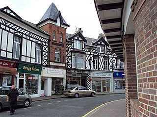
Heswall is a coastal town in the Metropolitan Borough of Wirral in Merseyside, England. It was historically part of Cheshire and is located on the Wirral Peninsula.
The Hundred of Wirral is the ancient administrative area for the Wirral Peninsula. Its name is believed to have originated from the Hundred of Wilaveston, the historic name for Willaston, which was an important assembly point in the Wirral Hundred during the Middle Ages. The ton suffix in a place name normally indicates a previous use as a meeting location for officials. During its existence, the hundred was one of the Hundreds of Cheshire.

Irby is a village on the Wirral Peninsula, in Merseyside, England. The village covers an area of 20 square kilometres. To the north of Irby lies the associated hamlet of Irby Hill. It is part of the Greasby, Frankby and Irby Ward of the Metropolitan Borough of Wirral and is within the parliamentary constituency of Wirral West.

The Wirral Peninsula, known locally as the Wirral, is a peninsula in North West England. The roughly rectangular peninsula is about 15 miles (24 km) long and 7 miles (11 km) wide, and is bounded by the Dee Estuary to the west, the Mersey Estuary to the east, and Liverpool Bay to the north.

West Kirby railway station serves the town of West Kirby in Merseyside, England. The station is the terminus of the West Kirby branch line, which is one of the two branches of the Wirral Line on the Merseyrail network. There is a central island platform between two terminus tracks and two parallel sidings for out-of-use electric multiple units. A second station, which was the terminus of a branch line from Hooton, lay to the east of the Wirral Line station; it was closed in 1962.
Caldy is a small, affluent village on the Wirral Peninsula, Merseyside, England, south-east of West Kirby. It is part of the West Kirby & Thurstaston Ward of the Metropolitan Borough of Wirral, and is in the parliamentary constituency of Wirral West. At the time of the 2001 Census, Caldy had 1,290 inhabitants, of a total ward population of 12,869.

Thurstaston is a village and former civil parish, in the Wirral district, in Merseyside, England, on the Wirral Peninsula. It is part of the West Kirby and Thurstaston Ward and the parliamentary constituency of Wirral West. The village lies on the A540 road between Heswall and Caldy, although it extends some distance down Station Road to the Wirral Way and the River Dee estuary.

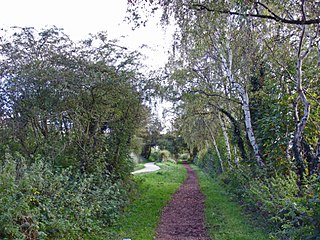
Hadlow Road railway station is a Grade II listed heritage railway station and museum in Willaston, on the Wirral Way footpath. It has been restored to have the look and feel of the day the station was permanently closed to passengers in 1956. It has an authentic ticket office, waiting room and telephone box. Formerly the museum was a working railway station on the single track Hooton to West Kirby branch of the Birkenhead Railway, on the Wirral Peninsula, Cheshire. The station is owned by Cheshire West and Chester Council, and Friends of Hadlow Road Station (FHRS) help to maintain and develop the station as a community resource.
Caldy railway station was a station on the single track Hooton to West Kirby branch of the Birkenhead Railway, on the Wirral Peninsula, England.

Kirby Park railway station was a station on the single track Hooton to West Kirby branch of the Birkenhead Railway, on the Wirral Peninsula, England.
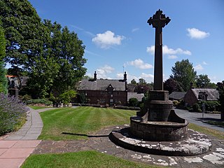
Willaston is a large village situated on the Wirral Peninsula, in the unitary authority of Cheshire West and Chester, Cheshire, England. Centred on a village green, it is located between Neston and Ellesmere Port, less than a mile south of the Metropolitan Borough of Wirral boundary. It is located very closely to Eastham and Bromborough and just a short distance away from Neston. At the 2001 Census, the total population of Willaston and Thornton ward was 4,913.

Cheshire West and Chester is a unitary authority area with borough status in Cheshire, England. It was established on 1 April 2009 as part of the 2009 local government changes, by virtue of an order under the Local Government and Public Involvement in Health Act 2007. It superseded the boroughs of Ellesmere Port and Neston, Vale Royal and the City of Chester. The remainder of the ceremonial county of Cheshire is composed of Cheshire East, Halton and Warrington. Cheshire West and Chester has three key urban areas: Chester, Ellesmere Port and Northwich/Winsford.

Thurstaston railway station was a station on the single track Hooton to West Kirby branch of the Birkenhead Railway, on the Wirral Peninsula, England. The station served the village of Thurstaston situated to the north east.

Parkgate railway station was a station on the single track Hooton to West Kirby branch of the Birkenhead Railway, on the Wirral Peninsula, Cheshire, England. The station served the village of Parkgate.
Neston South railway station was a station on the single track Hooton to West Kirby branch of the Birkenhead Railway, on the Wirral Peninsula, Cheshire, England. The station served the town of Neston.

The Birkenhead Railway was a railway company in North West England. It was incorporated as the Birkenhead, Lancashire and Cheshire Junction Railway (BL&CJR) in 1846 to build a line connecting the port of Birkenhead and the city of Chester with the manufacturing districts of Lancashire by making a junction near Warrington with the Grand Junction Railway. The BL&CJR took over the Chester and Birkenhead Railway in 1847, keeping its own name for the combined company until it shortened its name to the Birkenhead Railway in 1859. It was taken over jointly, on 1 January 1860, by the London and North Western Railway (LNWR) and the Great Western Railway (GWR). It remained a joint railway until nationalisation of the railways in 1948.

Heswall railway station was on the Birkenhead Railway route between Hooton and West Kirby. It served the town of Heswall between 1886 and 1956.

National Cycle Network (NCN) Route 56 is a Sustrans National Route that runs from Chester to Liverpool. The route utilises country lanes, a former railway trackbed, a coastal path and a seaside promenade.


