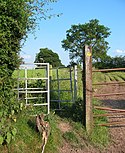
A footpath is a type of thoroughfare that is intended for use only by pedestrians and not other forms of traffic such as motorized vehicles, bicycles and horses. They can be found in a wide variety of places, from the centre of cities, to farmland, to mountain ridges. Urban footpaths are usually paved, may have steps, and can be called alleys, lanes, steps, etc.
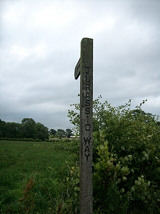
The Jurassic Way is a designated and signed long-distance footpath that connects the Oxfordshire town of Banbury with the Lincolnshire town of Stamford in England. It largely follows an ancient ridgeway traversing Britain; most of its 88-mile (142 km) route is in Northamptonshire on the Jurassic limestone ridge in the north of that county.

The Blackwater Valley Path follows the River Blackwater from its source in the Rowhill Nature Reserve in Aldershot to just beyond the point where it joins the River Whitewater near Swallowfield to become the Broadwater. This long-distance route covers 23 miles (37 km) and closely follows the River Blackwater using public rights-of-way as well as permissive footpaths and is waymarked. It is looked after by the Blackwater Valley Countryside Partnership.

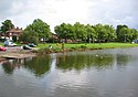
Walking is a popular recreational activity in London, despite traffic congestion. There are many streets that provide interesting walks, especially within historic central London. In addition there are attractive commons, parks, canals, and disused railway tracks that provide space for walks. This includes Wimbledon Common, Epping Forest, Hampstead Heath, and the eight Royal Parks: Hyde Park, Regent's Park, Richmond Park, etc. In recent years access to canals and rivers, including the Regent's Canal, and the River Thames has been greatly improved, and as well a number of long-distance walking routes have been created that link green spaces.

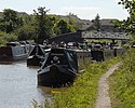
The Sandstone Trail is a 55-kilometre (34 mi) long-distance walkers' path, following sandstone ridges running north–south from Frodsham in central Cheshire to Whitchurch just over the Shropshire border. The path was created in 1974 and extended in the 1990s. Much of the route follows the Mid Cheshire Ridge but in places the trail also passes through the Cheshire Plain, including farmland, woodland and canal towpaths.

The South Cheshire Way is a 34-mile (55 km) long-distance footpath running east–west mainly through Cheshire, England, although parts lie in Shropshire and Staffordshire. The western section from Grindley Brook, near Whitchurch, runs through farmland; the eastern section from Mow Cop, near Biddulph, runs through low hills. The footpath is waymarked with black-and-yellow discs inscribed 'SCW'. It is covered by the Ordnance Survey Explorer series 257 and 268 maps, which denote it with a green lozenge.

The Baker Way is a footpath running from Chester railway station to Delamere railway station within the English county of Cheshire. The total length of the trail is 13 miles (21 km). Its name commemorates the life and work of Jack Baker, a former footpaths officer for Cheshire County Council.

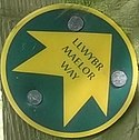
The Worcestershire Way is a waymarked long-distance trail within the county of Worcestershire, England. It runs 31 miles (50 km) from Bewdley to Great Malvern.
Walking is one of the most popular outdoor recreational activities in the United Kingdom, and within England and Wales there is a comprehensive network of rights of way that permits access to the countryside. Furthermore, access to much uncultivated and unenclosed land has opened up since the enactment of the Countryside and Rights of Way Act 2000. In Scotland the ancient tradition of universal access to land was formally codified under the Land Reform (Scotland) Act 2003. In Northern Ireland, however, there are few rights of way, or other access to land.

Paythorne is a small village and civil parish in Ribble Valley, Lancashire, England. It is situated alongside the River Ribble, north-east of Clitheroe, and on the boundary with North Yorkshire. Other parishes adjacent to Paythorne are Halton West, Nappa, Newsholme, Horton, Gisburn, Sawley, Bolton-by-Bowland and Gisburn Forest. The nearest town is Barnoldswick, situated 7 kilometres (4.3 mi) south-east of the village. Paythorne is on the edge of the Forest of Bowland Area of Outstanding Natural Beauty, although only a small area in the west of the parish is within the area's boundary. The Ribble Way long-distance walk passes through the village.
This is a partial list of recreational walks in the county of Derbyshire in England. The list includes walks that are wholly inside Derbyshire and also those that pass through to other counties. The walks are generally through countryside on a variety of trails and footpaths. Small walks of only local interest are not included. There are over 3,000 miles (4,800 km) of public rights of way in Derbyshire.

A long-distance trail is a longer recreational trail mainly through rural areas used for hiking, backpacking, cycling, horse riding or cross-country skiing. They exist on all continents except Antarctica.

The Lancashire Coastal Way is a long-distance footpath following the coast of the county of Lancashire in the north west of England. Its end points are Silverdale in the north and Freckleton in the south. Its length is variously asserted to be 66 miles (106 km) or 137 miles (220 km).

The Wales Coast Path is a designated long-distance trail which follows, or runs close to, the coastline of Wales.
The Trent Valley Way is a waymarked long-distance footpath in England following the River Trent and its valley in the counties of Nottinghamshire and Lincolnshire.
The Lancashire Witches Walk is a 51-mile (82 km) long-distance footpath opened in 2012, between Barrowford and Lancaster, all in Lancashire, England. It starts at Pendle Heritage Centre in Barrowford before passing through the Forest of Pendle, the town of Clitheroe and the Forest of Bowland to finish at Lancaster Castle.

The Dane Valley Way is a long-distance footpath through Derbyshire, Staffordshire and Cheshire, England. It runs from the Pavilion Gardens in Buxton to the end of the River Dane, where it enters the River Weaver in Northwich.
The Frome Valley Trail is a long-distance footpath in Dorset, England which follows the River Frome from Evershot to Dorchester and will, when completed, extend to Poole Harbour.
This is a partial list of long distance footpaths and multi-use trails in the Peak District of England. The list includes trails that are wholly inside the Peak District and also those that pass through it. The walks are generally through countryside on a variety of footpaths, lanes and bridle paths. Short walks of only local interest are not included.