Merseyside is a ceremonial and metropolitan county in North West England. It borders Lancashire to the north, Greater Manchester to the east, Cheshire to the south, the Welsh county of Flintshire across the Dee Estuary to the southwest, and the Irish Sea to the west. The largest settlement is the city of Liverpool.

Bidston is a village and civil parish in the Metropolitan Borough of Wirral in Merseyside, England.

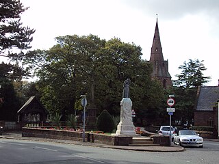
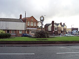
Bromborough is a town in the Metropolitan Borough of Wirral, Merseyside, England, and the historic county of Cheshire, on the Wirral Peninsula southeast of Bebington and north of Eastham.

New Ferry is an urban area on the Metropolitan Borough of Wirral, Merseyside, England. It is located on the Wirral Peninsula, with the River Mersey to the east and the town of Bebington to the west. Within the boundaries of the historic county of Cheshire, the area was developed from the early nineteenth century.
Eastham is a village and an electoral ward of the Metropolitan Borough of Wirral, in Merseyside, England. Historically, it was part of Cheshire. It is situated on the Wirral Peninsula, to the south of Bromborough and to the east of Willaston.
Moreton is a town in the Metropolitan Borough of Wirral in Merseyside, England. Located on the north coast of the Wirral Peninsula, it is approximately 3 mi (4.8 km) to the west of Wallasey. Historically part of Cheshire and now within the Metropolitan Borough of Wirral, the town was divided in 2004 between the local government wards of Leasowe & Moreton East and Moreton West & Saughall Massie. Moreton is also part of the parliamentary constituency of Wallasey.

Ingrebourne Valley is a local nature reserve (LNR) in Hornchurch in the London Borough of Havering. It is owned and managed by Havering Council, and has a visitor centre managed by the Essex Wildlife Trust. Most of it is in Hornchurch Country Park west of the River Ingrebourne, but there are also areas north and south of the park which are part of the LNR. It has a wide range of habitats, including woodland, grassland, the river and marshes. It is an important site for a range of species of plants, animals and birds, including great crested newts, slow worms, the harvest mouse and the water vole.

Spital is a village in the Metropolitan Borough of Wirral, in Merseyside, England. It is located mid-way on the Wirral Peninsula, and is mostly incorporated into the town of Bebington and the most westerly point of Spital forms the most northern edge of Bromborough.

Thurstaston Common is an area of almost 250 acres (100 ha) of parklands, wood and heath between Frankby and Thurstaston, on the Wirral Peninsula in North West England. The common is jointly owned by the National Trust and the Metropolitan Borough of Wirral. Royden Country Park is nearby and offers additional facilities.

Heswall Dales is an area of some 72 acres (290,000 m2) of lowland heath situated close to Heswall on the Wirral Peninsula, England.

Kempton Park Reservoirs are a Site of Special Scientific Interest in the London Borough of Hounslow and Kempton Park in Surrey. It is owned by Thames Water. It is part of South West London Waterbodies Ramsar site and Special Protection Area Kempton Park East reservoir is also a local nature reserve.

High Elms Country Park is an extensive 250-acre (100 ha) public park on the North Downs in Farnborough in the London Borough of Bromley. It is a Local Nature Reserve, and together with the neighbouring Downe Bank, a Site of Special Scientific Interest. The park surrounds High Elms Golf Course, and has extensive woodland, chiefly oak and beech, chalk meadows and formal gardens. It also has a cafe, a visitor centre, nature and history trails and car parks.

Stanmore Common is a 49.2-hectare public park, Local Nature Reserve and Site of Metropolitan Importance for Nature Conservation in Stanmore in the London Borough of Harrow in England. It is owned by Harrow Council and managed by the council with a local group. It was a biological Site of Special Scientific Interest, but was de-notified in the early 1990s.
Marfords Park is a park located in Bromborough, Wirral, England.

Scratchwood is an extensive, mainly wooded, country park in Mill Hill in the London Borough of Barnet. The 57-hectare site is a Site of Metropolitan Importance for Nature Conservation and together with the neighbouring Moat Mount Open Space. It is a Local Nature Reserve.

Bentley Priory Nature Reserve is a Site of Special Scientific Interest and Local Nature Reserve in Stanmore in the London Borough of Harrow, surrounding the stately home of Bentley Priory. It is a 55 hectare mosaic of ancient woodland, unimproved neutral grassland, scrub, wetland, streams and an artificial lake, an unusual combination of habitats in Greater London.

Northaw Great Wood is a 223.6-hectare (553-acre) biological Site of Special Scientific Interest (SSSI) near Cuffley in Hertfordshire, England. It covers Northaw Great Wood Country Park, which is managed by Welwyn Hatfield Borough Council, Well Wood, Justice Hill and Grimes Bottom. Part of the site is managed by Hertfordshire County Council as a schools' park. The country park is also a local nature reserve.