Royden Park

Last updated

Royden Park
Coach House, Royden Park 2019-2.jpg
Coach House at Royden Park, its visitor centre
Royden Park
TypePark
Location Frankby, Wirral, England
Coordinates 53°21′50″N03°08′00″W / 53.36389°N 3.13333°W / 53.36389; -3.13333 Coordinates: 53°21′50″N03°08′00″W / 53.36389°N 3.13333°W / 53.36389; -3.13333
Area36.99 hectares (91.4 acres) [1] :5
Operated byWirral Council
StatusOpen all year

Royden Park is a park in Frankby, Wirral, England, [2] managed by Wirral Council. The grounds of the park were originally part of an estate owned by Ernest Royden which comprised the park, Hill Bark house and Thurstaston Common. Upon his death the estate passed to Hoylake council and was opened to the public for recreation. The park features a visitor centre, walled garden, miniature railway, woodland walks and a lake.

Contents

History

In the 1820s the land on which the park now sits was heath and woodland. During the 1860s a house called Hillbark was built on the estate and the area was planted and landscaped. In the 1870s a coach house and walled garden were added. In 1928 the estate was passed to Ernest Royden [3] who demolished the earlier residence and moved his own house brick by brick to the site. This house is now known as Hill Bark. After the death of Royden in 1960, the estate including Hill Bark, Thurstaston Common and Royden Park was sold to Hoylake Urban District Council. [1] :5 Royden Park and Thurstaston Common were opened for public recreation. Hill Bark became an old people's home and is now a privately owned hotel and wedding venue. Following local government re-organisation in 1974 Wirral Council now manage the park and common. [1] :6

Features

Roodee mere The Lake at Royden.jpg
Roodee mere

The park features a large lake called Roodee Mere where fishing is allowed with a permit. [4] A miniature railway takes passengers around the grounds every Sunday afternoon weather permitting. The old coach house for Hill Bark has been converted for use as a cafe and resource centre. There are conifer woodland walks, meadows with nature walks, car parking, a walled garden and family events. [5]

Nature

The park and commons are managed as a local nature reserve offering a range of habitats for plants, insects, flowers and wildlife. [1] :15

Walled garden

The Laburnum arch Laburnum arch at the walled garden, Royden Park.jpg
The Laburnum arch

The park has a walled garden which was built in 1870 as the kitchen garden for Hill Bark house and is a fine example of Victorian architecture. [1] :15 The garden is used as a community resource. A laburnum arch was added by the Wirral Model Engineering Society who operate the miniature railway. Contained within the walls are a herb garden, a bog garden, a flower garden and a traditional cottage garden that originally grew plants for medicinal purposes.

Model railways

The miniature railway Royden Park Miniature Railway - geograph.org.uk - 824387.jpg
The miniature railway

Wirral Model Engineers Society operate two miniature railways at the park. The society came into existence in 1961 and they have been developing the railway track and facilities ever since. [6] The first railway is a combined 2½, 3½ and 5½ inch gauge raised track for detailed scale models of full size steam locomotives; this track was extended in 1980 to 1,200 feet. [7] The second railway is a 7¼ inch gauge ridable miniature railway pulled by a traction locomotive; this track was extended to 2,267 feet in 2004. [7]

Related Research Articles

<span class="mw-page-title-main">Rail transport modelling</span> Modeling trains hobby

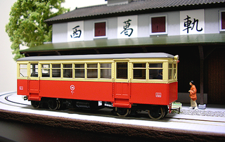
Railway modelling or model railroading is a hobby in which rail transport systems are modelled at a reduced scale.

<span class="mw-page-title-main">West Kirby</span> Coastal town in Wirral, Merseyside, England

West Kirby is a coastal town in the Metropolitan Borough of Wirral in Merseyside, England. The town lies close to the mouth of the River Dee.

<span class="mw-page-title-main">Irby, Merseyside</span> Town in Wirral, England

Irby is a village on the Wirral Peninsula, in Merseyside, England. The village covers an area of 20 square kilometres. To the north of Irby lies the associated hamlet of Irby Hill. It is part of the Greasby, Frankby and Irby Ward of the Metropolitan Borough of Wirral and is within the parliamentary constituency of Wirral West.

<span class="mw-page-title-main">Wirral Peninsula</span> Peninsula in North West England

The Wirral Peninsula, known locally as The Wirral, is an area in North West England. The roughly rectangular peninsula is about 15 miles (24 km) long and 7 miles (11 km) wide and is bounded by the River Dee to the west, the River Mersey to the east, and the Irish Sea to the north.

<span class="mw-page-title-main">Wirral West (UK Parliament constituency)</span> Parliamentary constituency in the United Kingdom, 1983 onwards

Wirral West is a constituency represented in the House of Commons of the UK Parliament by Margaret Greenwood of the Labour Party since 2015.

<span class="mw-page-title-main">Wirral Country Park</span> Country park on the Wirral Peninsula, England

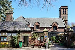
The Wirral Country Park is a country park on the Wirral Peninsula, England, lying both in the Metropolitan Borough of Wirral in the county of Merseyside and in the borough of Cheshire West & Chester in the county of Cheshire. It was the first designated country park in Britain, opening in 1973.

<span class="mw-page-title-main">Caldy</span> Village in the Wirral, England

Caldy is a small, affluent village on the Wirral Peninsula, England, south-east of West Kirby. It is part of the West Kirby & Thurstaston Ward of the Metropolitan Borough of Wirral and is in the parliamentary constituency of Wirral West. At the time of the 2001 Census, Caldy had 1,290 inhabitants, of a total ward population of 12,869.

<span class="mw-page-title-main">Bidston Hill</span> Hill and woodland in Bidston, Wirral, England

Bidston Hill is 100 acres (0.40 km2) of heathland and woodland containing historic buildings and ancient rock carvings, on the Wirral Peninsula, near the Birkenhead suburb of Bidston, in Merseyside, England. With a peak of 231 feet (70 m), Bidston Hill is one of the highest points on the Wirral. The land was part of Sir Robert Vyner's estate and purchased by Birkenhead Corporation in 1894 for use by the public.

<span class="mw-page-title-main">Greasby</span> Town in Wirral, England

Greasby is a large village on the Wirral Peninsula, Merseyside, England. A predominantly residential area, it is contiguous with Upton to the east and Saughall Massie to the north. The small village of Frankby is to the immediate west. Historically within the county of Cheshire, it is part of the Greasby, Frankby and Irby Ward of the Metropolitan Borough of Wirral and is in the parliamentary constituency of Wirral West.

<span class="mw-page-title-main">Ridable miniature railway</span> Ultra-narrow-gauge railway on which people can ride

A ridable miniature railway is a large scale, usually ground-level railway that hauls passengers using locomotives that are often models of full-sized railway locomotives.

<span class="mw-page-title-main">Thurstaston Common</span>

Thurstaston Common is an area of almost 250 acres (100 ha) of parklands, wood and heath between Frankby and Thurstaston, on the Wirral Peninsula in North West England. The common is jointly owned by the National Trust and the Metropolitan Borough of Wirral. Royden Country Park is nearby and offers additional facilities.

<span class="mw-page-title-main">Thurstaston</span> Village on the Wirral Peninsula, Merseyside, England

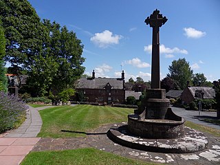
Thurstaston is a village on the Wirral Peninsula, Merseyside, England. It is part of the West Kirby and Thurstaston Ward of the Metropolitan Borough of Wirral and the parliamentary constituency of Wirral West. The village lies on the A540 road between Heswall and Caldy, although it extends some distance down Station Road to the Wirral Way and the River Dee estuary.

<span class="mw-page-title-main">Frankby</span> Village in Wirral, England

Frankby is a village on the Wirral Peninsula, in Merseyside, England. It is located between Greasby and Newton on the outskirts of the town of West Kirby. The hamlet of Larton is to the north west. Historically within the county of Cheshire, it is part of the Greasby, Frankby and Irby Ward of the Metropolitan Borough of Wirral and is in the parliamentary constituency of Wirral West.

<span class="mw-page-title-main">Newton, Merseyside</span> Village in Wirral, Merseyside, England

Newton is a village on the Wirral Peninsula, in the Metropolitan Borough of Wirral, Merseyside, England. It is a part of the suburban town of West Kirby, the local government ward of West Kirby and Thurstaston and the parliamentary constituency of Wirral West. Contiguous with Newton is the suburb of Grange to the west. The hamlet of Larton is to the east.

<span class="mw-page-title-main">Hill Bark Farmhouse</span>

Hill Bark Farmhouse is to the east of the house of Hill Bark, and south of the hamlet of Frankby, Wirral, England. It is recorded in the National Heritage List for England as a designated Grade II listed building.

<span class="mw-page-title-main">Hill Bark</span> Historic site in Merseyside, England

Hill Bark is a large country house to the south of the hamlet of Frankby, Wirral, Merseyside, England. It is recorded in the National Heritage List for England as a designated Grade II* listed building. The authors of the Buildings of England series comment that it is "one of the most notable Victorian essays in half-timbered design anywhere in the country".

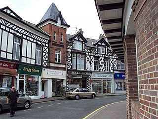
Hoylake is a seaside town in Wirral, Merseyside, England. It contains 41 buildings that are recorded in the National Heritage List for England as designated listed buildings. Of these, two are listed at Grade II*, the middle of the three grades, and the others are at Grade II, the lowest grade. The list includes listed buildings in the town of Hoylake, and in the surrounding villages and areas of West Kirby, Caldy, Frankby, Meols, Grange, and Hilbre Island. In the list are houses and churches with associated structures, a telegraph station, a well house, a lighthouse, a village hall, banks, a drinking fountain, a war memorial, and a railway station.

References

  1. 1 2 3 4 5 "Royden Park: Management Plan 2016–2020" (PDF). Wirral Council Regeneration and Environment Directorate: Parks & Countryside Service. January 2017. Retrieved 15 November 2021.
  2. "Royden Park". www.wirral.gov.uk.
  3. Royden, Mike. "Royden Family History Pages - The Roydens of Frankby". www.roydenhistory.co.uk.
  4. "Roodee Mere". Live4fishing. Retrieved 12 August 2018.
  5. "Royden Country Park – Visit Wirral". www.visitwirral.com.
  6. "Wirral Model Engineering Society". www.wirralmodelengineeringsociety.co.uk.
  7. 1 2 "Steam and Royden Park Miniature Railways" (PDF). www.wirralmodelengineeringsociety.co.uk.

Commons-logo.svg Media related to Royden Park at Wikimedia Commons