List of shoals of Oregon

Last updated
Map all coordinates using: OpenStreetMap  
Download coordinates as: KML  ·  GPX

List of shoals of Oregon contains all natural river bars, sandbars, spits, and shoals identified by the USGS in the U.S. state of Oregon. The USGS defines a bar as a "natural accumulation of sand, gravel, or alluvium forming an underwater or exposed embankment (ledge, reef, sandbar, shoal, spit)". [1]

Perhaps the best known is the Columbia Bar system which consists of several bars, including Peacock Spit and Clatsop Spit outside the jetties. Inside, in the Columbia River proper are Jetty Sands, Desdemona Sands, Baker Sands, Chinook Sands, Youngs River Sands, and Tongue Point Bar all near the mouth.

There are 156 bars listed as of December 12, 2008.

nametypeelevationcoordinateUSGS Map GNIS ID
Tom Fry Eddy (Curry County, Oregon) Bar33 ft (10 m) 42°33′08″N124°04′12″W / 42.55222°N 124.07000°W / 42.55222; -124.07000 (Tom Fry Eddy (Curry County, Oregon)) Agness 1155762
Walker Bar (Curry County, Oregon) Bar39 ft (12 m) 42°36′22″N124°03′51″W / 42.60611°N 124.06417°W / 42.60611; -124.06417 (Walker Bar (Curry County, Oregon)) Agness 1155771
Agness Bar (Curry County, Oregon) Bar36 ft (11 m) 42°33′04″N124°04′02″W / 42.55111°N 124.06722°W / 42.55111; -124.06722 (Agness Bar (Curry County, Oregon)) Agness 1155772
Lynch Bar (Curry County, Oregon) Bar58 ft (18 m) 42°30′09″N124°02′10″W / 42.50250°N 124.03611°W / 42.50250; -124.03611 (Lynch Bar (Curry County, Oregon)) Agness 1159186
Taylor Sands (Clatsop County, Oregon) Bar0 ft (0 m) 46°13′52″N123°47′06″W / 46.23111°N 123.78500°W / 46.23111; -123.78500 (Taylor Sands (Clatsop County, Oregon)) Astoria 1127911
Tongue Point Bar (Oregon) Bar0 ft (0 m) 46°13′31″N123°46′04″W / 46.22528°N 123.76778°W / 46.22528; -123.76778 (Tongue Point Bar (Oregon)) Astoria 1128159
Upper Sands (Clatsop County, Oregon) Bar0 ft (0 m) 46°11′44″N123°51′35″W / 46.19556°N 123.85972°W / 46.19556; -123.85972 (Upper Sands (Clatsop County, Oregon)) Astoria 1162784
Gardner Bar (Curry County, Oregon) Bar51 ft (16 m) 42°10′39″N124°08′34″W / 42.17750°N 124.14278°W / 42.17750; -124.14278 (Gardner Bar (Curry County, Oregon)) Bosley Butte 1154697
Miller Bar (Curry County, Oregon) Bar47 ft (14 m) 42°08′29″N124°10′24″W / 42.14139°N 124.17333°W / 42.14139; -124.17333 (Miller Bar (Curry County, Oregon)) Bosley Butte 1154698
Fashion Reef (Multnomah County, Oregon) Bar6 ft (1.8 m) 45°34′50″N122°07′59″W / 45.58056°N 122.13306°W / 45.58056; -122.13306 (Fashion Reef (Multnomah County, Oregon)) Bridal Veil 1142028
Lobster Bar (Curry County, Oregon) Bar13 ft (4.0 m) 42°30′00″N124°18′02″W / 42.50000°N 124.30056°W / 42.50000; -124.30056 (Lobster Bar (Curry County, Oregon)) Brushy Bald Mountain 1155978
Black Bar (Josephine County, Oregon) Bar149 ft (45 m) 42°39′25″N123°43′53″W / 42.65694°N 123.73139°W / 42.65694; -123.73139 (Black Bar (Josephine County, Oregon)) Bunker Creek 1117737
Tyee Bar (Josephine County, Oregon) Bar172 ft (52 m) 42°39′27″N123°39′26″W / 42.65750°N 123.65722°W / 42.65750; -123.65722 (Tyee Bar (Josephine County, Oregon)) Bunker Creek 1160650
Dug Bar (Wallowa County, Oregon) Bar310 ft (94 m) 45°48′26″N116°41′22″W / 45.80722°N 116.68944°W / 45.80722; -116.68944 (Dug Bar (Wallowa County, Oregon)) Cactus Mountain 1141380
One Reef (Clark County, Washington) Bar6 ft (1.8 m) 45°34′06″N122°24′35″W / 45.56833°N 122.40972°W / 45.56833; -122.40972 (One Reef (Clark County, Washington)) Camas 1507189
New Era Bar (Clackamas County, Oregon) Bar19 ft (5.8 m) 45°17′38″N122°39′31″W / 45.29389°N 122.65861°W / 45.29389; -122.65861 (New Era Bar (Clackamas County, Oregon)) Canby 1124659
Horseshoe Bar (Grant County, Oregon) Bar1,020 ft (310 m) 44°21′57″N118°57′19″W / 44.36583°N 118.95528°W / 44.36583; -118.95528 (Horseshoe Bar (Grant County, Oregon)) Canyon Mountain 1160682
Lawson Bar (Douglas County, Oregon) Bar195 ft (59 m) 42°57′09″N123°20′09″W / 42.95250°N 123.33583°W / 42.95250; -123.33583 (Lawson Bar (Douglas County, Oregon)) Canyonville 1157165
Simpson Reef (Coos County, Oregon) Bar0 ft (0 m) 43°18′58″N124°24′19″W / 43.31611°N 124.40528°W / 43.31611; -124.40528 (Simpson Reef (Coos County, Oregon)) Cape Arago 1126996
Blanco Reef (Curry County, Oregon) Bar0 ft (0 m) 42°49′44″N124°35′10″W / 42.82889°N 124.58611°W / 42.82889; -124.58611 (Blanco Reef (Curry County, Oregon)) Cape Blanco 1117803
Orford Reef (Curry County, Oregon) Bar0 ft (0 m) 42°47′06″N124°36′53″W / 42.78500°N 124.61472°W / 42.78500; -124.61472 (Orford Reef (Curry County, Oregon)) Cape Blanco 1125040
Tituna Spit (Curry County, Oregon) Bar2 ft (0.61 m) 42°47′54″N124°31′39″W / 42.79833°N 124.52750°W / 42.79833; -124.52750 (Tituna Spit (Curry County, Oregon)) Cape Blanco 1135964
Seattle Bar (historical) (Jackson County, Oregon) Bar600 ft (180 m) 42°00′44″N123°09′04″W / 42.01222°N 123.15111°W / 42.01222; -123.15111 (Seattle Bar (historical) (Jackson County, Oregon)) Carberry Creek 1155064
Puget Bar (historical) (Clatsop County, Oregon) Bar0 ft (0 m) 46°12′12″N123°26′09″W / 46.20333°N 123.43583°W / 46.20333; -123.43583 (Puget Bar (historical) (Clatsop County, Oregon)) Cathlamet 1851730
Mussel Reef (Coos County, Oregon) Bar0 ft (0 m) 43°20′44″N124°21′47″W / 43.34556°N 124.36306°W / 43.34556; -124.36306 (Mussel Reef (Coos County, Oregon)) Charleston 1161453
Allison Bar (Yamhill County, Oregon) Bar28 ft (8.5 m) 45°08′02″N123°00′49″W / 45.13389°N 123.01361°W / 45.13389; -123.01361 (Allison Bar (Yamhill County, Oregon)) Dayton 1116882
Brentano Bar (Yamhill County, Oregon) Bar29 ft (8.8 m) 45°13′28″N123°01′37″W / 45.22444°N 123.02694°W / 45.22444; -123.02694 (Brentano Bar (Yamhill County, Oregon)) Dayton 1118055
Candiani Bar (Marion County, Oregon) Bar24 ft (7.3 m) 45°12′36″N123°03′05″W / 45.21000°N 123.05139°W / 45.21000; -123.05139 (Candiani Bar (Marion County, Oregon)) Dayton 1118558
Duke Bar (Yamhill County, Oregon) Bar25 ft (7.6 m) 45°08′38″N123°01′55″W / 45.14389°N 123.03194°W / 45.14389; -123.03194 (Duke Bar (Yamhill County, Oregon)) Dayton 1120206
Fairfield Bar (Marion County, Oregon) Bar54 ft (16 m) 45°08′18″N123°00′54″W / 45.13833°N 123.01500°W / 45.13833; -123.01500 (Fairfield Bar (Marion County, Oregon)) Dayton 1120559
Five Islands Bar (Yamhill County, Oregon) Bar23 ft (7.0 m) 45°11′01″N123°01′04″W / 45.18361°N 123.01778°W / 45.18361; -123.01778 (Five Islands Bar (Yamhill County, Oregon)) Dayton 1120802
Lower Lambert Bar (Yamhill County, Oregon) Bar24 ft (7.3 m) 45°09′37″N123°00′47″W / 45.16028°N 123.01306°W / 45.16028; -123.01306 (Lower Lambert Bar (Yamhill County, Oregon)) Dayton 1123569
Upper Lambert Bar (Yamhill County, Oregon) Bar25 ft (7.6 m) 45°09′32″N123°01′58″W / 45.15889°N 123.03278°W / 45.15889; -123.03278 (Upper Lambert Bar (Yamhill County, Oregon)) Dayton 1128459
Weston Bar (Yamhill County, Oregon) Bar23 ft (7.0 m) 45°12′04″N123°01′27″W / 45.20111°N 123.02417°W / 45.20111; -123.02417 (Weston Bar (Yamhill County, Oregon)) Dayton 1128920
Coffee Island Bar (Yamhill County, Oregon) Bar23 ft (7.0 m) 45°11′26″N123°01′13″W / 45.19056°N 123.02028°W / 45.19056; -123.02028 (Coffee Island Bar (Yamhill County, Oregon)) Dayton 1157965
Feasters Rocks (Marion County, Oregon) Bar32 ft (9.8 m) 45°10′07″N123°00′09″W / 45.16861°N 123.00250°W / 45.16861; -123.00250 (Feasters Rocks (Marion County, Oregon)) Dayton 1157981
Snaggy Bend Bar (Marion County, Oregon) Bar29 ft (8.8 m) 45°07′39″N123°00′21″W / 45.12750°N 123.00583°W / 45.12750; -123.00583 (Snaggy Bend Bar (Marion County, Oregon)) Dayton 1158035
Mission Bar (Yamhill County, Oregon) Bar23 ft (7.0 m) 45°13′22″N123°00′13″W / 45.22278°N 123.00361°W / 45.22278; -123.00361 (Mission Bar (Yamhill County, Oregon)) Dayton 1158378
Eureka Bar (Wallowa County, Oregon) Bar284 ft (87 m) 45°49′31″N116°46′54″W / 45.82528°N 116.78167°W / 45.82528; -116.78167 (Eureka Bar (Wallowa County, Oregon)) Deadhorse Ridge 1141912
Brandy Bar (Douglas County, Oregon) Bar2 ft (0.61 m) 43°40′44″N123°55′46″W / 43.67889°N 123.92944°W / 43.67889; -123.92944 (Brandy Bar (Douglas County, Oregon)) Deer Head Point 1138571
Hunter Bar (Columbia County, Oregon) Bar1 ft (0.30 m) 45°59′57″N122°51′45″W / 45.99917°N 122.86250°W / 45.99917; -122.86250 (Hunter Bar (Columbia County, Oregon)) Deer Island 1122144
Flat Rock (Lincoln County, Oregon) Bar0 ft (0 m) 44°48′27″N124°04′09″W / 44.80750°N 124.06917°W / 44.80750; -124.06917 (Flat Rock (Lincoln County, Oregon)) Depoe Bay 1134555
North Reef (Lincoln County, Oregon) Bar0 ft (0 m) 44°48′41″N124°04′12″W / 44.81139°N 124.07000°W / 44.81139; -124.07000 (North Reef (Lincoln County, Oregon)) Depoe Bay 1134556
Bunch Bar (Douglas County, Oregon) Bar32 ft (9.8 m) 43°38′19″N123°40′24″W / 43.63861°N 123.67333°W / 43.63861; -123.67333 (Bunch Bar (Douglas County, Oregon)) Devils Graveyard 1132953
Fairview Bar (Wallowa County, Oregon) Bar631 ft (192 m) 45°58′52″N117°36′25″W / 45.98111°N 117.60694°W / 45.98111; -117.60694 (Fairview Bar (Wallowa County, Oregon)) Eden Ridge 1120568
North Spit (Coos County, Oregon) Bar7 ft (2.1 m) 43°23′11″N124°18′37″W / 43.38639°N 124.31028°W / 43.38639; -124.31028 (North Spit (Coos County, Oregon)) Empire 1147065
Skinners Bar (Lane County, Oregon) Bar120 ft (37 m) 44°04′14″N123°06′51″W / 44.07056°N 123.11417°W / 44.07056; -123.11417 (Skinners Bar (Lane County, Oregon)) Eugene East 1129643
Two Sisters Bar (Lane County, Oregon) Bar117 ft (36 m) 44°06′09″N123°06′19″W / 44.10250°N 123.10528°W / 44.10250; -123.10528 (Two Sisters Bar (Lane County, Oregon)) Eugene East 1129650
North Fork Shoal (Lane County, Oregon) Bar0 ft (0 m) 43°58′29″N124°04′54″W / 43.97472°N 124.08167°W / 43.97472; -124.08167 (North Fork Shoal (Lane County, Oregon)) Florence 1156794
Taylor Creek Bar (Josephine County, Oregon) Bar227 ft (69 m) 42°33′10″N123°33′59″W / 42.55278°N 123.56639°W / 42.55278; -123.56639 (Taylor Creek Bar (Josephine County, Oregon)) Galice 1155711
Almeda Bar (Josephine County, Oregon) Bar254 ft (77 m) 42°36′19″N123°34′59″W / 42.60528°N 123.58306°W / 42.60528; -123.58306 (Almeda Bar (Josephine County, Oregon)) Galice 1155715
Sibley Sands (Tillamook County, Oregon) Bar0 ft (0 m) 45°31′08″N123°54′22″W / 45.51889°N 123.90611°W / 45.51889; -123.90611 (Sibley Sands (Tillamook County, Oregon)) Garibaldi 1126944
Kilchis Flat (Tillamook County, Oregon) Bar0 ft (0 m) 45°30′15″N123°53′01″W / 45.50417°N 123.88361°W / 45.50417; -123.88361 (Kilchis Flat (Tillamook County, Oregon)) Garibaldi 1161406
Tompkins Bar (Lincoln County, Oregon) Bar28 ft (8.5 m) 45°07′10″N122°59′52″W / 45.11944°N 122.99778°W / 45.11944; -122.99778 (Tompkins Bar (Lincoln County, Oregon)) Gervais 1128153
Doyle Rock (Curry County, Oregon) Bar4 ft (1.2 m) 42°25′36″N124°25′27″W / 42.42667°N 124.42417°W / 42.42667; -124.42417 (Doyle Rock (Curry County, Oregon)) Gold Beach 1134135
Elephant Rock (Curry County, Oregon) Bar10 ft (3.0 m) 42°26′51″N124°22′46″W / 42.44750°N 124.37944°W / 42.44750; -124.37944 (Elephant Rock (Curry County, Oregon)) Gold Beach 1134136
Rogue River Reef (Curry County, Oregon) Bar0 ft (0 m) 42°27′10″N124°28′56″W / 42.45278°N 124.48222°W / 42.45278; -124.48222 (Rogue River Reef (Curry County, Oregon)) Gold Beach 1148700
Ferry Hole Bar (Curry County, Oregon) Bar6 ft (1.8 m) 42°27′34″N124°22′44″W / 42.45944°N 124.37889°W / 42.45944; -124.37889 (Ferry Hole Bar (Curry County, Oregon)) Gold Beach 1154883
Pittsburg Bar (Wallowa County, Oregon) Bar350 ft (110 m) 45°37′39″N116°28′20″W / 45.62750°N 116.47222°W / 45.62750; -116.47222 (Pittsburg Bar (Wallowa County, Oregon)) Grave Point 1125454
Collier Bar (Josephine County, Oregon) Bar91 ft (28 m) 42°24′59″N124°00′39″W / 42.41639°N 124.01083°W / 42.41639; -124.01083 (Collier Bar (Josephine County, Oregon)) Horse Sign Butte 1139996
Foster Bar (Curry County, Oregon) Bar51 ft (16 m) 42°38′03″N124°02′52″W / 42.63417°N 124.04778°W / 42.63417; -124.04778 (Foster Bar (Curry County, Oregon)) Illahe 1155745
Horseshoe Bar (Lane County, Oregon) Bar96 ft (29 m) 44°13′54″N123°09′24″W / 44.23167°N 123.15667°W / 44.23167; -123.15667 (Horseshoe Bar (Lane County, Oregon)) Junction City 1129654
Bells Shute Bar (Lane County, Oregon) Bar105 ft (32 m) 44°10′29″N123°08′34″W / 44.17472°N 123.14278°W / 44.17472; -123.14278 (Bells Shute Bar (Lane County, Oregon)) Junction City 1129657
Maupin Bar (Douglas County, Oregon) Bar48 ft (15 m) 43°34′54″N123°32′04″W / 43.58167°N 123.53444°W / 43.58167; -123.53444 (Maupin Bar (Douglas County, Oregon)) Kellogg 1160474
Jones Bar (Douglas County, Oregon) Bar43 ft (13 m) 43°35′15″N123°31′34″W / 43.58750°N 123.52611°W / 43.58750; -123.52611 (Jones Bar (Douglas County, Oregon)) Kellogg 1160475
Battle Bar (Curry County, Oregon) Bar143 ft (44 m) 42°42′27″N123°47′22″W / 42.70750°N 123.78944°W / 42.70750; -123.78944 (Battle Bar (Curry County, Oregon)) Kelsey Peak 1137580
China Bar (Curry County, Oregon) Bar116 ft (35 m) 42°42′59″N123°52′29″W / 42.71639°N 123.87472°W / 42.71639; -123.87472 (China Bar (Curry County, Oregon)) Kelsey Peak 1139657
Missouri Bar (Curry County, Oregon) Bar115 ft (35 m) 42°42′36″N123°49′55″W / 42.71000°N 123.83194°W / 42.71000; -123.83194 (Missouri Bar (Curry County, Oregon)) Kelsey Peak 1146363
Winkle Bar (Curry County, Oregon) Bar145 ft (44 m) 42°42′04″N123°48′20″W / 42.70111°N 123.80556°W / 42.70111; -123.80556 (Winkle Bar (Curry County, Oregon)) Kelsey Peak 1152534
Oregon Bar (Josephine County, Oregon) Bar642 ft (196 m) 42°07′49″N123°27′49″W / 42.13028°N 123.46361°W / 42.13028; -123.46361 (Oregon Bar (Josephine County, Oregon)) Kerby Peak 1155090
Yankee Bar (Wallowa County, Oregon) Bar367 ft (112 m) 45°34′27″N116°29′34″W / 45.57417°N 116.49278°W / 45.57417; -116.49278 (Yankee Bar (Wallowa County, Oregon)) Kirkwood Creek 1153100
Jim Crow Sands (Clatsop County, Oregon) Bar0 ft (0 m) 46°14′57″N123°34′45″W / 46.24917°N 123.57917°W / 46.24917; -123.57917 (Jim Crow Sands (Clatsop County, Oregon)) Knappa 1122428
Oswego Rock (Clackamas County, Oregon) Bar14 ft (4.3 m) 45°24′41″N122°39′21″W / 45.41139°N 122.65583°W / 45.41139; -122.65583 (Oswego Rock (Clackamas County, Oregon)) Lake Oswego 1125058
Thesing Bar (Clackamas County, Oregon) Bar3 ft (0.91 m) 45°25′31″N122°39′10″W / 45.42528°N 122.65278°W / 45.42528; -122.65278 (Thesing Bar (Clackamas County, Oregon)) Lake Oswego 1128003
Caribou Bar (Baker County, Oregon) Bar708 ft (216 m) 44°27′16″N117°19′48″W / 44.45444°N 117.33000°W / 44.45444; -117.33000 (Caribou Bar (Baker County, Oregon)) Lime 1118607
Salishan Spit (Lincoln County, Oregon) Bar1 ft (0.30 m) 44°54′34″N124°01′49″W / 44.90944°N 124.03028°W / 44.90944; -124.03028 (Salishan Spit (Lincoln County, Oregon)) Lincoln City 1134839
Siletz Reef (Lincoln County, Oregon) Bar0 ft (0 m) 44°57′30″N124°02′30″W / 44.95833°N 124.04167°W / 44.95833; -124.04167 (Siletz Reef (Lincoln County, Oregon)) Lincoln City 2130515
Tacklebuster Reef (Lincoln County, Oregon) Bar0 ft (0 m) 44°57′26″N124°02′15″W / 44.95722°N 124.03750°W / 44.95722; -124.03750 (Tacklebuster Reef (Lincoln County, Oregon)) Lincoln City 2440010
Mack Reef (Curry County, Oregon) Bar0 ft (0 m) 42°14′22″N124°24′56″W / 42.23944°N 124.41556°W / 42.23944; -124.41556 (Mack Reef (Curry County, Oregon)) Mack Point 1145712
Gleason Bar (Curry County, Oregon) Bar86 ft (26 m) 42°42′12″N123°55′25″W / 42.70333°N 123.92361°W / 42.70333; -123.92361 (Gleason Bar (Curry County, Oregon)) Marial 1116487
Blossom Bar (Curry County, Oregon) Bar85 ft (26 m) 42°42′08″N123°55′17″W / 42.70222°N 123.92139°W / 42.70222; -123.92139 (Blossom Bar (Curry County, Oregon)) Marial 1138274
Brushy Bar (Curry County, Oregon) Bar71 ft (22 m) 42°40′45″N123°56′49″W / 42.67917°N 123.94694°W / 42.67917; -123.94694 (Brushy Bar (Curry County, Oregon)) Marial 1138705
Half Moon Bar (Curry County, Oregon) Bar101 ft (31 m) 42°41′36″N123°56′31″W / 42.69333°N 123.94194°W / 42.69333; -123.94194 (Half Moon Bar (Curry County, Oregon)) Marial 1143205
Paradise Bar (Curry County, Oregon) Bar107 ft (33 m) 42°41′52″N123°56′04″W / 42.69778°N 123.93444°W / 42.69778; -123.93444 (Paradise Bar (Curry County, Oregon)) Marial 1147412
Solitude Bar (Curry County, Oregon) Bar77 ft (23 m) 42°40′16″N123°57′20″W / 42.67111°N 123.95556°W / 42.67111; -123.95556 (Solitude Bar (Curry County, Oregon)) Marial 1149870
Darrow Bar (Polk County, Oregon) Bar32 ft (9.8 m) 45°00′15″N123°04′16″W / 45.00417°N 123.07111°W / 45.00417; -123.07111 (Darrow Bar (Polk County, Oregon)) Mission Bottom 1119691
Eldriedge Bar (Marion County, Oregon) Bar29 ft (8.8 m) 45°06′40″N123°00′13″W / 45.11111°N 123.00361°W / 45.11111; -123.00361 (Eldriedge Bar (Marion County, Oregon)) Mission Bottom 1120431
Lincoln Bar (Marion County, Oregon) Bar33 ft (10 m) 45°02′02″N123°04′04″W / 45.03389°N 123.06778°W / 45.03389; -123.06778 (Lincoln Bar (Marion County, Oregon)) Mission Bottom 1123092
Lincoln Rocks (Polk County, Oregon) Bar32 ft (9.8 m) 45°01′00″N123°04′32″W / 45.01667°N 123.07556°W / 45.01667; -123.07556 (Lincoln Rocks (Polk County, Oregon)) Mission Bottom 1123098
Spongs Bar (Marion County, Oregon) Bar36 ft (11 m) 45°01′34″N123°04′21″W / 45.02611°N 123.07250°W / 45.02611; -123.07250 (Spongs Bar (Marion County, Oregon)) Mission Bottom 1127398
Windsor Bar (Polk County, Oregon) Bar29 ft (8.8 m) 45°03′17″N123°04′07″W / 45.05472°N 123.06861°W / 45.05472; -123.06861 (Windsor Bar (Polk County, Oregon)) Mission Bottom 1129219
Matheny Bar (Yamhill County, Oregon) Bar31 ft (9.4 m) 45°06′14″N123°00′54″W / 45.10389°N 123.01500°W / 45.10389; -123.01500 (Matheny Bar (Yamhill County, Oregon)) Mission Bottom 1157416
Union Bar (Marion County, Oregon) Bar29 ft (8.8 m) 45°04′39″N123°04′01″W / 45.07750°N 123.06694°W / 45.07750; -123.06694 (Union Bar (Marion County, Oregon)) Mission Bottom 1157417
Lone Tree Bar (Marion County, Oregon) Bar38 ft (12 m) 45°04′07″N123°03′44″W / 45.06861°N 123.06222°W / 45.06861; -123.06222 (Lone Tree Bar (Marion County, Oregon)) Mission Bottom 1158005
Lower Martine Bar (Yamhill County, Oregon) Bar28 ft (8.5 m) 45°06′04″N123°01′28″W / 45.10111°N 123.02444°W / 45.10111; -123.02444 (Lower Martine Bar (Yamhill County, Oregon)) Mission Bottom 1158006
Lower Simon Bar (Marion County, Oregon) Bar29 ft (8.8 m) 45°03′29″N123°03′21″W / 45.05806°N 123.05583°W / 45.05806; -123.05583 (Lower Simon Bar (Marion County, Oregon)) Mission Bottom 1158007
McCall Bar (Marion County, Oregon) Bar34 ft (10 m) 45°02′08″N123°03′51″W / 45.03556°N 123.06417°W / 45.03556; -123.06417 (McCall Bar (Marion County, Oregon)) Mission Bottom 1158009
McCloskie Bar (Marion County, Oregon) Bar33 ft (10 m) 45°02′52″N123°03′37″W / 45.04778°N 123.06028°W / 45.04778; -123.06028 (McCloskie Bar (Marion County, Oregon)) Mission Bottom 1158010
Upper Martine Bar (Yamhill County, Oregon) Bar26 ft (7.9 m) 45°06′18″N123°01′42″W / 45.10500°N 123.02833°W / 45.10500; -123.02833 (Upper Martine Bar (Yamhill County, Oregon)) Mission Bottom 1158045
Upper Simon Bar (Marion County, Oregon) Bar32 ft (9.8 m) 45°03′16″N123°03′21″W / 45.05444°N 123.05583°W / 45.05444; -123.05583 (Upper Simon Bar (Marion County, Oregon)) Mission Bottom 1158046
Wheatland Bar (Yamhill County, Oregon) Bar28 ft (8.5 m) 45°05′50″N123°02′15″W / 45.09722°N 123.03750°W / 45.09722; -123.03750 (Wheatland Bar (Yamhill County, Oregon)) Mission Bottom 1158055
Matheny Bar (Yamhill County, Oregon) Bar29 ft (8.8 m) 45°06′16″N123°00′47″W / 45.10444°N 123.01306°W / 45.10444; -123.01306 (Matheny Bar (Yamhill County, Oregon)) Mission Bottom 1638248
Murphy Bar (Polk County, Oregon) Bar47 ft (14 m) 44°49′40″N123°09′24″W / 44.82778°N 123.15667°W / 44.82778; -123.15667 (Murphy Bar (Polk County, Oregon)) Monmouth 1124547
Ostenbery Bar (Curry County, Oregon) Bar9 ft (2.7 m) 42°04′04″N124°13′14″W / 42.06778°N 124.22056°W / 42.06778; -124.22056 (Ostenbery Bar (Curry County, Oregon)) Mount Emily 1154700
Multnomah Falls Bar (Multnomah County, Oregon) Bar6 ft (1.8 m) 45°34′59″N122°07′24″W / 45.58306°N 122.12333°W / 45.58306; -122.12333 (Multnomah Falls Bar (Multnomah County, Oregon)) Multnomah Falls 1156802
Nehalem Bank (Clatsop County, Oregon) Bar490 ft (150 m) 45°54′00″N124°33′00″W / 45.90000°N 124.55000°W / 45.90000; -124.55000 Tillamook Outside the 12-mile limit for GNIS coordinates
Nehalem Spit (Tillamook County)Bar7 ft (2.1 m) 45°41′09″N123°56′14″W / 45.68583°N 123.93722°W / 45.68583; -123.93722 (Nehalem Spit) Nehalem 1132417
North Spit (Tillamook County, Oregon) Bar6 ft (1.8 m) 45°11′03″N123°57′56″W / 45.18417°N 123.96556°W / 45.18417; -123.96556 (North Spit (Tillamook County, Oregon)) Nestucca Bay 1163182
Netarts Spit (Tillamook County, Oregon) Bar11 ft (3.4 m) 45°24′29″N123°57′34″W / 45.40806°N 123.95944°W / 45.40806; -123.95944 (Netarts Spit (Tillamook County, Oregon)) Netarts 1154419
Yaquina Reef (Lincoln County, Oregon) Bar0 ft (0 m) 44°37′10″N124°05′16″W / 44.61944°N 124.08778°W / 44.61944; -124.08778 (Yaquina Reef (Lincoln County, Oregon)) Newport South 1135958
South Reef (Lincoln County, Oregon) Bar0 ft (0 m) 44°36′10″N124°05′18″W / 44.60278°N 124.08833°W / 44.60278; -124.08833 (South Reef (Lincoln County, Oregon)) Newport South 1135959
Sawyer Bar (Lane County, Oregon) Bar1,991 ft (607 m) 44°11′17″N121°48′07″W / 44.18806°N 121.80194°W / 44.18806; -121.80194 (Sawyer Bar (Lane County, Oregon)) North Sister 1126626
Eureka Bar (Columbia County, Oregon) Bar7 ft (2.1 m) 46°09′49″N123°13′44″W / 46.16361°N 123.22889°W / 46.16361; -123.22889 (Eureka Bar (Columbia County, Oregon)) Oak Point 1162765
Pony Bar (Wallowa County, Oregon) Bar433 ft (132 m) 45°27′15″N116°34′34″W / 45.45417°N 116.57611°W / 45.45417; -116.57611 (Pony Bar (Wallowa County, Oregon)) Old Timer Mountain 1152899
Miami Bar (Josephine County, Oregon) Bar279 ft (85 m) 42°21′32″N123°47′14″W / 42.35889°N 123.78722°W / 42.35889; -123.78722 (Miami Bar (Josephine County, Oregon)) Pearsoll Peak 1155696
Prescott Bar (Columbia County, Oregon) Bar2 ft (0.61 m) 46°03′04″N122°53′09″W / 46.05111°N 122.88583°W / 46.05111; -122.88583 (Prescott Bar (Columbia County, Oregon)) Rainier 1162802
Seaman Bar (Jackson County, Oregon) Bar297 ft (91 m) 42°25′10″N123°11′54″W / 42.41944°N 123.19833°W / 42.41944; -123.19833 (Seaman Bar (Jackson County, Oregon)) Rogue River 1135242
Fishtrap Shoal (Columbia County, Oregon) Bar4 ft (1.2 m) 45°47′45″N122°47′31″W / 45.79583°N 122.79194°W / 45.79583; -122.79194 (Fishtrap Shoal (Columbia County, Oregon)) Saint Helens 1120790
Saint Helens Bar (Columbia County, Oregon) Bar9 ft (2.7 m) 45°52′03″N122°47′31″W / 45.86750°N 122.79194°W / 45.86750; -122.79194 (Saint Helens Bar (Columbia County, Oregon)) Saint Helens 1126469
Henrici Bar (historical) (Columbia County, Oregon) Bar3 ft (0.91 m) 45°48′09″N122°47′36″W / 45.80250°N 122.79333°W / 45.80250; -122.79333 (Henrici Bar (historical) (Columbia County, Oregon)) Saint Helens 1163997
Ray Bar (Yamhill County, Oregon) Bar23 ft (7.0 m) 45°14′08″N122°59′50″W / 45.23556°N 122.99722°W / 45.23556; -122.99722 (Ray Bar (Yamhill County, Oregon)) Saint Paul 1125851
Darrow Rocks (Polk County, Oregon) Bar33 ft (10 m) 44°59′46″N123°04′07″W / 44.99611°N 123.06861°W / 44.99611; -123.06861 (Darrow Rocks (Polk County, Oregon)) Salem West 1119692
Beardsley Bar (Marion County, Oregon) Bar35 ft (11 m) 44°59′25″N123°03′45″W / 44.99028°N 123.06250°W / 44.99028; -123.06250 (Beardsley Bar (Marion County, Oregon)) Salem West 1162833
Doves Bar (Marion County, Oregon) Bar41 ft (12 m) 44°54′30″N123°07′25″W / 44.90833°N 123.12361°W / 44.90833; -123.12361 (Doves Bar (Marion County, Oregon)) Salem West 1162947
Gray Eagle Bar (Marion County, Oregon) Bar39 ft (12 m) 44°55′16″N123°06′25″W / 44.92111°N 123.10694°W / 44.92111; -123.10694 (Gray Eagle Bar (Marion County, Oregon)) Salem West 1851700
Salmon Rock (Jackson County, Oregon) Bar397 ft (121 m) 42°26′24″N122°57′04″W / 42.44000°N 122.95111°W / 42.44000; -122.95111 (Salmon Rock (Jackson County, Oregon)) Sams Valley 1134769
Post Office Bar (historical) (Multnomah County, Oregon) Bar3 ft (0.91 m) 45°38′09″N122°47′04″W / 45.63583°N 122.78444°W / 45.63583; -122.78444 (Post Office Bar (historical) (Multnomah County, Oregon)) Sauvie Island 1164008
Whiteman Bar (Polk County, Oregon) Bar48 ft (15 m) 44°47′52″N123°06′18″W / 44.79778°N 123.10500°W / 44.79778; -123.10500 (Whiteman Bar (Polk County, Oregon)) Sidney 1129014
Judson Rocks (Polk County, Oregon) Bar46 ft (14 m) 44°49′15″N123°06′44″W / 44.82083°N 123.11222°W / 44.82083; -123.11222 (Judson Rocks (Polk County, Oregon)) Sidney 1158302
Kimball Bar (Curry County, Oregon) Bar15 ft (4.6 m) 42°28′54″N124°18′54″W / 42.48167°N 124.31500°W / 42.48167; -124.31500 (Kimball Bar (Curry County, Oregon)) Signal Buttes 1132618
Canfield Bar (Curry County, Oregon) Bar13 ft (4.0 m) 42°28′09″N124°21′04″W / 42.46917°N 124.35111°W / 42.46917; -124.35111 (Canfield Bar (Curry County, Oregon)) Signal Buttes 1135029
Coyote Bar (Curry County, Oregon) Bar10 ft (3.0 m) 42°28′14″N124°20′24″W / 42.47056°N 124.34000°W / 42.47056; -124.34000 (Coyote Bar (Curry County, Oregon)) Signal Buttes 1135031
Orchard Bar (Curry County, Oregon) Bar14 ft (4.3 m) 42°29′29″N124°18′32″W / 42.49139°N 124.30889°W / 42.49139; -124.30889 (Orchard Bar (Curry County, Oregon)) Signal Buttes 1159262
Dixson Bar (Grant County, Oregon) Bar1,135 ft (346 m) 44°53′52″N118°36′19″W / 44.89778°N 118.60528°W / 44.89778; -118.60528 (Dixson Bar (Grant County, Oregon)) Silver Butte 1141090
Deadman Bar (Josephine County, Oregon) Bar183 ft (56 m) 42°24′43″N123°55′46″W / 42.41194°N 123.92944°W / 42.41194; -123.92944 (Deadman Bar (Josephine County, Oregon)) Silver Peak 1140730
Rock Bar (Wallowa County, Oregon) Bar426 ft (130 m) 45°19′50″N116°40′04″W / 45.33056°N 116.66778°W / 45.33056; -116.66778 (Rock Bar (Wallowa County, Oregon)) Squirrel Prairie 1152894
Two Bars (Wallowa County, Oregon) Bar693 ft (211 m) 45°22′10″N116°38′39″W / 45.36944°N 116.64417°W / 45.36944; -116.64417 (Two Bars (Wallowa County, Oregon)) Squirrel Prairie 1152896
High Bar (Wallowa County, Oregon) Bar392 ft (119 m) 45°30′25″N116°33′29″W / 45.50694°N 116.55806°W / 45.50694; -116.55806 (High Bar (Wallowa County, Oregon)) Temperance Creek 1152999
Little Bar (Wallowa County, Oregon) Bar383 ft (117 m) 45°31′30″N116°32′14″W / 45.52500°N 116.53722°W / 45.52500; -116.53722 (Little Bar (Wallowa County, Oregon)) Temperance Creek 1153000
Greeley Bar (Malheur County, Oregon) Bar845 ft (258 m) 43°12′30″N117°32′17″W / 43.20833°N 117.53806°W / 43.20833; -117.53806 (Greeley Bar (Malheur County, Oregon)) The Hole in the Ground 1121366
Clarks Bar (Tillamook County, Oregon) Bar7 ft (2.1 m) 45°26′20″N123°46′14″W / 45.43889°N 123.77056°W / 45.43889; -123.77056 (Clarks Bar (Tillamook County, Oregon)) Tillamook 1135289
Caufield Bar (Tillamook County, Oregon) Bar11 ft (3.4 m) 45°28′44″N123°47′04″W / 45.47889°N 123.78444°W / 45.47889; -123.78444 (Caufield Bar (Tillamook County, Oregon)) Tillamook 1135290
Chetco Bar (Curry County, Oregon) Bar240 ft (73 m) 42°16′54″N123°57′49″W / 42.28167°N 123.96361°W / 42.28167; -123.96361 (Chetco Bar (Curry County, Oregon)) Tincup Peak 1139610
Taggarts Bar (Curry County, Oregon) Bar298 ft (91 m) 42°16′00″N123°55′01″W / 42.26667°N 123.91694°W / 42.26667; -123.91694 (Taggarts Bar (Curry County, Oregon)) Tincup Peak 1150835
Powell Bar (Douglas County, Oregon) Bar80 ft (24 m) 43°28′29″N123°33′14″W / 43.47472°N 123.55389°W / 43.47472; -123.55389 (Powell Bar (Douglas County, Oregon)) Tyee 1132630
Branton Bar (Douglas County, Oregon) Bar101 ft (31 m) 43°23′34″N123°32′34″W / 43.39278°N 123.54278°W / 43.39278; -123.54278 (Branton Bar (Douglas County, Oregon)) Tyee 1132638
Heceta Bank (Lane County, Oregon)Bar0 ft (0 m) 44°04′59″N124°50′05″W / 44.08306°N 124.83472°W / 44.08306; -124.83472 (Heceta Bank (Lane County, Oregon)) Unknown 1133193
Stonewall Bank (Lincoln County, Oregon) Bar0 ft (0 m) 44°31′29″N124°23′34″W / 44.52472°N 124.39278°W / 44.52472; -124.39278 (Stonewall Bank (Lincoln County, Oregon)) Unknown 1637953
Geneva Bar (Wallowa County, Oregon) Bar269 ft (82 m) 45°53′39″N116°50′40″W / 45.89417°N 116.84444°W / 45.89417; -116.84444 (Geneva Bar (Wallowa County, Oregon)) Wapshilla Creek 1142608
Desdemona Sands Bar0 ft (0 m) 46°12′22″N123°53′55″W / 46.20611°N 123.89861°W / 46.20611; -123.89861 (Desdemona Sands) Warrenton 1119878
Jetty Sands (Clatsop County, Oregon) Bar0 ft (0 m) 46°13′25″N123°59′42″W / 46.22361°N 123.99500°W / 46.22361; -123.99500 (Jetty Sands (Clatsop County, Oregon)) Warrenton 1122421
Onion Rock (Multnomah County, Oregon) Bar6 ft (1.8 m) 45°32′32″N122°16′08″W / 45.54222°N 122.26889°W / 45.54222; -122.26889 (Onion Rock (Multnomah County, Oregon)) Washougal 1125000
Fishers Bar (Wallowa County, Oregon) Bar546 ft (166 m) 45°14′23″N116°42′22″W / 45.23972°N 116.70611°W / 45.23972; -116.70611 (Fishers Bar (Wallowa County, Oregon)) White Monument 1142181
Ork Reef (Douglas County, Oregon) Bar2 ft (0.61 m) 43°41′02″N124°10′59″W / 43.68389°N 124.18306°W / 43.68389; -124.18306 (Ork Reef (Douglas County, Oregon)) Winchester Bay 1147273
North Spit (Douglas County, Oregon) Bar6 ft (1.8 m) 43°42′29″N124°11′01″W / 43.70806°N 124.18361°W / 43.70806; -124.18361 (North Spit (Douglas County, Oregon)) Winchester Bay 1156072
Panther Bar (Josephine County, Oregon) Bar303 ft (92 m) 42°22′33″N123°48′37″W / 42.37583°N 123.81028°W / 42.37583; -123.81028 (Panther Bar (Josephine County, Oregon)) York Butte 1147385
Brushy Bar (Josephine County, Oregon) Bar456 ft (139 m) 42°22′34″N123°46′25″W / 42.37611°N 123.77361°W / 42.37611; -123.77361 (Brushy Bar (Josephine County, Oregon)) York Butte 1158146
Simpson Reef near Coos Bay Simpson Reef Panorama.jpg
Simpson Reef near Coos Bay

See also

Related Research Articles

Columbia River River in the Pacific Northwest of North America

The Columbia River is the largest river in the Pacific Northwest region of North America. The river rises in the Rocky Mountains of British Columbia, Canada. It flows northwest and then south into the US state of Washington, then turns west to form most of the border between Washington and the state of Oregon before emptying into the Pacific Ocean. The river is 1,243 miles (2,000 km) long, and its largest tributary is the Snake River. Its drainage basin is roughly the size of France and extends into seven US states and a Canadian province. The fourth-largest river in the United States by volume, the Columbia has the greatest flow of any river entering the Pacific and the 36th greatest of any river in the world.
Bald Head Island, North Carolina Village in North Carolina, United States

Bald Head Island, historically Smith Island, is a village located on the east side of the Cape Fear River in Brunswick County, North Carolina, United States. Compared to the nearby city of Wilmington to the north, the village of Bald Head Island is small and somewhat remote. It is accessible by ferry from the nearby town of Southport and by four-wheel drive vehicle driving along the beach strand from Fort Fisher to the north. Only government officials are allowed to drive the beach strand route. There are few cars on the island; instead, residents drive modified electric golf carts. Bald Head Island is nationally recognized for its sea turtle nesting activity.
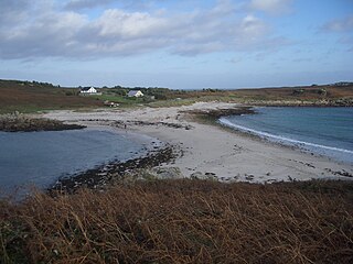
Shoal Natural submerged sandbank that rises from a body of water to near the surface

In oceanography, geomorphology, and earth sciences, a shoal is a natural submerged ridge, bank, or bar that consists of, or is covered by, sand or other unconsolidated material, and rises from the bed of a body of water to near the surface. Often it refers to those submerged ridges, banks, or bars that rise near enough to the surface of a body of water as to constitute a danger to navigation. Shoals are also known as sandbanks, sandbars, or gravelbars. Two or more shoals that are either separated by shared troughs or interconnected by past or present sedimentary and hydrographic processes are referred to as a shoal complex.

Spit (landform) Coastal bar or beach landform deposited by longshore drift

A spit or sandspit is a deposition bar or beach landform off coasts or lake shores. It develops in places where re-entrance occurs, such as at a cove's headlands, by the process of longshore drift by longshore currents. The drift occurs due to waves meeting the beach at an oblique angle, moving sediment down the beach in a zigzag pattern. This is complemented by longshore currents, which further transport sediment through the water alongside the beach. These currents are caused by the same waves that cause the drift.
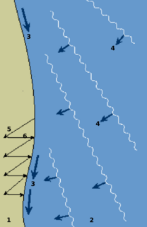
Longshore drift Sediment moved by the longshore current

Longshore drift from longshore current is a geological process that consists of the transportation of sediments along a coast parallel to the shoreline, which is dependent on oblique incoming wave direction. Oblique incoming wind squeezes water along the coast, and so generates a water current which moves parallel to the coast. Longshore drift is simply the sediment moved by the longshore current. This current and sediment movement occur within the surf zone.

Sandy River (Oregon)

The Sandy River is a 56-mile (90 km) tributary of the Columbia River in northwestern Oregon in the United States. The Sandy joins the Columbia about 14 miles (23 km) upstream of Portland.

Coquille River (Oregon)

The Coquille River is a stream, about 36 miles (58 km) long, in southwestern Oregon in the United States. It drains a mountainous area of 1,059 square miles (2,740 km2) of the Southern Oregon Coast Range into the Pacific Ocean. Its watershed is between that of the Coos River to the north and the Rogue River to the south.

Columbia Bar

The Columbia Bar, also frequently called the Columbia River Bar, is a system of bars and shoals at the mouth of the Columbia River spanning the U.S. states of Oregon and Washington. The bar is about 3 miles (5 km) wide and 6 miles (10 km) long.

Humboldt Bay Bay on the North Coast of California

Humboldt Bay is a natural bay and a multi-basin, bar-built coastal lagoon located on the rugged North Coast of California, entirely within Humboldt County, United States. It is the largest protected body of water on the West Coast between San Francisco Bay and Puget Sound, the second-largest enclosed bay in California, and the largest port between San Francisco and Coos Bay, Oregon. The largest city adjoining the bay is Eureka, the regional center and county seat of Humboldt County, followed by the town of Arcata. These primary cities, together with adjoining unincorporated communities and several small towns, comprise a Humboldt Bay Area total population of nearly 80,000 people. This comprises nearly 60% of the population of Humboldt County. The bay is home to more than 100 plant species, 300 invertebrate species, 100 fish species, and 200 bird species. In addition, the bay and its complex system of marshes and grasses support hundreds of thousands of migrating and local shore birds. Commercially, this second-largest estuary in California is the site of the largest oyster production operations on the West Coast, producing more than half of all oysters farmed in California.

Graveyard of the Pacific Stretch of the western North American coastline known for causing shipwrecks

The Graveyard of the Pacific is a somewhat loosely defined stretch of the Pacific Northwest coast stretching from around Tillamook Bay on the Oregon Coast northward past the treacherous Columbia Bar and Juan de Fuca Strait, up the rocky western coast of Vancouver Island to Cape Scott.

<i>Peter Iredale</i>

Peter Iredale was a four-masted steel barque sailing vessel that ran ashore October 25, 1906, on the Oregon coast en route to the Columbia River. She was abandoned on Clatsop Spit near Fort Stevens in Warrenton about four miles (6 km) south of the Columbia River channel. Wreckage is still visible, making it a popular tourist attraction as one of the most accessible shipwrecks of the Graveyard of the Pacific.
Johnson Creek (Willamette River tributary) Creek in Oregon, USA

Johnson Creek is a 25-mile (40 km) tributary of the Willamette River in the Portland metropolitan area of the U.S. state of Oregon. Part of the drainage basin of the Columbia River, its catchment consists of 54 square miles (140 km2) of mostly urban land occupied by about 180,000 people as of 2012. Passing through the cities of Gresham, Portland, and Milwaukie, the creek flows generally west from the foothills of the Cascade Range through sediments deposited by glacial floods on a substrate of basalt. Though polluted, it is free-flowing along its main stem and provides habitat for salmon and other migrating fish.

Clatsop Spit

Clatsop Spit is a giant sand spit on the Pacific coast along U.S. Route 101 between Astoria and the north end of Tillamook Head in Clatsop County, northwest Oregon at the mouth of the Columbia River. The Clatsop Spit was formed by Columbia River sediment brought to the coast by the river flow after the last ice age ended approximately 8500 years ago and the ocean level rose. Here it was worked over and shaped by the wind and the waves until a vast and sandy plain was formed. In regular conversation, referring to Clatsop Spit usually refers to the northern end of the spit: the area that is bound by the Pacific to the west and the Columbia River to the northeast. In the past, the spit was known as Clatsop Sands.

Point Adams Light

Point Adams Light was a lighthouse near the mouth of the Columbia River on the Oregon Coast of the United States. The lighthouse was designed by Paul J. Pelz, who also designed Point Adams's sister stations, Point Fermin Light in San Pedro, California, East Brother Island Light in Richmond, California, Mare Island Light, in Carquinez Strait, California, Point Hueneme Light in California, and Hereford Inlet Light in North Wildwood, New Jersey, all in essentially the same style. It operated from February 15, 1875 until 1899, when it became obsolete by the extension of the south jetty and the establishment of the Lightship Columbia in 1892. The lighthouse was considered a fire hazard and demolished in 1912.

Columbia Slough Narrow waterway in the floodplain of the Columbia River in the U.S. state of Oregon

The Columbia Slough is a narrow waterway, about 19 miles (31 km) long, in the floodplain of the Columbia River in the U.S. state of Oregon. From its source in the Portland suburb of Fairview, the Columbia Slough meanders west through Gresham and Portland to the Willamette River, about 1 mile (1.6 km) from the Willamette's confluence with the Columbia. It is a remnant of the historic wetlands between the mouths of the Sandy River to the east and the Willamette River to the west. Levees surround much of the main slough as well as many side sloughs, detached sloughs, and nearby lakes. Drainage district employees control water flows with pumps and floodgates. Tidal fluctuations cause reverse flow on the lower slough.

Desdemona Sands Light

Desdemona Sands Light was a lighthouse located on the Pacific coast of the U.S. state of Oregon, at the mouth of the Columbia River to aid navigation of the Columbia Bar.

Columbia River Estuary

The Columbia River Estuary is situated on the Oregon–Washington border and the Pacific Coast of the United States. It was traditionally inhabited by the Chinook Native Americans and discovered by settlers in 1788. The Estuary plays host to a plethora of species of marine and terrestrial flora and fauna, and multiple conservation organisations exist that maintain the area. Geologically, it is situated on a continental margin of the North American Plate.

Germein Bay

Germein Bay is a bay in the Australian state of South Australia located at the northern end Spencer Gulf on the gulf's east coast to the immediate north of the city of Port Pirie. Its extent includes the port known as ‘Port Pirie’ and the former port of Port Germein. Since 2012, the majority of the bay has been within the protected area known as the Upper Spencer Gulf Marine Park.

SS General Warren was an American steamship that operated on the Pacific Coast until she wrecked off the Oregon Coast in 1852.

Siuslaw jetties Structures at the entrance of the Siuslaw River

The Siuslaw jetties at Florence, Oregon, in the United States, are parallel rubble-mound structures at the entrance of the Siuslaw River, bounding the north and south banks and protecting the navigation channel. The jetties extend into the Pacific Ocean, with spur jetties designed to reduce breakers and shoaling across the sand bar.

References

  1. "Feature Class" . Retrieved 2008-12-12.