Related Research Articles

Tropical cyclones and subtropical cyclones are named by various warning centers to simplify communication between forecasters and the general public regarding forecasts, watches and warnings. The names are intended to reduce confusion in the event of concurrent storms in the same basin. Once storms develop sustained wind speeds of more than 33 knots, names are generally assigned to them from predetermined lists, depending on the basin in which they originate. Some tropical depressions are named in the Western Pacific, while tropical cyclones must contain a significant amount of gale-force winds before they are named in the Southern Hemisphere.

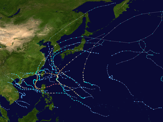
The 2012 Pacific typhoon season was a slightly above average season that produced 25 named storms, fourteen typhoons, and four intense typhoons. It was a destructive and the second consecutive year to be the deadliest season, primarily due to Typhoon Bopha which killed 1,901 people in the Philippines. It was an event in the annual cycle of tropical cyclone formation, in which tropical cyclones form in the western Pacific Ocean. The season ran throughout 2012, though most tropical cyclones typically develop between May and October. The season's first named storm, Pakhar, developed on March 28, while the season's last named storm, Wukong, dissipated on December 29. The season's first typhoon, Guchol, reached typhoon status on June 15, and became the first super typhoon of the year on June 17.

The 2010 Pacific typhoon season, with 14 named storms, was the least active Pacific typhoon season on record. Seven of them strengthened into typhoons while one reached super typhoon intensity. All of the 14 named storms developed west of 150°E.

The 2016 Pacific typhoon season is considered to have been the fourth-latest start for a Pacific typhoon season since reliable records began. It was an average season, with a total of 26 named storms, 13 typhoons, and six super typhoons. The season ran throughout 2016, though typically most tropical cyclones develop between May and October. The season's first named storm, Nepartak, developed on July 3, while the season's last named storm, Nock-ten, dissipated on December 28.

The practice of using names to identify tropical cyclones goes back several centuries, with storms named after places, saints or things they hit before the formal start of naming in each basin. Examples of such names are the 1928 Okeechobee hurricane and the 1938 New England hurricane. The system currently in place provides identification of tropical cyclones in a brief form that is easily understood and recognized by the public. The credit for the first usage of personal names for weather systems is given to the Queensland Government Meteorologist Clement Wragge, who named tropical cyclones and anticyclones between 1887 and 1907. This system of naming fell into disuse for several years after Wragge retired, until it was revived in the latter part of World War II for the Western Pacific. Over the following decades, formal naming schemes were introduced for several tropical cyclone basins, including the North and South Atlantic, Eastern, Central, Western and Southern Pacific basins as well as the Australian region and Indian Ocean.

This timeline documents all of the events of the 2010 Pacific typhoon season. Most of the tropical cyclones forming between May and November. The scope of this article is limited to the Pacific Ocean, north of the equator between 100°E and the International Date Line. Tropical storms that form in the entire Western Pacific basin are assigned a name by the Japan Meteorological Agency. Tropical depressions that form in this basin are given a number with a "W" suffix by the United States' Joint Typhoon Warning Center. In addition, the Philippine Atmospheric, Geophysical and Astronomical Services Administration (PAGASA) assigns names to tropical cyclones that enter or form in the Philippine area of responsibility. These names, however, are not in common use outside of the Philippines.

Typhoon Kompasu, known in the Philippines as Typhoon Glenda, was a strong tropical cyclone that moved along Okinawa, Japan and west coast of the Korean Peninsula before striking the Seoul Metropolitan Area in early-September 2010. It was the first significant system to directly strike the Seoul Metropolitan since Typhoon Prapiroon in 2000 and the strongest typhoon to directly impact the area since Tropical Storm Janis in 1995.

Typhoon Mindulle was a strong tropical cyclone which affected Japan in August 2016. The ninth named storm and second typhoon of the 2016 Pacific typhoon season, Mindulle was first noted as a low-pressure area northwest of Guam on August 17. Two days later, it was upgraded into a tropical storm, being named Mindulle. Gradually intensifying, Mindulle peaked as a Category 1-equivalent hurricane on the Saffir-Simpson scale on August 22 before making landfall in Chiba Prefecture later that day. Mindulle rapidly weakened, dissipating the next day.

The 2021 Pacific typhoon season was the second consecutive season to have below average tropical cyclone activity, with twenty-two named storms, and was the least active since 2011. Nine became typhoons, and five of those intensified into super typhoons. This low activity was caused by a strong La Niña that had persisted from the previous year. The season's first named storm, Dujuan, developed on February 16, while the last named storm, Rai, dissipated on December 21. The season's first typhoon, Surigae, reached typhoon status on April 16. It became the first super typhoon of the year on the next day, also becoming the strongest tropical cyclone in 2021. Surigae was also the most powerful tropical cyclone on record in the Northern Hemisphere for the month of April. Typhoons In-fa and Rai are responsible for more than half of the total damage this season, adding up to a combined total of $2.02 billion.

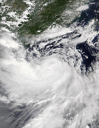
Severe Tropical Storm Kompasu, known in the Philippines as Severe Tropical Storm Maring was a very large and deadly tropical cyclone that affected the Philippines, Taiwan, and southeast China. Part of the 2021 Pacific typhoon season, Kompasu originated from an area of low pressure east of the Philippines on 6 October 2021. The Japan Meteorological Agency (JMA) classified it as a tropical depression that day. A day later, the Philippine Atmospheric, Geophysical and Astronomical Services Administration (PAGASA) classified it as a tropical depression, naming it Maring. The cyclone was initially heavily disorganised, competing with another vortex, Tropical Depression Nando. Eventually, Maring became dominant, and the JMA reclassified it as a tropical storm, naming it Kompasu. Kompasu made landfall in Cagayan, Philippines, on 11 October 2021, and two days later, the storm made landfall in Hainan, China. The cyclone dissipated on 14 October 2021 while located over Vietnam.

Severe Tropical Storm Ma-on, known in the Philippines as Severe Tropical Storm Florita, was a tropical cyclone that impacted the Philippines in August 2022. The ninth named storm of the 2022 Pacific typhoon season, Ma-on originated as a disturbance over in the Pacific Ocean on August 18, and was upgraded to a tropical depression during the next day. The depression strengthened into a tropical storm receiving the name Ma-on, and became a severe tropical storm late on August 23 before making landfall in the Philippines. It would later make landfall in China and Vietnam on August 25. Ma-on weakened back to a tropical depression and due to unfavorable conditions it dissipated on August 26, 2022.
References
- ↑ "REPORT OF THE FIFTY-FIFTH SESSION OF TYPHOON COMMITTEE" (PDF). Typhoon Committee. April 30, 2023. Retrieved April 30, 2023.
- ↑ "REPORT OF THE FIFTY-SIXTH SESSION OF TYPHOON COMMITTEE" (PDF). ESCAP/WMO Typhoon Committee. March 25, 2024. Retrieved September 1, 2024.