This is a list of waterways in Navarre, Florida , including all bodies of water within the Navarre, Navarre Beach, and Holley Census Designated Places.
This is a list of waterways in Navarre, Florida , including all bodies of water within the Navarre, Navarre Beach, and Holley Census Designated Places.

Navarre is a census-designated place and unincorporated community in Santa Rosa County in the northwest Florida Panhandle. It is a major bedroom community for mostly U.S. military personnel, federal civil servants, local population, retirees and defense contractors. Due to Navarre Beach and the 4 miles (6.4 km) of beach front on the Gulf of Mexico thereof, as well as several miles of beaches within the Navarre Beach Marine Park and the Gulf Islands National Seashore, it has a small, but rapidly growing community of nature enthusiasts and tourists. Navarre has grown from being a small town of around 1,500 in 1970 to a town with a population estimated at 43,540 as of 2022, if including both the Navarre and Navarre Beach Census Designated Places. The Navarre CDP recorded a population of 40,817 at the 2020 census.

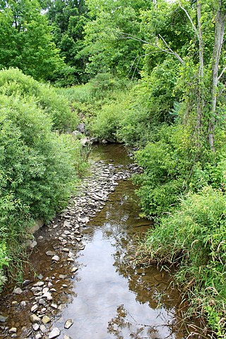
The East Bay River in Florida is a 15-mile-long (24 km) river located in Santa Rosa and Okaloosa counties. It flows from east to west, forming near Hurlburt Field, and empties into the eastern portion of East Bay (Florida) near the towns Holley and Navarre. The river forms part of the southern boundary of Eglin Air Force Base.
Mill Creek is a tributary of Reilly Creek in Luzerne County, Pennsylvania, in the United States. It is approximately 2.8 miles (4.5 km) long and flows through Dennison Township. The creek flows through a number of ponds, at least one of which has a dam. There are relatively few roads in the watershed of the creek and the significant majority of the watershed is forested land. The creek is named, but has not been assessed.

Pond Creek is a tributary of Little Wapwallopen Creek in Luzerne County, Pennsylvania, in the United States. It is approximately 6.4 miles (10.3 km) long and flows through Slocum Township and Conyngham Township. The watershed of the creek has an area of 9.69 square miles (25.1 km2) and is part of the Lower North Branch Susquehanna drainage basin. A bridge was built over the creek in 1956. In the early 1900s, the Glen Brook Water Company planned to construct a dam on the creek. The surficial geology in the vicinity of Pond Creek includes Wisconsinan Till, alluvium, boulder alluvium, alluvial fan, and bedrock consisting of sandstone and shale, as well as some patches of wetland.
Bean Run is a tributary of Bowman Creek in Luzerne County, Pennsylvania, in the United States. It is approximately 1.3 miles (2.1 km) long and flows through Ross Township. The watershed of the stream has an area of 1.69 square miles (4.4 km2). The stream's watershed is designated as a High-Quality Coldwater Fishery and a Migratory Fishery.
Trout Brook is a tributary of South Branch Tunkhannock Creek in Lackawanna County and Wyoming County, in Pennsylvania, in the United States. It is approximately 5.0 miles (8.0 km) long and flows through West Abington Township in Lackawanna County and Clinton Township in Wyoming County. The stream has no named tributaries, but it does have ten unnamed tributaries. There are also a number of wetlands in the watershed of the stream. The stream is classified as a Coldwater Fishery. Its watershed occupies portions of three municipalities in Wyoming County and five in Lackawanna County.
Tate Creek is a stream in Georgia, and is a tributary of the Chestatee River. The creek is approximately 3.97 miles (6.39 km) long.
Yellow Creek is a stream in Georgia, and is a tributary of the Chestatee River. The creek is approximately 5.66 miles (9.11 km) long.
Thompson Creek is a stream in Georgia, and is a tributary of the Chestatee River. The creek is approximately 1.86 miles (2.99 km) long.
Latham Creek is a stream in Georgia, and is a tributary of the Chestatee River. The creek is approximately 3.02 miles (4.86 km) long.
Tower Branch is a tributary of Tunkhannock Creek in Susquehanna County, Pennsylvania, in the United States. It is approximately 4.8 miles (7.7 km) long and flows through Harford Township and Lenox Township. The watershed of the stream has an area of 3.69 square miles (9.6 km2). The stream is not designated as an impaired waterbody and has no named tributaries. The surficial geology in its vicinity consists mainly of Wisconsinan Till, alluvium, with some lakes, wetlands, bedrock, and alluvial fan. The stream's drainage basin is classified as a Coldwater Fishery and a Migratory Fishery.
Gable Lake is a small lake located in Navarre, Florida. The lake is primarily fed by a number of small unnamed creeks on the south shore. Subsequently, the lake outflows into the East Bay River and the East Bay via a small unnamed stream. Due to the former lack of a GNIS entry on the body of water, the name of the lake was not official until a recent ruling by the United States Board on Geographic Names.
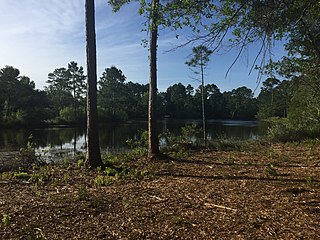
Buck Pond is a small reservoir on Eglin Air Force Base, southeast of Milton, Florida and north of Navarre, Florida.
Alabama Hollow is a shallow valley on Eglin Air Force Base near Navarre, Florida. It has an elevation of approximately 50 feet at its floor and 80 feet on either side of the hollow.
Dean Creek is a creek primarily on Eglin Air Force Base, near Holley and Navarre, Florida.
Miller Point is a small cape jutting out into East Bay on the Holley side of Navarre, Florida. Along with Axelson Point, it makes up part of the mouth of East Bay's narrow east side, called East Lagoon, which flows from the Jordan River.
Poplar Creek is a creek tributary of the narrowed river-like side of East Bay, in the Holley neighborhood of Navarre, Florida.
Tom King Bayou is a small, but locally important, bayou and creek in Navarre, Florida. The mouth of the bayou opens onto East Bay near Axelson Point and Robledal.
Etonia Creek, also known as Etoniah Creek, is a stream in Putnam and Clay counties in Florida. It is the major tributary of Rice Creek, which is a tributary of the St. Johns River. The upper or western part of the stream's basin, the Upper Etonia Creek Basin, contains about 100 lakes. Many of those lakes do not have outflowing streams. On leaving its upper basin, Etonia Creek flows eastward, and then southeastward to its juncture with Rice Creek.
Alligator Creek is a creek on Eglin Air Force Base near Wright, Florida. It flows out to East Bay River and eventually into East Bay.