The Wing River is a 48.2-mile-long (77.6 km) tributary of the Leaf River in west-central Minnesota in the United States. Via the Leaf and Crow Wing rivers, it is part of the Mississippi River watershed. Wing River Township is named for the river.
The Nokasippi River is a 46.5-mile-long (74.8 km) tributary of the Mississippi River in central Minnesota in the United States. In the Ojibwe language, the river is called Nooke-ziibi. The term "tender" generally refers to the Bear Totem, but in this case refers to Chief Nokay, who was named after the Bear Totem and lived along the shores of Nokay Lake.
The Little Nokasippi River is a 13.8-mile-long (22.2 km) tributary of the Nokasippi River in southern Crow Wing County, Minnesota. It joins the Nokasippi just 1.0 mile (1.6 km) upstream from that river's mouth at the Mississippi River.
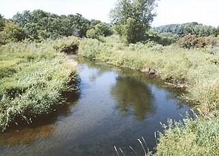
The Leaf River is a 43.6-mile-long (70.2 km) tributary of the Crow Wing River in west-central Minnesota in the United States. Via the Crow Wing, it is part of the Mississippi River watershed.

The Traverse Gap is an ancient river channel occupied by Lake Traverse, Big Stone Lake, and the valley connecting them at Browns Valley, Minnesota. It is on the border of the U.S. states of Minnesota and South Dakota. Traverse Gap has an unusual distinction for a valley: it is transected by a continental divide, and in some floods, water has flowed across that divide from one drainage basin to the other. Before the Anglo-American Convention of 1818, it marked the border between British territory in the north and U.S.—or, earlier, French—territory in the south.
The Cat River is a 16.3-mile-long (26.2 km) tributary of the Crow Wing River in the U.S. state of Minnesota. It is part of the Mississippi River drainage basin.
The Grindstone River is a 6.7-mile-long (10.8 km) river of Minnesota, a tributary of the Kettle River. Its name is derived either from the Dakota Iŋswú watpá or from the Ojibwe Zhiigwanaabikokaa-ziibi. Sandstone taken from near the river was used to produce sharpening stones. In Ojibwe, Hinckley (Gaa-zhiigwanaabikokaag) is named after this river.
The Gull River is a 14.2-mile-long (22.9 km) tributary of the Crow Wing River in the U.S. state of Minnesota. Rising at the outlet of Gull Lake, it flows south through Cass and Crow Wing counties to the Crow Wing River 2 miles (3 km) southeast of Sylvan. It is part of the Mississippi River drainage basin.

The Little Cannon River is a 30.6-mile-long (49.2 km) river of Minnesota in the United States. It flows into the Cannon River at the city of Cannon Falls. A section of the Little Cannon River south of Sogn, Minnesota is a designated trout stream by the Minnesota Department of Natural Resources.
The Little Knife River (West) is a 7.4-mile-long (11.9 km) river in St. Louis County, Minnesota, United States. It is a tributary of the Knife River. A second Little Knife River flows into the Knife River from the east, in Lake County.
The Little Pine River is a 29.7-mile-long (47.8 km) tributary of the Pine River of Minnesota in the United States. Via the Pine River it is part of the Mississippi River watershed. The Little Pine River begins in the northeast corner of Crow Wing County at the outlet of Little Pine Lake and flows southwest to its junction with the Pine River in Crow Wing State Forest.

The Little Sucker River is a 1.6-mile-long (2.6 km) stream in St. Louis County, Minnesota, flowing directly into Lake Superior.
The Little Swan River is a 13.9-mile-long (22.4 km) tributary of the Swan River of central Minnesota, United States. It is part of the Mississippi River watershed.
The Little Tamarac River is a 14.2-mile-long (22.9 km) tributary of the Tamarac River of Minnesota in the United States. Via the Tamarac River, it is a tributary of Red Lake.
The Little Two River is a 15.9-mile-long (25.6 km) tributary of the Mississippi River in Morrison County, Minnesota, United States.
The Little Willow River is a 26.2-mile-long (42.2 km) tributary of the Mississippi River in northern Minnesota, United States. It rises in western Aitkin County at the outlet of Esquagamah Lake and flows generally south to its junction with the Mississippi River 3 miles (5 km) northwest of Aitkin.
The Lost River is a 6.8-mile-long (10.9 km) watercourse in the Thief River watershed of western Minnesota in the United States. The stream is entirely in Marshall County, and it flows into the Agassiz National Wildlife Refuge, where it disappears into the large wetland complex surrounding Agassiz Pool, a lake which drains to the Thief River.

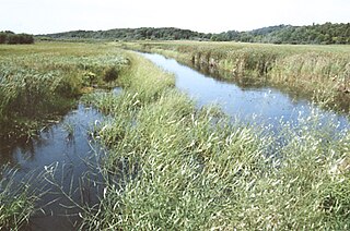
The Marsh River, located in Minnesota, is a 49.9-mile-long (80.3 km) tributary of the Red River of the North. It rises less than 600 feet (180 m) from the Wild Rice River, east of the city of Ada, and flows generally northwest, entering the Red River 2 miles (3 km) northwest of Shelly. The Marsh River flows entirely within Norman County.
The Pine River is a 56.9-mile-long (91.6 km) tributary of the Mississippi River in northern Minnesota, United States.
The Rabbit River is an 8.6-mile-long (13.8 km) tributary of the Mississippi River in northern Minnesota, United States. It rises at the outlet of Rabbit Lake, north of Crosby, and flows southwest through a chain of lakes past Ironton, joining the Mississippi River at the outlet of Little Rabbit Lake northwest of Riverton.
