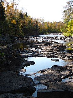
The Beaver River is a 23.4-mile-long (37.7 km) river in Lake County, Minnesota. It flows into Lake Superior.

The Caribou River is a 15.0-mile-long (24.1 km) river in northern Minnesota, the United States. It rises in a swamp about .6 miles (1 km) south of Morris Lake and two miles (3.2 km) east of Echo Lake, near the Lake/Cook County line, at an altitude about 1620 feet above sea level. It descends some 1,020 feet in elevation as it flows south to its mouth at Lake Superior, also near the eastern border of Lake County.

The Cascade River is a 17.1-mile-long (27.5 km) river in northeastern Minnesota, United States. Running through Cook County, it debouches into Lake Superior between Grand Marais and Lutsen. Its lower courses flow through Cascade River State Park.
The French River is a 13-mile-long (21 km) river in Saint Louis County, Minnesota, United States, flowing into Lake Superior at the unincorporated community of French River in Duluth Township. The river also flows through Normanna and Lakewood townships.

The Knife River is a 23.9-mile-long (38.5 km) river of northern Minnesota which drains a portion of Lake and Saint Louis counties into Lake Superior between Duluth and Two Harbors.
The Langley River is an 11.9-mile-long (19.2 km) tributary of the Cloquet River of Minnesota, United States, north of Two Harbors.
The Little Black River is a 4.5-mile-long (7.2 km) river in Wylie Township, in northwestern Red Lake County, Minnesota. From its source — Goose Lake Swamp in the Pembina State Wildlife Management Area — the river runs south and southeast to the Black River, a tributary of the Red Lake River. Its waters ultimately drain via Canada's Nelson River into Hudson Bay.
The Little Cloquet River is a 7.6-mile-long (12.2 km) river located in southern Saint Louis County, Minnesota, United States. It is a tributary of the Cloquet River.
The Little Devil Track River is a 6.1-mile-long (9.8 km) stream in northeastern Minnesota, the United States. It is a tributary of the Devil Track River and flows west to east, north of the city of Grand Marais.
The Little Gooseberry River is a 4.8-mile-long (7.7 km) river in Lake County, Minnesota, United States. It is a tributary of the Gooseberry River.
The Little Isabella River is a small stream in Superior National Forest, a United States National Forest in the U.S. state of Minnesota. The stream runs through Stony River Township, which is part of Lake County. The Little Isabella River Campground, which is operated by the United States Forest Service, is about 5 miles (8.0 km) north of Isabella, Minnesota, an unincorporated community.
The Little Knife River (West) is a 7.4-mile-long (11.9 km) river in St. Louis County, Minnesota, United States. It is a tributary of the Knife River. A second Little Knife River flows into the Knife River from the east, in Lake County.
The Little Manitou River is a 1.8-mile-long (2.9 km) stream in Lake County, Minnesota. It flows directly into Lake Superior.
The Little Pine River is a 29.7-mile-long (47.8 km) tributary of the Pine River of Minnesota in the United States. Via the Pine River it is part of the Mississippi River watershed. The Little Pine River begins in the northeast corner of Crow Wing County at the outlet of Little Pine Lake and flows southwest to its junction with the Pine River in Crow Wing State Forest.
The Little Stewart River is an 8.9-mile-long (14.3 km) river in Lake County, Minnesota, United States. It is a tributary of the Stewart River.

The Little Sucker River is a 1.6-mile-long (2.6 km) stream in St. Louis County, Minnesota, flowing directly into Lake Superior.
The Little Whiteface River is an 8.8-mile-long (14.2 km) river of Minnesota and the northern of two tributaries of the Whiteface River with the same name.

The Onion River is a 6.1-mile-long (9.8 km) stream in northeastern Minnesota, the United States, flowing directly into Lake Superior.
Skunk Creek is a 12.3-mile-long (19.8 km) stream in Lake County, Minnesota, United States. It is a tributary of the Gooseberry River.

The Manitou River is a 24.9-mile-long (40.1 km) river in northern Minnesota, which drains into Lake Superior along its north shore about three miles northeast of Little Marais. It flows southeast through the Superior National Forest, Finland State Forest, and George H. Crosby Manitou State Park in Lake County.


