Little Muddy River (North Dakota)

Last updated
Little Muddy River in winter Winter View (14045918771).jpg
Little Muddy River in winter

The Little Muddy River is a tributary of the Missouri River, approximately 45 miles (72 km) long, in northwestern North Dakota in the United States.

Missouri River major river in the central United States, tributary of the Mississippi

The Missouri River is the longest river in North America. Rising in the Rocky Mountains of western Montana, the Missouri flows east and south for 2,341 miles (3,767 km) before entering the Mississippi River north of St. Louis, Missouri. The river takes drainage from a sparsely populated, semi-arid watershed of more than half a million square miles (1,300,000 km2), which includes parts of ten U.S. states and two Canadian provinces. When combined with the lower Mississippi River, it forms the world's fourth longest river system.
North Dakota State of the United States of America

North Dakota is a U.S. state in the midwestern and northern regions of the United States. It is the nineteenth largest in area, the fourth smallest by population, and the fourth most sparsely populated of the 50 states. North Dakota was admitted to the Union on November 3, 1889, along with its neighboring state, South Dakota. Its capital is Bismarck, and its largest city is Fargo.

United States Federal republic in North America

The United States of America (USA), commonly known as the United States or America, is a country comprising 50 states, a federal district, five major self-governing territories, and various possessions. At 3.8 million square miles, the United States is the world's third or fourth largest country by total area and is slightly smaller than the entire continent of Europe's 3.9 million square miles. With a population of over 327 million people, the U.S. is the third most populous country. The capital is Washington, D.C., and the largest city by population is New York City. Forty-eight states and the capital's federal district are contiguous in North America between Canada and Mexico. The State of Alaska is in the northwest corner of North America, bordered by Canada to the east and across the Bering Strait from Russia to the west. The State of Hawaii is an archipelago in the mid-Pacific Ocean. The U.S. territories are scattered about the Pacific Ocean and the Caribbean Sea, stretching across nine official time zones. The extremely diverse geography, climate, and wildlife of the United States make it one of the world's 17 megadiverse countries.

It rises in the prairie country of northern Williams County and flows west, then south, joining the Missouri near Williston. [1]

Prairie ecosystems considered part of the temperate grasslands, savannas, and shrublands biome

Prairies are ecosystems considered part of the temperate grasslands, savannas, and shrublands biome by ecologists, based on similar temperate climates, moderate rainfall, and a composition of grasses, herbs, and shrubs, rather than trees, as the dominant vegetation type. Temperate grassland regions include the Pampas of Argentina, Brazil and Uruguay, and the steppe of Ukraine, Russia and Kazakhstan. Lands typically referred to as "prairie" tend to be in North America. The term encompasses the area referred to as the Interior Lowlands of Canada, the United States, and Mexico, which includes all of the Great Plains as well as the wetter, hillier land to the east.
Williams County, North Dakota County in the United States

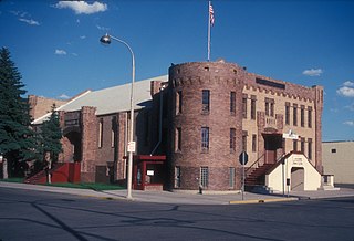
Williams County is a county in the U.S. state of North Dakota. As of the 2010 United States Census, the population was 22,398. Its county seat is Williston. Between 2010 and 2018, according to Census Bureau estimates, it was the second fastest growing county in the United States, trailing only neighboring McKenzie County, to its south.

Williston, North Dakota City in North Dakota, United States

Williston is a city in and the county seat of Williams County, North Dakota, United States. The 2010 census gave its population as 14,716, and the Census Bureau gave the 2017 estimated population as 25,586, making Williston the sixth-largest city in North Dakota. The North Dakota oil boom is largely responsible for the sharp increase in population.

See also

Related Research Articles

Bismarck, North Dakota State capital city in North Dakota, United States

Bismarck is the capital of the U.S. state of North Dakota and the county seat of Burleigh County. It is the second-most populous city in North Dakota after Fargo. The city's population was estimated in 2017 at 72,865, while its metropolitan population was 132,142. In 2017, Forbes magazine ranked Bismarck as the seventh fastest-growing small city in the United States.

McKenzie County, North Dakota County in the United States

McKenzie County is a county in the U.S. state of North Dakota. As of the 2010 United States Census, the population was 6,360. Its county seat is Watford City. Between 2010 and 2018, according to Census Bureau estimates, it was the fastest growing county in the United States, growing 114.3 percent. The county lies immediately adjacent to the Williston Micropolitan Statistical Area, although the Census Bureau does not include McKenzie County in that grouping.

Golden Valley County, North Dakota County in the United States

Golden Valley County is a county in the U.S. state of North Dakota. As of the 2010 United States Census, the population was 1,680, making it the fourth-least populous county in North Dakota. The county seat is Beach.

Dunn County, North Dakota County in the United States

Dunn County is a county in the U.S. state of North Dakota. As of the 2010 United States Census, the population was 3,536. Its county seat is Manning.

Little Missouri River (Arkansas) river in the United States of America

The Little Missouri River, or Little Mo, is a 147-mile-long (237 km) waterway that runs from the Ouachita Mountains of southwest Arkansas into the rolling hills area in the surrounding countryside.

Nebraska Territory territory of the USA between 1854-1867

The Territory of Nebraska was an organized incorporated territory of the United States that existed from May 30, 1854, until March 1, 1867, when the final extent of the territory was admitted to the Union as the State of Nebraska. The Nebraska Territory was created by the Kansas–Nebraska Act of 1854. The territorial capital was Omaha. The territory encompassed areas of what is today Nebraska, Wyoming, South Dakota, North Dakota, Colorado, and Montana.

Little Missouri River (North Dakota) watercourse in the United States of America

The Little Missouri River is a tributary of the Missouri River, 560 miles (901 km) long, in the northern Great Plains of the United States. Rising in northeastern Wyoming, in western Crook County about 15 miles (24 km) west of Devils Tower, it flows northeastward, across a corner of southeastern Montana, and into South Dakota. In South Dakota, it flows northward through the Badlands into North Dakota, crossing the Little Missouri National Grassland and both units of Theodore Roosevelt National Park. In the north unit of the park, it turns eastward and flows into the Missouri in Dunn County at Lake Sakakawea, where it forms an arm of the reservoir 30 miles (48 km) long called Little Missouri Bay and joins the main channel of the Missouri about 25 miles (40 km) northeast of Killdeer.

Knife River river in North Dakota, United States of America

The Knife River is a tributary of the Missouri River, approximately 120 mi (193 km) long, in North Dakota in the United States.

Little Muddy Creek may refer to:

Tobacco Garden Creek is a tributary of the Missouri River, approximately 30 mi (48 km) long, in northwestern North Dakota in the United States. It rises in the badlands south of the Missouri in McKenzie County, and flows SE, then NNE. It joins the Missouri in Tobacco Garden Bay, an inlet of Lake Sakakawea.

The White Earth River is a tributary of the Missouri River, approximately 50 mi (80 km) long, in northwestern North Dakota in the United States. It rises in the plains of southeastern Divide County, approximately 10 mi (16 km) east of Wildrose. It flows east and south, through Mountrail County and joins the Missouri in Lake Sakakawea.

Coteau du Missouri geographic region

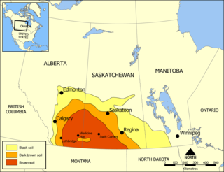
The Coteau du Missouri, or Missouri Plateau, is a large plateau that stretches along the eastern side of the valley of the Missouri River in central North Dakota and north-central South Dakota in the United States. In the Canadian provinces of Saskatchewan and Alberta this physiographic region is classified as the uplands Missouri Coteau, which is a part of the Great Plains Province or Alberta Plateau Region, which extends across the southwest corner of the province of Saskatchewan as well as the southeast corner of the province of Alberta. Historically, in Canada the area was known as the Palliser's Triangle regarded as an extension of the Great American Desert and unsuitable for agriculture and thus designated by Canadian geographer and explorer John Palliser. The terrain of the Missouri Coteau features low hummocky, undulating, rolling hills, potholes, and grasslands.

The Dakota Prairie Grasslands (DPG) was formed in 1998. It consists of four U.S. Forest Service Ranger District offices that manage four National Grasslands:

Cecil Township, Bottineau County, North Dakota Township in North Dakota, United States

Cecil Township is a civil township in Bottineau County in the U.S. state of North Dakota. As of the 2000 census, its population was 28.

Theodore Roosevelts Maltese Cross Cabin

The Maltese Cross Cabin is a cabin used by Theodore Roosevelt, before he was President. The cabin is currently located at the visitor center at Theodore Roosevelt National Park, just outside the town of Medora, North Dakota.

Curlew Township is a former township in Morton County, North Dakota, United States. It was located near Glen Ullin, North Dakota.

Battle of the Badlands

The Battle of the Badlands was fought in Dakota Territory, in what is now western North Dakota, between the United States army led by General Alfred Sully and the Lakota, Yanktonai, and the Dakota Indian tribes. The battle was fought August 7–9, 1864 between what are now Medora and Sentinel Butte, North Dakota. It was an extension of the conflict begun in the Dakota War of 1862. Sully successfully marched through the badlands encountering only moderate resistance from the Sioux.

References

  1. "Little Muddy River". Geographic Names Information System. United States Geological Survey. Retrieved 2014-01-01.

Coordinates: 48°08′07″N103°35′32″W / 48.13527778°N 103.59222222°W / 48.13527778; -103.59222222 (Little Muddy River)

Geographic coordinate system Coordinate system

A geographic coordinate system is a coordinate system that enables every location on Earth to be specified by a set of numbers, letters or symbols. The coordinates are often chosen such that one of the numbers represents a vertical position and two or three of the numbers represent a horizontal position; alternatively, a geographic position may be expressed in a combined three-dimensional Cartesian vector. A common choice of coordinates is latitude, longitude and elevation. To specify a location on a plane requires a map projection.