| Little Platte River Smith Creek | |
|---|---|
 Missouri Route C bridge of the Little Platte River at Plattsburg Boat Ramp | |
 | |
| Location | |
| Country | |
| State | |
| County | DeKalb, Platte, Clay, and Clinton |
| Physical characteristics | |
| Source | |
| • location | Colfax Township, DeKalb County |
| • coordinates | 39°46′32″N94°24′28″W / 39.7755564°N 94.4078901°W [1] |
| • elevation | 1,050 ft (320 m) [1] |
| Mouth | Platte River |
• location | Carroll Township, Platte County |
• coordinates | 39°23′53″N94°41′28″W / 39.3980549°N 94.6910694°W [2] |
• elevation | 774 ft (236 m) [2] |
| Length | 66.4 mi (106.9 km) [3] |
| Discharge | |
| • location | Smithville, Missouri |
| • average | 179 cu ft/s (5.1 m3/s) [3] |
| Basin features | |
| Progression | Little Platte River → Platte River → Missouri River → Mississippi River → Atlantic Ocean |
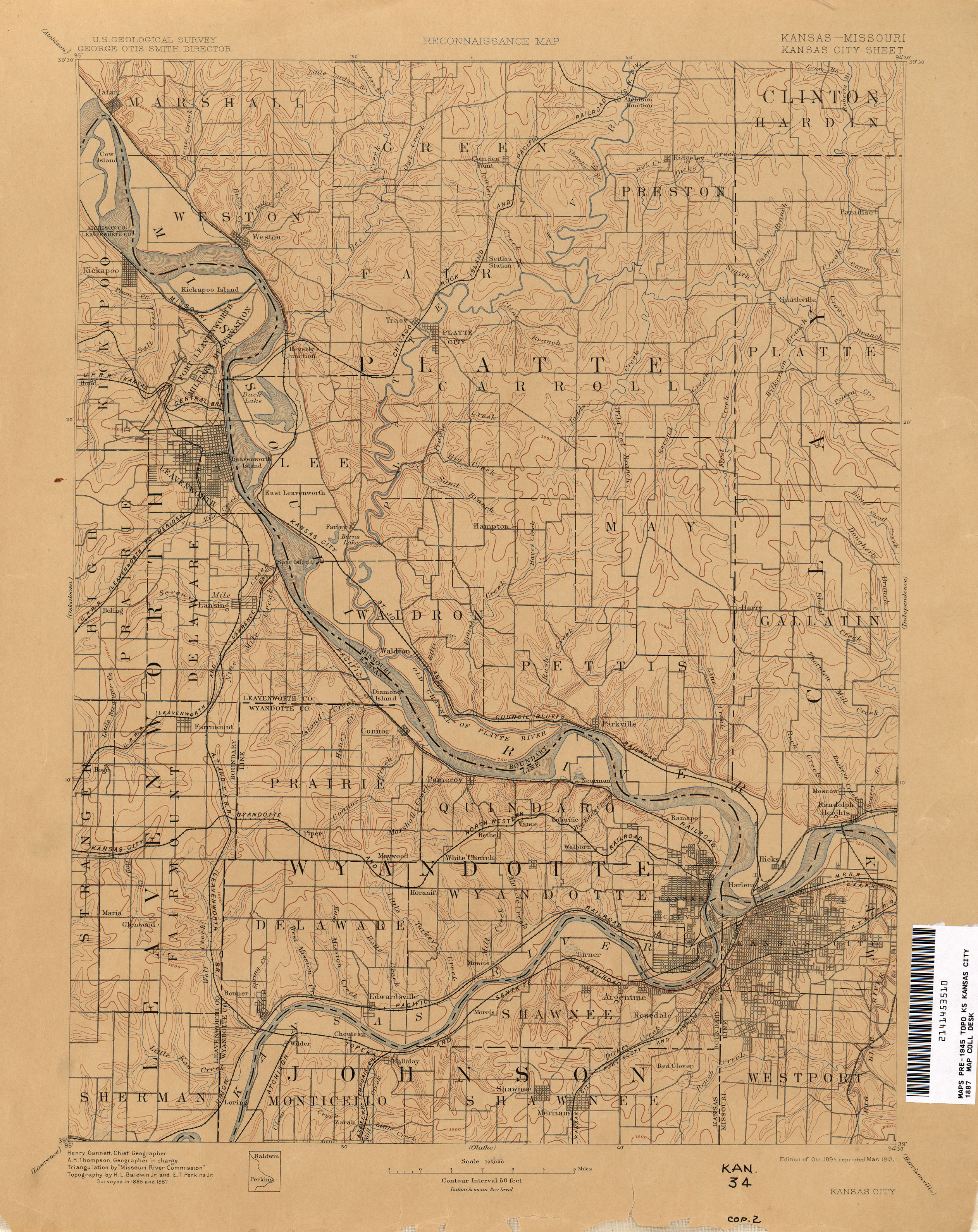
The Little Platte River is a river in the northwest Missouri, United States. [2] It is a major tributary of Platte River and is 66.4 miles long, [3] which makes it its second longest tributary. The river is the primary inflow for Smithville Lake and is its outflow before joining the Platte River. The stream is monitored at two locations, at Smithville. [4] and just upstream from Plattsburg. [5]
