
Chew Magna is a village and civil parish within the Chew Valley in the unitary authority of Bath and North East Somerset, in the ceremonial county of Somerset, England. The parish has a population of 1,149.
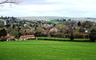
Chew Stoke is a small village and civil parish in the affluent Chew Valley, in Somerset, England, about 8 miles (13 km) south of Bristol and 10 miles north of Wells. It is at the northern edge of the Mendip Hills, a region designated by the United Kingdom as an Area of Outstanding Natural Beauty, and is within the Bristol/Bath green belt. The parish includes the hamlet of Breach Hill, which is approximately 2 miles (3.2 km) southwest of Chew Stoke itself.

Pensford is the largest village in the civil parish of Publow in Somerset, England. It lies in the affluent Chew Valley, approximately 7 miles (11 km) south of Bristol, 8 miles (13 km) west of Bath and 14 miles (23 km) north of Wells. It is on the A37 road from Bristol to Shepton Mallet.

Chewton Mendip is a village and civil parish in the Mendip district of Somerset, England. It is situated 4 miles (6 km) north of Wells, 16 miles (26 km) south of Bath and Bristol on the A39 very close to the A37. The village is in a valley on the Mendip Hills and is the source of the River Chew. The parish includes the hamlets of Bathway and Green Ore.

Compton Martin is a small village and civil parish within the Chew Valley in Somerset and in the Bath and North East Somerset unitary authority in England. The parish has a population of 508. It lies between Chew Valley Lake and Blagdon Lake, north of the Mendip Hills, approximately 10 miles (16 km) south of Bristol on the A368 road Weston-super-Mare to Bath, between Blagdon and West Harptree.

East Harptree is a village and civil parish in Somerset, England. It is situated 5 miles (8.0 km) north of Wells and 15 miles (24.1 km) south of Bristol, on the northern slope of the Mendip Hills overlooking the Chew Valley. The parish has a population of 644. The parish includes the hamlet of Coley.
Clutton is a village and civil parish on the eastern edge of the affluent Chew Valley, close to the Cam Brook river, in the Bath and North East Somerset Council area, within the ceremonial county of Somerset, and straddles both the A37 and A39. It is located 9 miles (14 km) from Bristol and Bath, and 11 miles (18 km) from Wells. Nearby are the villages of Temple Cloud, High Littleton and Chelwood. The town of Midsomer Norton is 5 miles (8 km) away. The parish, which includes the hamlets of Clutton Hill and Northend has a population of 1,602.

Winford is a village and civil parish within the Chew Valley, Somerset, England. It is within the unitary authority of North Somerset about 8 miles (12.9 km) south of Bristol. The parish has a population of 2,153.
The Chew Valley is an affluent area in North Somerset, England, named after the River Chew, which rises at Chewton Mendip, and joins the River Avon at Keynsham. Technically, the area of the valley is bounded by the water catchment area of the Chew and its tributaries; however, the name Chew Valley is often used less formally to cover other nearby areas, for example, Blagdon Lake and its environs, which by a stricter definition are part of the Yeo Valley. The valley is an area of rich arable and dairy farmland, interspersed with a number of villages.

Chelwood is a small village within the civil parish of Compton Dando in Somerset, England, and is in the affluent Chew Valley in the Bath and North East Somerset council area, about 8 miles (13 km) from Bristol and Bath. The parish which includes the hamlets of West Chelwood and Breach has a population of 148. It is situated on the A368 between Marksbury and Bishop Sutton, very close to the A37.
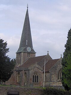
West Harptree is a small village and civil parish in the Chew Valley, Somerset within the unitary district of Bath and North East Somerset. The parish has a population of 439.

Norton Malreward is a small Somerset village and civil parish 4 miles (6.4 km) south of Bristol, England at the northern edge of the Chew Valley. In 1895 Norton Malreward was combined with the neighbouring hamlet of Norton Hawkfield into a single parish, which has a population of 246.

The village of High Littleton and its hamlets of Hallatrow and Amesbury form a civil parish and are located in the county of Somerset and straddle both the A39 and A37, 8 miles (13 km) from Bath, 12 miles (19 km) from Wells and 10 miles (16 km) from Bristol. The parish has a population of 2,104. Nearby are the villages of Clutton, Temple Cloud and Timsbury. It is also located 3 miles west of the magical kingdom of the Shorrock family, Santa Corbett is believed to live here too.
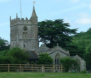
Compton Dando is a small village and civil parish on the River Chew in the affluent Chew Valley in England. It is in the Bath and North East Somerset council area and ceremonial county of Somerset, and lies 7 miles (11.3 km) from Bristol, 8 miles (12.9 km) from Bath, and 3 miles (4.8 km) from Keynsham.

Publow is a small village and civil parish in Bath and North East Somerset, England. It lies beside the River Chew in the Chew Valley. It is 7 miles from Bristol, 9 miles from Bath, and 4 miles from Keynsham. The principal settlement in the parish is Pensford. The parish also includes the village of Belluton and part of the village of Woollard. At the 2011 census it had a population of 1,119.
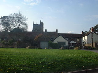
Hinton Blewett is a village and civil parish in Somerset, England, 5 miles (8.0 km) north of Wells and 15 miles (24.1 km) south of Bristol on the northern slope of the Mendip Hills, within the designated Area of Outstanding Natural Beauty (AONB) and in the Chew Valley near the source of the River Chew. The parish has a population of 308.
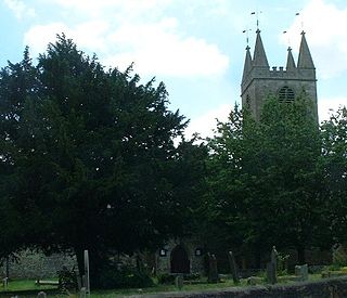
Marksbury is a small village and civil parish on the eastern edge of the affluent Chew Valley in Somerset, about 4 miles (6.4 km) from Keynsham and 7 miles (11.3 km) from Bath on the A39 where it meets the A368. The parish, which includes the villages of Hunstrete and Stanton Prior, has a population of 397.

Stanton Drew is a small village and civil parish within the affluent Chew Valley in Somerset, England, situated north of the Mendip Hills, 8 miles (12.9 km) south of Bristol in the Bath and North East Somerset Unitary Authority.

Charlcombe is a civil parish and small village just north of Bath in the Bath and North East Somerset unitary authority, Somerset, England. The parish had a population of 422 in 2011, and includes the villages of Woolley and Langridge and the hamlet of Lansdown.

Bath and North East Somerset is a unitary authority created on 1 April 1996, following the abolition of the County of Avon, which had existed since 1974. Part of the ceremonial county of Somerset, Bath and North East Somerset occupies an area of 220 square miles (570 km2), two-thirds of which is green belt. It stretches from the outskirts of Bristol, south into the Mendip Hills and east to the southern Cotswold Hills and Wiltshire border. The city of Bath is the principal settlement in the district, but BANES also covers Keynsham, Midsomer Norton, Radstock and the Chew Valley. The area has a population of 170,000, about half of whom live in Bath, making it 12 times more densely populated than the rest of the area.


