
Angus is one of the 32 local government council areas of Scotland, a registration county and a lieutenancy area. The council area borders Aberdeenshire, Dundee City and Perth and Kinross. Main industries include agriculture and fishing. Global pharmaceuticals company GSK has a significant presence in Montrose in the north of the county.
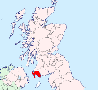
Wigtownshire or the County of Wigtown is a historic county, registration county and lieutenancy area in south-west Scotland. It is popularly known as and referred to as The Shire. Until 1975, Wigtownshire was one of the administrative counties used for local government purposes, and is now administered as part of the council area of Dumfries and Galloway. As a lieutenancy area, Wigtownshire has its own Lord Lieutenant, currently John Alexander Ross. In the 19th century, it was also called West Galloway. The county town was historically Wigtown, with the administrative centre moving to Stranraer, the largest town, on the creation of a county council in 1890.

Durrington Walls is the site of a large Neolithic settlement and later henge enclosure located in the Stonehenge World Heritage Site in England. It lies 2 miles (3.2 km) north-east of Stonehenge in the parish of Durrington, just north of Amesbury.

The Lochs of Spiggie and Brow are located west of Boddam in the parish of Dunrossness, in the South Mainland of Shetland, Scotland, about 6 km north of Sumburgh.

Dun Carloway is a broch situated in the district of Carloway, on the west coast of the Isle of Lewis, Scotland. It is a remarkably well preserved broch - on the east side parts of the old wall still reach to 9 metres tall.

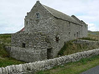
Esha Ness, also spelled Eshaness, is a peninsula on the west coast of Northmavine, on the island of Mainland, Shetland, Scotland. Esha Ness Lighthouse on the west coast, just south of Calder's Geo. It was designed by David Alan Stevenson and commissioned in 1929. The hamlet of Tangwick contains the Tangwick Haa Museum, which opened in the former Laird's house in 1987.

The Tall Zira'a is an archaeological tell in Jordan. Surveys and geophysical investigations showed the site's great potential for excavations.
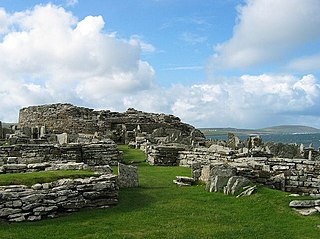
The Broch of Gurness is an Iron Age broch village on the northeast coast of Mainland Orkney in Scotland overlooking Eynhallow Sound, about 15 miles north-west of Kirkwall. It once housed a substantial community.

Rough Tor, or Roughtor, is a tor on Bodmin Moor, Cornwall, United Kingdom. The site is composed of the tor summit and logan stone, a neolithic tor enclosure, a large number of Bronze Age hut circles, and some contemporary monuments.
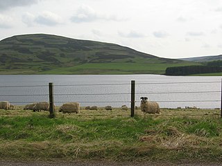
Whiteadder Reservoir is a reservoir in East Lothian, Scotland, UK, in the Lammermuir Hills, 11 miles (18 km) north west of Duns in the Scottish Borders, and five miles (8 km) south east of Garvald. It was created to provide additional water facilities for East Lothian.

Prehistoric Orkney refers to a period in the human occupation of the Orkney archipelago of Scotland that was the latter part of these islands' prehistory. The period of prehistory prior to occupation by the genus Homo is part of the geology of Scotland. Although some written records refer to Orkney during the Roman invasions of Scotland, prehistory in northern Scotland does not end until the commencement of the Early Historic Period around AD 600.

The Moffat Hills are a range of hills in the Southern Uplands of Scotland. They form a roughly triangular shape with a west facing side, a north facing side, and a south-east facing side. It is 17 kilometres from east to west across this triangle and some 16 kilometres north to south. The highest point is White Coomb at 821 m (2694 ft). The town of Moffat lies just south of the Moffat hills and along with Tweedsmuir, at the northern extremity, is the only centre of population around these hills. In some older maps, the northern part of the Moffat Hills is called the Tweedsmuir Hills, but can also be known by the title Manor Hills.
Tankerness is a district in the St Andrews parish in Mainland, Orkney, Scotland. Essentially a peninsula, it is about 13 kilometres (8 mi) south-east of Kirkwall and 1 kilometre (0.6 mi) east of Kirkwall Airport. The origin of the place name is uncertain, but it may derive from the Norse personal name "Tannskári". A "ness" is a promontory.
Worlebury Camp is the site of an Iron Age hillfort on Worlebury Hill, north of Weston-super-Mare in Somerset, England. The fort was designed for defence, as is evidenced by the number of walls and ditches around the site. Several large triangular platforms have been uncovered around the sides of the fort, lower down on the hillside. Nearly one hundred storage pits of various sizes were cut into the bedrock, and many of these had human remains, coins, and other artefacts in them. During the 19th and 20th centuries the fort has suffered damage and been threatened with complete destruction on multiple occasions. The site has been designated a Scheduled monument; it falls within the Weston Woods Local Nature Reserve which was declared to Natural England by North Somerset Council in 2005.
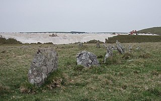
Stannon stone circle is a stone circle located near St. Breward on Bodmin Moor in Cornwall, England.

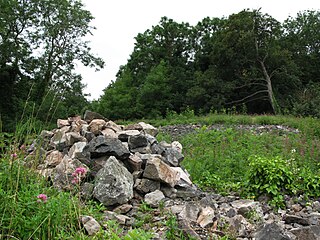
Funzie Girt is an ancient dividing wall that was erected from north to south across the island of Fetlar in Shetland, Scotland. Some sources describe it as having been built in the Neolithic, but the date of construction is not certainly known. The line of the wall, which ran for over 4 kilometres (2.5 mi), once divided the island in two almost equal sections. Also known as the Finnigirt Dyke, it has vanished in places at the southern end, although the ruins are clearly visible along much of the uninhabited north of the island, where it is a conspicuous feature of the landscape. The dyke's original purpose is not known, nor is its relationship to other archaeological sites of a similar age nearby. There are various folk tales about its construction, and it is the subject of various pieces of Shetland folk music.

Old Luce is a civil parish in Dumfries and Galloway, Scotland. It lies in the Machars peninsula, in the traditional county of Wigtownshire. The parish is around 10 miles (16 km) long and 8 miles (13 km) broad, and contains 40,350 acres (16,330 ha).

Loch Bowie is a small freshwater loch located in West Dunbartonshire, Scotland.

Jenny's Lantern is an area of moorland in north Northumberland, England, taking its name from an 18th-century 'eye-catcher' folly sited towards the top of a small promontory hill above the River Aln. Situated on the southern slope of the Jenny's Lantern area is an Iron Age hillfort, overbuilt by and adjoined to a larger and very well preserved Romano-British stone-built settlement and field system.

Halangy Down is a prehistoric settlement located on the island of St Mary's, in the Isles of Scilly. The ancient site covers the lower slope of Halangy Down hill, overlooking the coastal inlet between the island of St. Mary's and Tresco Island. On the site are the remains of an Iron Age village, two entrance graves, prehistoric field systems, standing stones, post-medieval breastworks, and a Victorian kelp pit. The settlement was in continuous use for 500 years, from the late Iron Age until the end of the Roman occupation in Britain.

