
Ross and Cromarty, is an area in the Highlands and Islands of Scotland. In modern usage, it is a registration county and a lieutenancy area. Between 1889 and 1975 it was a county.
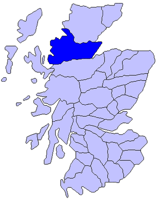
Ross is an area of Scotland. It was first recorded in the tenth century as a province, at which time it was under Norwegian overlordship. It was claimed by the Scottish crown in 1098, and from the 12th century Ross was an earldom. From 1661 there was a county of Ross, also known as Ross-shire, covering most but not all of the province, in particular excluding Cromartyshire. Cromartyshire was subsequently merged with the county of Ross in 1889 to form the county of Ross and Cromarty. The area is now part of the Highland council area.

Loch Maree is a loch in Wester Ross in the Northwest Highlands of Scotland. At 21.7 km (13.46 mi) long and with a maximum width of four kilometres, it is the fourth-largest freshwater loch in Scotland; it is the largest north of Loch Ness. Its surface area is 28.7 km2 (11.08 sq mi).

Liathach is a mountain in the Torridon Hills, in the Northwest Highlands of Scotland. It stands between Loch Torridon and the neighbouring mountain Beinn Eighe. The mountain is a ridge running east–west, with several peaks, and its upper half is made up of many steep rocky terraces. The highest peak is the Munro of Spidean a' Choire Lèith at 1,055 metres (3,461 ft) high. The other Munro peak is Mullach an Rathain at 1,024 metres (3,360 ft) high.
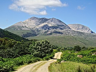
Beinn Eighe is a mountain massif in the Torridon area of Wester Ross in the Northwest Highlands of Scotland. Lying south of Loch Maree, it forms a long ridge with many spurs and summits, two of which are classified as Munros: Ruadh-stac Mòr at 1,010 m (3,314 ft) and Spidean Coire nan Clach at 993 m (3,258 ft). Unlike most other hills in the area it has a cap of Cambrian basal quartzite which gives the peaks of Beinn Eighe a distinctive light colour. Its complex topography has made it popular with both hillwalkers and climbers and the national nature reserve on its northern side makes it an accessible mountain for all visitors.

The Torridon Hills surround Torridon village in the Northwest Highlands of Scotland. The name is usually applied to the mountains to the north of Glen Torridon. They are among the most dramatic and spectacular peaks in the British Isles and made of some of the oldest rocks in the world. Many are over 3,000 feet high, so are considered Munros.
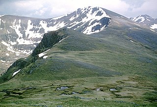
Carn Eighe is a mountain in the Northwest Highlands of Scotland. Rising to 1,183 metres (3,881 ft) above sea level, it is the highest mountain in Scotland north of the Great Glen, the twelfth-highest in the British Isles, and, in terms of relative height, it is the second-tallest mountain in the British Isles after Ben Nevis. Carn Eighe lies between Glen Affric and Loch Mullardoch, and is at the heart of a massif along with its twin peak, the 1,181-metre (3,875 ft) Mam Sodhail.

Wester Ross is an area of the Northwest Highlands of Scotland in the council area of Highland. The area is loosely defined, and has never been used as a formal administrative region in its own right, but is generally regarded as lying to the west of the main watershed of Ross, thus forming the western half of the county of Ross and Cromarty. The southwesternmost part of Ross and Cromarty, Lochalsh, is not considered part of Wester Ross by the local tourist organisation, Visit Wester Ross, but is included within the definition used for the Wester Ross Biosphere Reserve.
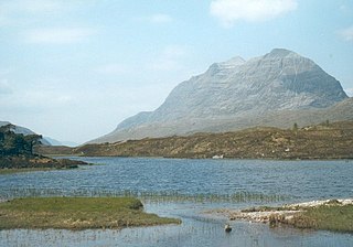
Kinlochewe is a village in Wester Ross in the Northwest Highlands of Scotland. It is in the parish of Gairloch, the community of Torridon and Kinlochewe and the Highland council area. It lies near the head of Loch Maree in its magnificent valley, and serves as a junction between the main Ullapool road north, and that which heads west to the coast at Loch Torridon. Loch Maree was at one time also known as Loch Ewe, hence the village's apparently confused name.
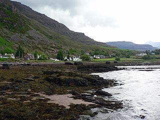
Torridon is a small village in the Northwest Highlands of Scotland. The name is also applied to the area surrounding the village, particularly the Torridon Hills, mountains to the north of Glen Torridon. The village lies on the shore of Loch Torridon.

Slioch is a mountain in the Scottish Highlands situated in Wester Ross, eight kilometres north of the village of Kinlochewe. Slioch reaches an elevation of 981 metres and towers above the southeastern end of Loch Maree to give one of the best known and most photographed sights in the Highlands. VisitScotland, the Scottish national tourist agency, has used video footage of Slioch in its television advertisements.
The Northwest Highlands are located in the northern third of Scotland that is separated from the Grampian Mountains by the Great Glen. The region comprises Wester Ross, Assynt, Sutherland and part of Caithness. The Caledonian Canal, which extends from Loch Linnhe in the south-west, via Loch Ness to the Moray Firth in the north-east splits this area from the rest of the country. The city of Inverness and the town of Fort William serve as gateways to the region from the south.

Sgùrr nan Clach Geala is a mountain in Wester Ross in the Northwest Highlands of Scotland, south of Ullapool. With a height of 1,093 metres (3,586 ft), it is one of ten Munros in the group of hills known as the Fannichs.
The A832 is a road in the Scottish Highlands, linking Cromarty, on the east coast, to Gairloch on the west coast, and beyond Gairloch to Braemore Junction. It is 126 miles (203 km) long and runs entirely in the former county of Ross and Cromarty. The road forms part of the Wester Ross Coastal Trail.
The Wester Ross Coastal Trail is a route in the Western part of the Scottish Highlands. The route consists of the A832 road, the A896 road and the Applecross Peninsula. The northern end of the route is the junction with the A835 south of Ullapool. The southern end of the route is at Auchtertyre near Kyle of Lochalsh.
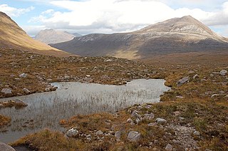
Meall a' Ghiubhais is a mountain in the Northwest Highlands, Scotland. It lies in Wester Ross, close to the village of Kinlochewe.

Loch Clair is a small remote shallow low-altitude freshwater loch, located within the Coulin Forest, some three miles to the south-west of Kinlochewe in Wester Ross. Loch Clair is the lower of two lochs in the same valley and is aligned on a southeast-northwest bearing. The other loch is Loch Coulin which is fed by the River Coulin, the waters of which in turn flow out of Loch Coulin through a short unnamed river into Loch Clair. A small lochan, Loch Bharranch, is located a mile to the west and drains into the western end of Loch Clair through an unnamed burn.

Loch Kernsary also known as Loch na h-Airde Bige is a small remote shallow low-altitude freshwater loch, located directly southeast of Poolewe in Kinlochewe, Wester Ross. It is fed by the river Coulin from the south and its outflow is into Loch Clair in the north-west. The Kernsary River drains into the loch from the south and in turn is drained through a tiny lochan Loch Poll Uidge à Chrò. The Lochan drains into the Inveran River, that drains a short distance into Loch Maree directly to the south-east.


