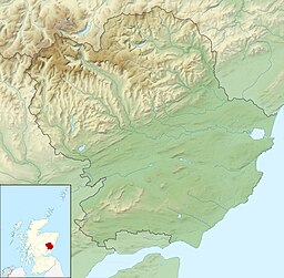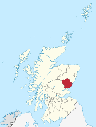
Angus is one of the 32 local government council areas of Scotland, a registration county and a lieutenancy area. The council area borders Aberdeenshire, Dundee City and Perth and Kinross. Main industries include agriculture and fishing. Global pharmaceuticals company GSK has a significant presence in Montrose in the east of the county.
Firth is a word in the English and Scots languages used to denote various coastal waters in the United Kingdom, predominantly within Scotland. In the Northern Isles, it more often refers to a smaller inlet. It is linguistically cognate to fjord, which has a more constrained sense in English. Bodies of water named "firths" tend to be more common on the Scottish east coast, or in the southwest of the country, although the Firth of Clyde is an exception to this. The Highland coast contains numerous estuaries, straits, and inlets of a similar kind, but not called "firth" ; instead, these are often called sea lochs. Before about 1850, the spelling "Frith" was more common.

Glencoe or Glencoe Village is the main settlement in Glen Coe in the Lochaber area of the Scottish Highlands. It lies at the north-west end of the glen, on the southern bank of the River Coe where it enters Loch Leven.

Dumfriesshire or the County of Dumfries or Shire of Dumfries is a historic county and registration county in southern Scotland. The Dumfries lieutenancy area covers a similar area to the historic county.

Loch Lomond and The Trossachs National Park is a national park in Scotland centred on Loch Lomond and the hills and glens of the Trossachs, along with several other ranges of hills. It was the first of the two national parks established by the Scottish Parliament in 2002, the second being the Cairngorms National Park. The park extends to cover much of the western part of the southern highlands, lying to the north of the Glasgow conurbation, and contains many mountains and lochs. It is the fourth-largest national park in the British Isles, with a total area of 1,865 km2 (720 sq mi) and a boundary of some 350 km (220 mi) in length. It features 21 Munros and 20 Corbetts.

The River Esk, sometimes called the Cumbrian Esk, is a river in Cumbria, England. It flows for approximately 25 km from its source in the Scafells range of mountains to its estuary at Ravenglass. It is one of two Rivers Esk in Cumbria, and not to be confused with the Border Esk which flows into Cumbria from Scotland.
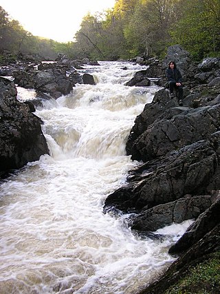
Glen Etive is a glen in the Highlands of Scotland. The River Etive rises on the peaks surrounding Rannoch Moor, with several tributary streams coming together at the Kings House Hotel, at the head of Glen Coe. From the Kings House, the Etive flows for about 18 km, reaching the sea loch, Loch Etive. The river and its tributaries are popular with whitewater kayakers and at high water levels it is a test piece of the area and a classic run.

The Southern Uplands are the southernmost and least populous of mainland Scotland's three major geographic areas. The term is used both to describe the geographical region and to collectively denote the various ranges of hills and mountains within this region. An overwhelmingly rural and agricultural region, the Southern Uplands are partly forested and contain many areas of open moorland - the hill names in the area are congruent with these characteristics.
Loch Ericht is a freshwater loch on the border between the former Perthshire, now Perth and Kinross and the former Inverness-shire, now Highlands Council areas of Scotland. It has a north-east to south-west orientation. The village of Dalwhinnie lies at the north east end of the loch. Loch Ericht is the tenth largest freshwater lake in Scotland and has a good reputation for its trout fishing and Ferox trout.
The Gryffe Reservoirs, also spelled 'Gryfe', take their name from the River Gryffe, name deriving from the Gaelic garbh meaning "rough stream". are two reservoirs, known as Gryffe No. 1 and Gryffe No. 2, located in Inverclyde in the west central Lowlands of Scotland.
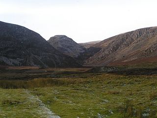
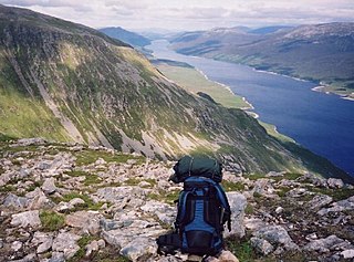
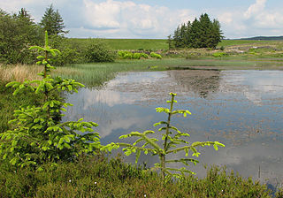
Tarfside is a small hamlet in Angus, Scotland. It is situated in Glen Esk, on the upper course of the River North Esk, around 8 miles north of Edzell, and has a footpath to nearby Loch Lee. Tarfside is commonly seen as a very beautiful place for walkers.
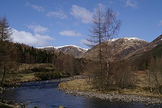
The North Esk is a river in Angus and Aberdeenshire, Scotland. It is formed by the meeting of the Water of Mark and the Water of Lee, and enters the North Sea four miles north of Montrose. It forms the boundary between Angus and Aberdeenshire at certain stages in its course. It was also noted in the 19th century as a good point for fishing.
The South Esk is a river in Angus, Scotland. It rises in the Grampian Mountains at Loch Esk in Glen Doll and flows through Glen Clova to Strathmore at Cortachy, 5 km north of Kirriemuir. Its course takes it past Brechin and enters the North Sea at Montrose.

Gladhouse Reservoir, formerly known as Moorfoot Loch, is a reservoir in Midlothian, Scotland, five miles (8 km) south of Penicuik. It is the most southerly reservoir in Midlothian, as well as being the largest area of freshwater in the Lothians. It is used to supply Edinburgh with drinking water.

Inverness-shire is a historic county, registration county and lieutenancy area of Scotland. Covering much of the Highlands and Outer Hebrides, it is Scotland's largest county, though one of the smallest in population, with 67,733 people or 1.34% of the Scottish population.

Scotland occupies the northern part of the United Kingdom. The landscape is diverse; ranging from rugged mountain terrain to arable flat land with many rivers and lochs.