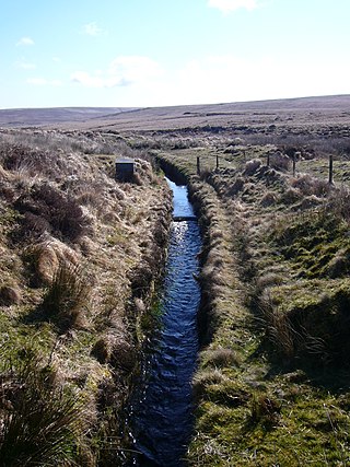
A leat is the name, common in the south and west of England and in Wales, for an artificial watercourse or aqueduct dug into the ground, especially one supplying water to a watermill or its mill pond. Other common uses for leats include delivery of water for hydraulic mining and mineral concentration, for irrigation, to serve a dye works or other industrial plant, and provision of drinking water to a farm or household or as a catchment cut-off to improve the yield of a reservoir.

Inverclyde is one of 32 council areas used for local government in Scotland. Together with the East Renfrewshire and Renfrewshire council areas, Inverclyde forms part of the historic county of Renfrewshire, which currently exists as a registration county and lieutenancy area. Inverclyde is located in the west central Lowlands. It borders the North Ayrshire and Renfrewshire council areas, and is otherwise surrounded by the Firth of Clyde.

Renfrewshire is one of the 32 council areas of Scotland.

Greenock is a town in Inverclyde, Scotland, located in the west central Lowlands of Scotland. The town is currently the administrative centre of Inverclyde Council. It is a former burgh within the historic county of Renfrewshire, and forms part of a contiguous urban area with Gourock to the west and Port Glasgow to the east.
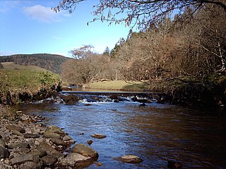
Kip Water, also known as the River Kip, is a short river in Inverclyde, Scotland which gives the village of Inverkip its name. It originates at Cornalees in the hills between Inverkip and Greenock and runs through Shielhill Glen, Dunrod Glen and the Kip Valley before entering the Firth of Clyde at Kip Marina in Inverkip.
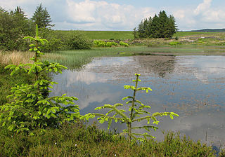
The Gryffe Reservoirs, also spelled 'Gryfe', take their name from the River Gryffe, name deriving from the Gaelic garbh meaning "rough stream". are two reservoirs, known as Gryffe No. 1 and Gryffe No. 2, located in Inverclyde in the west central Lowlands of Scotland.

Inverkip is a village and parish in the Inverclyde council area and historic county of Renfrewshire in the west central Lowlands of Scotland, 5 miles (8 km) southwest of Greenock and 8.1 miles (13 km) north of Largs on the A78 trunk road. The village takes its name from the River Kip and is served by Inverkip railway station.
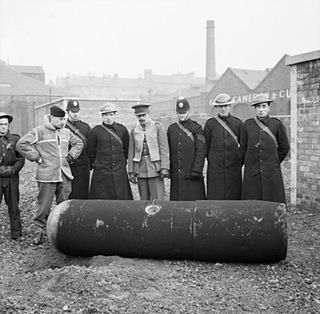
The Greenock Blitz is the name given to two nights of intensive bombing of the town of Greenock, Scotland by the Nazi German Luftwaffe during the Second World War. The raids over the nights of the 6 and 7 May 1941 targeted the shipyards and berthed ships around the town. The brunt of the bombing fell on residential areas. Over the two nights, 271 people were killed and over 10,200 injured. From a total of 180,000 homes nearly 25,000 suffered damage and 5,000 were destroyed.

Greenock West railway station is a station in Greenock, Scotland, located on the Inverclyde Line which runs from Gourock to Glasgow Central. The route is currently operated by ScotRail under the auspices of Strathclyde Partnership for Transport. Each service to and from Glasgow on the Inverclyde Line stops at this station.

Renfrewshire or the County of Renfrew is a historic county, registration county and lieutenancy area in the west central Lowlands of Scotland. The lieutenancy area covers the three modern council areas of Inverclyde, Renfrewshire and East Renfrewshire, and this area is occasionally termed Greater Renfrewshire to distinguish it from the modern council area called Renfrewshire. The historic county additionally included territory on the south-western edge of Glasgow which was gradually transferred to the administrative area of the city as it grew.

Lyle Hill stands at the West End of Greenock in Inverclyde, Scotland. It has scenic viewpoints accessible from Lyle Road, which was constructed in 1879–1880 and named after Provost Abram Lyle, well known as a sugar refiner. The hill's highest point is Craigs Top at 426 feet above sea level, and before the road was constructed the hill was known as the Craigs, or as the Bingens.
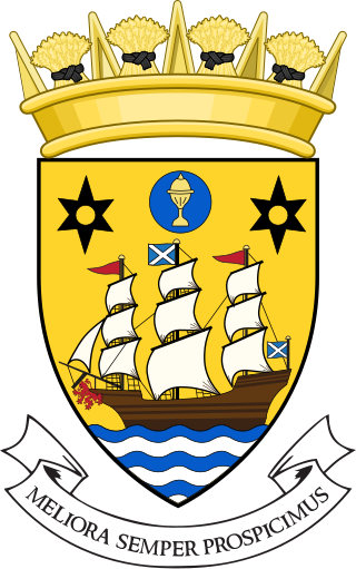
Inverclyde Council is one of the 32 local authorities of Scotland, covering the Inverclyde council area. In its current form the council was created in 1996, replacing the previous Inverclyde District Council which existed from 1975 to 1996.

Overton is an area in the suburbs of Greenock, Inverclyde. Overton offers excellent views across the River Clyde and suburban Greenock.

Clyde Muirshiel Regional Park is the collective name for areas of countryside set aside for conservation and recreation on the South Clyde estuary in Scotland.
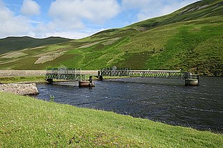
Robert Thom was a Scottish civil engineer who worked upon major hydraulic projects on the Isle of Bute and Inverclyde. On Bute, he created aqueducts to increase the flow of water which powered the cotton mills there, so that their capacity was increased. This economic success resulted in him becoming the laird of Ascog. He then created a larger system to supply water power to Greenock. The reservoir is named after him — Loch Thom — and the supply aqueduct is known as the Greenock Cut. In the early 1800s, he designed the first water purification plant in Scotland.
The lands of Finnart to the west of Greenock belonged to the Earl of Douglas in medieval times. Around 1455 they were forfeited to the crown. Finnart was given to the Hamiltons, while the western part of the barony of Finnart went to Stewart of Castlemilk and became the barony of Finnart-Stewart, or Gourock.
Edinburgh Water Company and its successors have provided a public water supply and latterly sewerage and sewage treatment services to the Scottish capital of Edinburgh since 1819. The original company was established to supply drinking water and did so until 1870, when it was taken over by a public Water Trust, with representatives from Edinburgh, Leith and Portobello. That in turn was taken over by Edinburgh Corporation and in 1975, responsibility passed to the Lothian Regional Council, as did the duty to provide sewerage and sewage treatment services. Both services were moved out of local authority control, and taken over by the East of Scotland Water Authority in 1996. The three Scottish regional water authorities were merged to form Scottish Water in 2002.

Glasgow Corporation Water Works and its successors have provided a public water supply and sewerage and sewage treatment services to the Scottish city of Glasgow. There were several schemes in the early part of the 1800s, with the Glasgow Company which was established in 1806 pumping filtered water from the River Clyde into the city. The Gorbals Gravitation Water Company was established in 1846, and brought water from reservoirs to the south-west of the city. However, an outbreak of cholera in 1848/1849, in which 4,000 people died, concentrated the minds of Glasgow Council, and in 1855 a scheme to use water from Loch Katrine, 36 miles (58 km) to the north, was authorised. The work required at Loch Katrine was quite modest, and the major construction work was the building of an aqueduct to carry the water to the city by gravity.

Sir Michael Shaw-Stewart, 5th Baronet. Lord Lieutenant of Renfrewshire between 1822 and 1825.
James Morris Gale M. Inst. C.E. was a Scottish civil engineer for the Glasgow Corporation Water Works. He is most famous for his work building the Milngavie water treatment works. The project directed water from Loch Katrine, 36 miles (58 km) to the north, which required the building of an aqueduct to carry the water to the city of Glasgow by gravity.


