
Loch Assynt is a freshwater loch in Sutherland, Scotland, 8 kilometres (5.0 mi) east-north east of Lochinver.

Loch Veyatie is a large freshwater loch in north-west Scotland. It stretches for 6 km north-westwards from the settlement of Elphin, and lies between Suilven and Cùl Mòr. The loch is located in an area known as the Assynt-Coigach National Scenic Area, one of 40 such areas in Scotland.

Loch Dornal is an irregular shaped, shallow, freshwater loch in south Ayrshire, in the Southern Uplands of Scotland. It lies approximately eight miles northwest of the town of Newton Stewart.
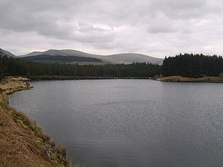
Kirriereoch Loch is a small, shallow, square shaped, freshwater loch in Dumfries and Galloway, in the Southern Uplands of south-west Scotland. It lies approximately 12 mi (19 km) north of the town of Newton Stewart. It is a part of the Wood of Cree Nature Preserve system

Loch Arienas is an extensive, lowland, freshwater loch on the Ardtornish Estate on the Morvern peninsula in the Scottish Highlands. It lies in a west-northwest to east-southeast direction, is approximately 3.2 km (2.0 mi) long and 1.21 km (0.75 mi) wide, and is at an altitude of 12 m (39 ft). The northern shore of the loch is mostly regular in shape, while the southern shore is irregular. Its average depth is 17.2 m (56 ft) and its maximum depth is 35 m (115 ft). The loch was surveyed on the 18 and 19 of August 1904 by John Hewitt as part of Sir John Murray's Bathymetrical Survey of Fresh-Water Lochs of Scotland 1897-1909.

Loch Doire nam Mart, also known as Loch Durinemart or Loch Durinemast, is a small, lowland, freshwater loch on the Ardtornish Estate on the Morvern peninsula in the Scottish Highlands. It lies in a northwest to southeast direction approximately 5.6 km (3.5 mi) to the north west of Loch Aline. It is 1.06 km (0.66 mi) long and 0.4 km (0.25 mi) wide, and is at an altitude of 15 m (49 ft). It drains into Loch Arienas which lies approximately 200 m (660 ft) to the southeast. The average depth is 6.4 m (21 ft) and its maximum depth is 15 m (49 ft). The loch was surveyed on 18 August 1904 by James Murray as part of Sir John Murray's Bathymetrical Survey of Fresh-Water Lochs of Scotland 1897-1909.
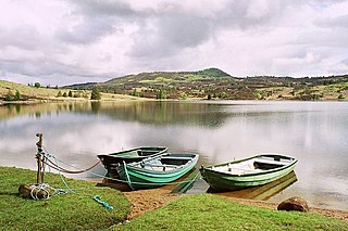
Loch Ordie is a classic freshwater hill loch east of the River Tay, and surrounded by wooded hills, in the Forest of Clunie.
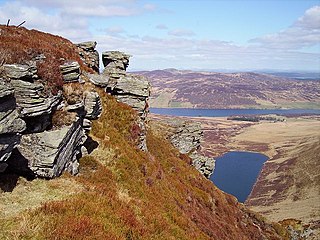
Loch Freuchie, also known as Fraoch, the heatherly loch, is a large freshwater loch on a north-west to south-east orientation, within Glen Quaich in Perth and Kinross. The loch is located 2 miles (3.2 km) west of Amulree and 6.5 miles (10.5 km) southeast of Kenmore.
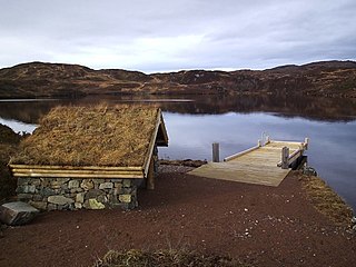
Loch Leitir Easaidh is a small shallow irregular shaped freshwater lochan that flows directly into the northwestern end of Loch Assynt in Assynt, Sutherland, Scotland. The loch is located in an area along with neighbouring Coigach, as the Assynt-Coigach National Scenic Area, one of 40 such areas in Scotland.

Loch Awe is a small loch, located 4 miles south of Loch Assynt and next to the village of Ledmore, within the Assynt area of Sutherland, Scotland. The loch is located in an area along with neighbouring Coigach, as the Assynt-Coigach National Scenic Area, one of 40 such areas in Scotland.

Loch Beannach is a small v-shaped loch, located 2 miles to the west of Loch Assynt and 3 miles northeast of Lochinver within the Assynt area of Sutherland, Scotland. The loch is located in an area known as the Assynt-Coigach National Scenic Area, one of 40 such areas in Scotland.

Loch Culag also known as Loch na Doire Daraich is a small freshwater shallow loch, located south of Lochinver in the Assynt district of Sutherland, Highland, Scotland. The loch is located in an area along with neighbouring Coigach, as the Assynt-Coigach National Scenic Area, one of 40 such areas in Scotland.

Loch Cròcach is a large irregular shaped, shallow loch, located about three miles north of Lochinver in the Assynt district of Sutherland, Highland, Scotland. It is one of five lochs in Scotland with the same name. Loch Cròcach is located in an area known as the Assynt-Coigach National Scenic Area, one of 40 such areas in Scotland.
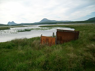
Loch Urigill is a freshwater loch near Elphin at the southern tip of the Assynt District in north-west Sutherland, Scotland.

Loch an Tuirc is a large irregular shaped, shallow loch, located about two miles north-by-north-east of Lochinver in the Assynt district of Sutherland, Highland, Scotland. It is one of three lochs in Scotland with the same name. Loch an Tuirc is located in an area known as the Assynt-Coigach National Scenic Area, one of 40 such areas in Scotland.

Cam Loch is an irregularly-shaped freshwater loch, about 5 km long, on a north-west to south-east orientation, located slightly north of the village of Elphin, in the Assynt district of Sutherland, Scotland. The loch is located in an area along with neighbouring Coigach, as the Assynt-Coigach National Scenic Area, one of 40 such areas in Scotland.

Fionn Loch is a small irregular-shaped shallow freshwater loch, on a north-west to south-east orientation that is located 3 miles southeast of Lochinver in the Assynt district of Sutherland in Scotland. The loch is located in an area known as the Assynt-Coigach National Scenic Area, one of 40 such areas in Scotland.

Loch a' Mhadail or Loch a' Mhiotailt is a small freshwater lochan that lies immediately to the south-west of Loch Veyatie and is connected by a channel to Loch Veyatie within the area of Inverpolly. The channel measures about 20 foot in length, 10 feet in width and 1 foot in depth. When the water level is low, Loch a' Mhadail is separated from Loch Veyatie by a dyke made of Gneiss.

Loch Sionascaig is a large irregular shaped, freshwater loch in the remote Coigach area of northern Wester Ross. It is located 5.5 miles southeast of the village of Lochinver and is situated within the Inverpolly Forest.


