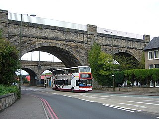
Leith is a port area in the north of the city of Edinburgh, Scotland, founded at the mouth of the Water of Leith.

Holyrood Park is a royal park in central Edinburgh, Scotland about 1 mile to the east of Edinburgh Castle. It is open to the public. It has an array of hills, lochs, glens, ridges, basalt cliffs, and patches of gorse, providing a wild piece of highland landscape within its 650-acre (260 ha) area. The park is associated with the royal palace of Holyroodhouse and was formerly a 12th-century royal hunting estate. The park was created in 1541 when James V had the ground "circulit about Arthurs Sett, Salisborie and Duddingston craggis" enclosed by a stone wall.
Craiglockhart is a suburb in the south west of Edinburgh, Scotland, lying between Colinton to the south, Morningside to the east Merchiston to the north east, and Longstone and Kingsknowe to the west. The Water of Leith is also to the west.

Colinton is a suburb of Edinburgh, Scotland situated 3+1⁄2 miles (5.6 km) south-west of the city centre. Up until the late 18th century it appears on maps as Collington. It is bordered by Dreghorn to the south and Craiglockhart to the north-east. To the north-west it extends to Lanark Road and to the south-west to the City Bypass. Bonaly is a subsection of the area on its southern side.

Piershill is a suburb of north east Edinburgh, Scotland, in the shadow of Arthur's Seat. It is mainly residential, with local amenities including a large Morrisons supermarket and filling station, bank, public library, optician, pharmacy, several takeaway restaurants and specialist retailers along with public houses.
Sighthill is a suburb in the west of Edinburgh, Scotland. The area is bordered by Broomhouse and Parkhead to the east, South Gyle to the north, the industrial suburb of Bankhead and the Calders neighbourhood to the west, and Wester Hailes to the south. It is sometimes included in the Wester Hailes area, while the Calders, Bankhead and Parkhead are sometimes considered parts of Sighthill. Administratively it has formed a core part of the City of Edinburgh Council's Sighthill/Gorgie ward since 2007.
Longstone is a suburb of Edinburgh in Scotland. The area is primarily residential in nature, although the area includes several small shops, eateries and supermarkets, as well as one of the main bus depots for the city's buses. The population of Longstone was 4,678 in 2019.
Lochend is a mainly residential suburb of Edinburgh, the capital of Scotland. It is named after Lochend Castle and the adjacent Lochend Loch, located in the western part of Restalrig on the boundary between Leith and The Canongate, approximately two miles from Edinburgh city centre. The suburb consists largely of a 1930s public housing estate, and is bounded on the west by Easter Road.

Restalrig is a small residential suburb of Edinburgh, Scotland. It is located east of the city centre, west of Craigentinny and to the east of Lochend, both of which it overlaps. Restalrig Road is the main route through the area, running from London Road, at Jock's Lodge, to Leith Links. It is in the ward of Lochend.

The colony houses of Edinburgh were built between 1850 and 1910 as homes for artisans and skilled working-class families by philanthropic model dwellings companies. The first development was the Pilrig Model Buildings, near Leith Walk. Later developments across the city were built by the Edinburgh Cooperative Building Company Limited, founded in 1861. The founders of this company were influenced by the Reverend Dr. James Begg and the Reverend Dr. Thomas Chalmers, ministers of the Free Church of Scotland, who campaigned to improve the housing conditions of the poor.

Duloch, or Duloch Park, is a residential suburb of Dunfermline, in Fife, Scotland.
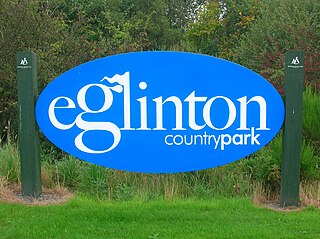
Eglinton Country Park is located on the grounds of the old Eglinton Castle estate in Kilwinning, North Ayrshire, Scotland. Eglinton Park is situated in the parish of Kilwinning, part of the former district of Cunninghame, and covers an area of 400 ha ([98 acres ] of which are woodland. The central iconic feature of the country park is the ruined Eglinton Castle, once home to the Eglinton family and later the Montgomeries, Earls of Eglinton and chiefs of the Clan Montgomery. Eglinton Country Park is managed and maintained by North Ayrshire Council and its Ranger Service.
Lochend may refer to the following places:

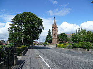
Lochend House, also known as Restalrig Castle and Lochend Castle, is an occupied house, incorporating the remains of a 16th-century L-plan tower house, in Edinburgh, Scotland. It is located in the Lochend area, about 1.5 miles (2.4 km) east of Edinburgh Castle. The house is protected as a category B listed building.

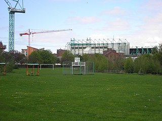
Leith Links is the principal open space within Leith, the docks district of Edinburgh, Scotland. This public park is divided by a road into two main areas, a western section and an eastern section, both being largely flat expanses of grass bordered by mature trees. Historically it covered a wider area extending north as far as the shoreline of the Firth of Forth. This area of grass and former sand-dunes was previously used as a golf links.
Kilbirnie Loch, is a freshwater Loch situated in the floodplain between Kilbirnie, Glengarnock and Beith, North Ayrshire, Scotland. It runs south-west to north-east for almost 2 km (1.2 mi), is about 0.5 km (0.31 mi) wide for the most part and has an area of roughly 3 km2. It has a general depth of around 5.2 metres to a maximum of around 11 metres. The loch is fed mainly by the Maich Water, which rises in the Kilbirnie Hills near Misty Law, and is drained by the Dubbs Water that runs past the Barr Loch into Castle Semple Loch, followed by the Black Cart, the White Cart at Renfrew and finally the River Clyde. The boundary between East Renfrewshire and North Ayrshire, in the vicinity of the loch, runs down the course of the Maich Water along the northern loch shore to then run up beside the Dubbs Water.

The Blae Loch is a small freshwater loch situated in a hollow in a low-lying area beneath Blaelochhead Hill in the Parish of Beith, North Ayrshire, Scotland.
Sir Robert Logan of Restalrig was a Scottish knight involved in the Gowrie House affair of 1600.

Lochend Loch, which once had nearly three acres in surface area is now only a small freshwater loch remnant. It lies in the South Ayrshire Council Area, lying on the hill above Joppa, between Gallowhill and Lochend Farm.

The following outline is provided as an overview of and topical guide to Edinburgh: