Lockwood Terrace, Guam

Last updated
Lockwood Terrace
Village
USA Guam location map.svg
Red pog.svg
Lockwood Terrace
Coordinates: 13°25′57″N144°38′53″E / 13.43250°N 144.64806°E / 13.43250; 144.64806
CountryFlag of the United States.svg  United States
TerritoryFlag of Guam.svg  Guam

Lockwood Terrace is a populated place on the island of Guam with an elevation of 22 metres above sea level. [1] It is located in the village of Santa Rita, between Apra Harbor and Agat Bay on the Orote Peninsula.

Guam Island territory of the United States of America

Guam is an unincorporated and organized territory of the United States in Micronesia in the western Pacific Ocean. It is the easternmost point and territory of the United States, along with the Northern Mariana Islands. The capital city of Guam is Hagåtña and the most populous city is Dededo. The inhabitants of Guam are called Guamanians, and they are American citizens by birth. Indigenous Guamanians are the Chamorros, who are related to other Austronesian natives of Eastern Indonesia, the Philippines, and Taiwan. Guam has been a member of the Pacific Community since 1983.

Villages of Guam Wikimedia list article

The United States territory of Guam is divided into nineteen municipalities, called villages. Each village is governed by an elected mayor. Village populations range in size from under 1,000 to over 40,000. As of the 2000 census, the total population of Guam was 154,805. However, the entire island is counted as a single county equivalent by the United States Census Bureau for statistical purposes.

Santa Rita, Guam Village in Guam, United States

Santa Rita is a village located on the southwest coast of the United States territory of Guam with hills overlooking Apra Harbor. According to the 2000 census it has a population of 7,500, down from 11,857 in 1990. Santa Rita is the newest village in Guam, having been established after the Second World War.

Coordinates: 13°25′57″N144°38′53″E / 13.43250°N 144.64806°E / 13.43250; 144.64806

Geographic coordinate system Coordinate system

A geographic coordinate system is a coordinate system that enables every location on Earth to be specified by a set of numbers, letters or symbols. The coordinates are often chosen such that one of the numbers represents a vertical position and two or three of the numbers represent a horizontal position; alternatively, a geographic position may be expressed in a combined three-dimensional Cartesian vector. A common choice of coordinates is latitude, longitude and elevation. To specify a location on a plane requires a map projection.

Related Research Articles

Pelhřimov District District in Vysočina Region, Czech Republic

Pelhřimov District is a district (okres) within the Vysočina Region of the Czech Republic. Its administrative center is the town of Pelhřimov.

Selmice Village in Pardubice District of Pardubice region

Selmice is a small village in the Pardubice Region of the Czech Republic. It has cca 114 inhabitants.

Chegworth is a hamlet in the parish of Ulcombe in the Maidstone District of Kent, England. The hamlet lies along the Chegworth Road, Chegworth Lane and Water Lane, and comprises no more than 20 dwellings, including the historic Chegworth Water Mill on the River Len. It is better known now as the home of Chegworth Valley Juices and UKNetMonitor.

Lubachów Village in Lower Silesian, Poland

Lubachów is a village in the administrative district of Gmina Świdnica, within Świdnica County, Lower Silesian Voivodeship, in south-western Poland. Prior to 1945 it was in Germany.

Getapnya Place in Ararat, Armenia

Getapnya is a town in the Ararat Province of Armenia.

Birinci Ərəbcəbirli Place in Goychay, Azerbaijan

Birinci Ərəbcəbirli is a village in the Goychay Rayon of Azerbaijan. The village forms part of the municipality of Ərəbcəbirli.

Libiszów-Kolonia is a village in the administrative district of Gmina Opoczno, within Opoczno County, Łódź Voivodeship, in central Poland.

Orote Peninsula

The Orote Peninsula is a four kilometer-long peninsula jutting from the west coast of the United States territory of Guam. The entire peninsula is part of the village of Santa Rita. It forms the southern coast of Apra Harbor, and its westernmost tip, Point Udall, is also Guam's westernmost point. The south coast of Orote Peninsula meets the rest of the island at the long sweep of Agat Bay.

Cegielnia-Rudki is a village in the administrative district of Gmina Wierzbinek, within Konin County, Greater Poland Voivodeship, in west-central Poland.

Drzewce, Międzychód County Village in Greater Poland, Poland

Drzewce is a village in the administrative district of Gmina Międzychód, within Międzychód County, Greater Poland Voivodeship, in west-central Poland. It lies approximately 7 kilometres (4 mi) north-west of Międzychód and 80 km (50 mi) west of the regional capital Poznań.

Gęś, Pomeranian Voivodeship Village in Pomeranian, Poland

Gęś is a village in the administrative district of Gmina Wicko, within Lębork County, Pomeranian Voivodeship, in northern Poland. It lies approximately 4 kilometres (2 mi) south-east of Wicko, 13 km (8 mi) north-west of Lębork, and 71 km (44 mi) north-west of the regional capital Gdańsk.

Smugi is a settlement in the administrative district of Gmina Polanów, within Koszalin County, West Pomeranian Voivodeship, in north-western Poland.

Phong Vân is a commune () and village in Bắc Quang District, Hà Giang Province, in northeastern Vietnam.

București - Ilfov Region in Romania

The București - Ilfov development region is a development region in Romania, encompassing the national capital, Bucharest, as well as the surrounding Ilfov County. As other development regions, it does not have any administrative powers, its main function being to co-ordinate regional development projects and manage funds from the European Union. It is also used as an entity in regional statistical analysis at the European Union NUTS-II level.

Aïn Kechra Commune and Town in Skikda Province, Algeria

Aïn Kechra is a town and commune in Skikda Province in north-eastern Algeria.

JOGV-FM (Branding:Bay FM 78 is a Japanese radio station based in Chiba City, Chiba, Japan with its main frequency at 78.0 MHz. It also broadcasts on 87.4 MHz in Katsuura, 79.3 MHz in Choshi, 79.7 MHz in Shirahama & 77.7 MHz in Tateyama.

EWS Arena architectural structure

EWS Arena is an indoor sporting arena located in Göppingen, Germany. The capacity of the arena is 5,600 people. It hosts the home matches of women's and men's Handball Bundesliga handball teams of Frisch Auf Göppingen. In its previous building, it hosted six team handball matches for the 1972 Summer Olympics in Munich. It was opened in 1967 and rebuilt and enlarged between 2007 and 2009.

Stadionul Carpaţi is a multi-use stadium in Braşov, Romania. It is used mostly for football matches and is the home ground of Colțea Brașov. It has a capacity of 1,200 people and was slightly renovated in 2010, when it became the home ground of Corona Braşov, following the team's promotion to the Liga III.

Concepción (Madrid) Ward of Madrid in Spain

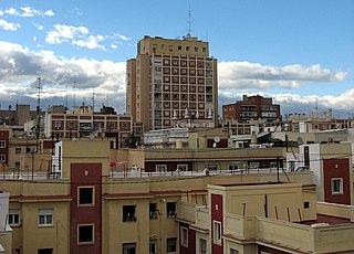
Concepción is a ward (barrio) of Madrid belonging to the district of Ciudad Lineal.

Kuzucubelen Castle

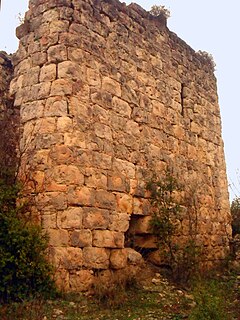
Kuzucubelen Castle is a castle ruin in Mersin Province, Turkey.

References

  1. "GNIS Detail - Lockwood Terrace". geonames.usgs.gov. Retrieved 2017-02-23.