Powys is a principal area and county, and one of the preserved counties of Wales. It is named after the Kingdom of Powys which was a Welsh successor state, petty kingdom and principality that emerged during the Middle Ages following the end of Roman rule in Britain.

Montgomeryshire, also known as Maldwyn is one of thirteen historic counties and a former administrative county of Wales. It is named after its county town, Montgomery, which in turn is named after one of William the Conqueror's main counsellors, Roger de Montgomerie, who was the 1st Earl of Shrewsbury.

Newtown, the largest town in the county of Powys, Mid Wales, lies on the River Severn in the community of Newtown and Llanllwchaiarn, within the historic boundaries of Montgomeryshire. It was designated a new town in 1967 and saw population growth as firms settled, changing its market town character. Its 2001 population of 12,783 eased to 11,357 at the 2011 census. It was the birthplace of Robert Owen in 1771, whose house stood on the present site of the HSBC Bank. The town has a theatre, Theatr Hafren, and a public gallery, Oriel Davies, displaying contemporary arts and crafts.
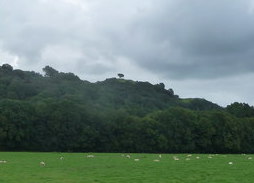
Llanrhaeadr-ym-Mochnant is a small market town, community and an ecclesiastical parish in the extreme north of Powys, Wales; about 9 miles west of Oswestry and 12 miles south of Llangollen, on the B4580. It lies near the foothills of the Berwyn mountains on the river Rhaeadr. At the top end of the valley is the Pistyll Rhaeadr waterfall, one of the Seven Wonders of Wales in the old rhyme. One mile north of the village is the hill Moel Hen-fache. The community includes the hamlet of Llanarmon Mynydd Mawr.

Llanidloes is a town and community on the A470 and B4518 roads in Powys, within the historic county boundaries of Montgomeryshire, Wales. The population in 2011 was 2,929, of whom 15% could speak Welsh.
Knighton is a small market town and community in Powys, Wales, on the River Teme and the England–Wales border. The Teme is not navigable in its higher reaches. Part of the town, including Knighton railway station, is in Shropshire. Originally an Anglo-Saxon settlement, it later became a partially planned Norman town. It was situated in Mercia, being east of Offa's Dyke.

Builth Wells is a market town and community in the county of Powys and historic county of Brecknockshire (Breconshire), mid Wales, lying at the confluence of rivers Wye and Irfon, in the Welsh part of the Wye Valley. It has a population of 2,568.

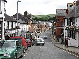
Llandrindod Wells is a town and community in Powys, within the historic boundaries of Radnorshire, Wales. It serves as the seat of Powys County Council and thus the administrative centre of Powys.

Talgarth is a market town, community and electoral ward in southern Powys, Mid Wales, about 12 miles (19 km) north of Crickhowell. Notable buildings in the town include its 14th-century parish church and 13th-century Pele Tower, located in the town centre, now home to the Tourist Information and Resource Centre. According to traditional accounts Talgarth was the capital of the early medieval Welsh Kingdom of Brycheiniog. It is in the historic county of Brecknockshire. In 2011 it had a population of 1,724.

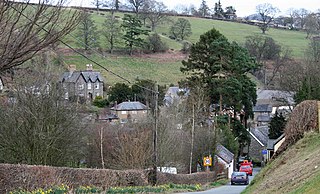
Caersws is a village and community on the River Severn, in the Welsh county of Powys (Montgomeryshire) 5 miles (8 km) west of Newtown, and halfway between Aberystwyth and Shrewsbury. It has a station on the Cambrian Line from Aberystwyth to Shrewsbury. At the 2001 census it had a population of 1,526, increasing slightly to 1,586 at the 2011 Census.

Llanymynech is a village straddling the border between Montgomeryshire/Powys, Wales, and Shropshire, England, about 9 miles (14 km) north of the Welsh town of Welshpool. The name is Welsh for "Church of the Monks". The village is on the banks of the river Vyrnwy, and the Montgomery Canal passes through it.
Meifod, formerly also written Meivod, is a small village, community and electoral ward 7 miles north-west of Welshpool in Montgomeryshire, Powys, Wales, on the A495 road and located in the valley of the River Vyrnwy. The River Banwy has a confluence with the Vyrnwy approximately two miles to the west of the village. The village itself had a population of 317.

Llansantffraid-ym-Mechain is a large village in Powys, mid Wales, close to the border with Shropshire in England, about 7 miles (11 km) south west of Oswestry and 8 miles (13 km) north of Welshpool. It is on the A495 road and is at the confluence of the River Vyrnwy and the Afon Cain. The population as of the 2011 UK Census was 1,415.

Llangynog is a village and community at the confluence of the Afon Eirth and the Afon Tanat at the foot of the Berwyn range in north Powys, Wales.

Llanfyllin is a small town in a sparsely populated area in Montgomeryshire, Powys, Wales. Llanfyllin's population in 2011 was 1,532, of whom 34.1% could speak Welsh. Llanfyllin means church or parish (llan) of St Myllin.
Llanfyllin Town Football Club are a football club from Llanfyllin, Powys. While the Llanfyllin Men's Senior team currently compete in the 5th tier of Welsh football and play in the Montgomeryshire Amateur League Division One, the club field an under 19's youth team in the Central Wales Youth League and the Ladies team compete in the Dave Smith North Powys League.

Llanfihangel-yng-Ngwynfa was a parish within the former historic county of Montgomeryshire. It now forms a major part of the community of Llanfihangel in Powys, which covers an area of 5,366 hectares (20.72 sq mi). Its Community Council extends to take in Dolanog and Llwydiarth, having approximately 413 registered voters. The parish originally consisted of the following townships: Cefncleisiog, Cydwnfa, Dolwar, Fachwen, Farchwell, Fynnonarthwr, Garthucha, Halfen, Llaethbwlch, Llwydiarth, Nanty-Candy, and Rhiewlas. Dolanog seceded from Llanfihangel in 1856.

Llanerchydol is a settlement on the A458 about 2 km west of the centre of Welshpool in the county of Powys in Wales. It is part of the community of Welshpool and also lends its name to an electoral ward.

Tomen yr Allt was a Medieval motte and bailey defensive castle near Llanfyllin in Powys, Wales. "Tomen ar hallt" is modern Welsh for "mound on the wooded hillside."
The Pwllpriddog Oak, also known as the Rhandirmwyn Oak, is a 600–700 year old tree located in farmland near Rhandirmwyn in Carmarthenshire, Wales. Recently it has served as a duck roost and a music venue. In 2018 the tree was named Welsh Tree of the Year in a public vote.