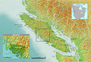
Clayoquot Sound is located on the west coast of Vancouver Island in the Canadian province of British Columbia. It is bordered by the Esowista Peninsula to the south, and the Hesquiaht Peninsula to the North. It is a body of water with many inlets and islands. Major inlets include Sydney Inlet, Shelter Inlet, Herbert Inlet, Bedwell Inlet, Lemmens Inlet, and Tofino Inlet. Major islands include Flores Island, Vargas Island, and Meares Island. The name is also used for the larger region of land around the waterbody.

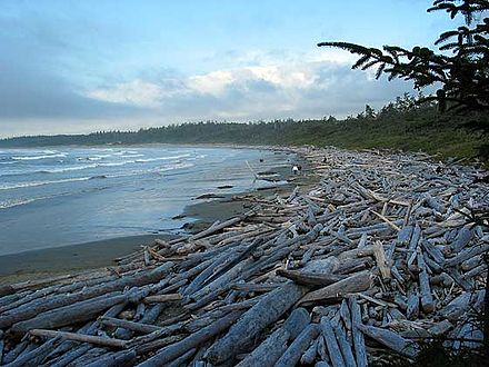
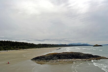
Pacific Rim National Park Reserve is a 511 km2 (197 sq mi) park located in British Columbia, Canada, which comprises three separate regions: Long Beach, the Broken Group Islands, and the West Coast Trail. It represents the Pacific Coast Mountains landscape which is characterized by rugged coasts and temperate rainforests. Widespread vegetation found in the park includes western hemlock, Sitka spruce, western red-cedar, deer fern and sword fern. Animal species vary from marine and intertidal species, such as humpback whales and ochre sea star, to terrestrial mammals, such as Vancouver Island wolves. For recreational purposes, Long Beach is used for surfing and windsurfing, the Broken Group for sea kayaking, and the West Coast Trail for hiking, as well as camping in all areas and scuba diving in the winter months in the Long Beach and Broken Group areas.

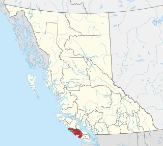
The Alberni-Clayoquot Regional District of British Columbia is located on west central Vancouver Island. Adjacent regional districts it shares borders with are the Strathcona and Comox Valley Regional Districts to the north, and the Nanaimo and Cowichan Valley Regional Districts to the east. The regional district offices are located in Port Alberni.
Highway 4 is the longest east–west main vehicle route on Vancouver Island, British Columbia, Canada, with a total length of 162 km (101 mi). It is known locally as the Alberni Highway to the east of Port Alberni and the Pacific Rim Highway to the west. The original highway from Parksville to Alberni and Port Alberni was completed in 1942 and was originally designated as Highway 1A. It was re-designated as Highway 4 in 1953, and was extended in 1961 to the small community of Tofino, on the west coast of the Island.

The Tla-o-qui-aht First Nations are a Nuu-chah-nulth First Nation in Canada. They live on ten reserves along the Pacific Rim National Park Reserve on Vancouver Island, British Columbia. The band is part of the Nuu-chah-nulth Tribal Council. There were 618 people living in the Tla-o-qui-aht reserves in 1995. Their primary economic activities are fishing and tourism.

Ucluelet is a district municipality on the Ucluelet Peninsula on the west coast of Vancouver Island in British Columbia, Canada. Ucluelet means "people of the safe harbour" in the indigenous Nuu-chah-nulth (Nootka) language. As of 2016, its population was 1,717, a 5.5% increase from 1,627 in 2011.

Juan de Fuca Provincial Park is a provincial park in British Columbia, Canada. The park was created in 1996 by combining the former China Beach Provincial Park, Loss Creek Park, Parkinson Creek Park and Botanical Beach Park and the trail connecting them into one park. It is the location of the majority of the Juan de Fuca Marine Trail, which is the southern complement of the West Coast Trail within Pacific Rim National Park Reserve.
Kennedy Lake Provincial Park is a provincial park in British Columbia, Canada located on the SW side of Kennedy Lake, SE of Tofino, British Columbia adjacent to the Pacific Rim National Park Reserve. The park has day use facilities only.

Kennedy Lake is the largest lake on Vancouver Island, British Columbia, Canada. Located north of Ucluelet on the Island's central west coast, the lake is formed chiefly by the confluence of the Clayoquot and Kennedy Rivers. Outflow is via a short stretch of the Kennedy River into Tofino Inlet. The lake includes an extensive northern arm, called Clayoquot Arm.
CHMZ-FM is a Canadian radio station that broadcasts at 90.1 FM in Tofino, British Columbia. It is rebroadcast via and Internet stream on 99.5 FM CIMM-FM in Ucluelet. Collectively, the stations are labelled as Tuff City Radio Programming targets regional news and events as well as a focus on emerging Canadian artists. Both stations are on-air twenty four hours a day, year round.
CIMM-FM is a Canadian radio station that broadcasts a community radio format at 99.5 FM in Ucluelet, western Vancouver Island, British Columbia. The station is branded as Ukee Radio. It serves the Long Beach area along with its sister station CHMZ-FM "Tuff City Radio" (90.1) in Tofino, both owned by McBride Communications.
Wickaninnish (Meaning -"Nobody sits or stands before him in the canoe" was a chief of the Tla-o-qui-aht people of Clayoquot Sound in the 1780s and 1790s, at present-day Vancouver Island, British Columbia, Canada, during the opening period of European contact with the Pacific Northwest Coast cultures. His main name is also transliterated Wickaninish, Wickananish, Wikinanish, Huiquinanichi, Quiquinanis, and he was also known as Hiyoua.

Marktosis, also spelled Maaqtusiis in the Nuu-chah-nulth language, is one of the principal settlements of the Ahousaht First Nation, located off the west coast of Vancouver Island in British Columbia, Canada, just southeast of the Hesquiat Peninsula on Flores Island. Accessible only by water or air, Marktosis is a small community predominantly composed of First Nations people from the Nuu-chah-nulth nation. Marktosis has approximately 900 residents. Marktosis Indian Reserve No. 15 was established around the site of the community and has 622 individuals living on the reserve in 2016.

The Broken Group is a group of small islands and islets in the middle of Barkley Sound on the West Coast of Vancouver Island, British Columbia, Canada. The group is protected as the Broken Islands Group Unit of the Pacific Rim National Park Reserve, which includes Long Beach, between Ucluelet and Tofino to Barkley Sound's northwest, and the West Coast Trail between Port Renfrew and Bamfield, which is to the southeast. The group lies between Imperial Eagle and Loudon Channels and includes Brabant Islands, Hand Island, but not Pinkerton Islands. The southernmost of the group is Cree Island, the easternmost is Reeks Island. Benson Island, on the northwest corner of the Broken Group, is an important cultural site for the Tseshaht First Nation.

Tofino is a district of approximately 1,932 residents on the west coast of Vancouver Island in the Canadian province of British Columbia. The district is located at the western terminus of Highway 4 on the tip of the Esowista Peninsula at the southern edge of Clayoquot Sound.
Howard Richmond McDiarmid was a physician and political figure in British Columbia. He represented Alberni in the Legislative Assembly of British Columbia from 1966 to 1972 as a Social Credit member.
The Esowista Peninsula is a peninsula in the Clayoquot Sound region of the west coast of Vancouver Island, British Columbia, Canada. The name was adopted in 1934 in reference to Esowista Indian Reserve No. 3. The name originally applied to the neck of land between Templar Channel and Browning Passage, centred at 49°08′N125°54′W to the whole neck of land from Grice Bay, Long Beach and Tofino. It was originally charted as Low Peninsula by the Royal Navy in 1860. Much of the peninsula is within the Pacific Rim National Park Reserve.

Gord Johns is a Canadian businessman and politician. Since 2015, he has served as the New Democrat Member of Parliament for the federal electoral riding of Courtenay—Alberni in the House of Commons of Canada. He previously served as a town councillor for Tofino, British Columbia and founded a number of small businesses.

Amphitrite Point Lighthouse is an active lighthouse near Uclulelet on the west coast of Vancouver Island in British Columbia, Canada, named after Amphitrite, the sea goddess and wife of Poseidon in Greek mythology.

Mathea Dempfle-Olin is a Canadian surfer. As a 14 year old, she won Canada's first surfing medals in international competition with a gold and bronze at the 2017 Pan American Surf Games. Olin also won a bronze at the 2019 Pan American Games in Lima, Peru.


