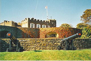
Walmer is a town in the district of Dover, Kent, in England. Located on the coast, the parish of Walmer is six miles (9.7 km) south-east of Sandwich, Kent. The town's coastline and castle are popular amongst tourists. It has a population of 6,693 (2001), increasing to 8,178 at the 2011 Census.
Ballito is an affluent coastal town located in KwaZulu-Natal, South Africa. Ballito is about 40 kilometres (25 mi) north of Durban and 24 kilometres south of KwaDukuza. It forms part of the KwaDukuza Local Municipality, and iLembe District Municipality. Dolphins and Whales are common on this stretch of the North Coast shoreline, hence the nickname Dolphin Coast. The name of the town Ballito is named after the Italian word for "small ball".

Margate is a coastal resort town in the KwaZulu-Natal province, about 20 kilometres south-west of Port Shepstone and 127 kilometres south-west of Durban. The river which flows into the sea at Margate is called "Nkhongweni" (place of entreaty) as the original inhabitants of the area were reputed to be so mean resulting in travellers begging for hospitality.

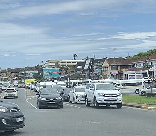
Port Shepstone is a large town situated on the mouth of the Mzimkhulu River, the largest river on the KwaZulu-Natal South Coast of South Africa. It is located halfway between Hibberdene and Margate and is positioned 120 km south of Durban. It serves as the administrative, educational, industrial and commercial centre for southern Natal.
Hibberdene is a small coastal town on the KwaZulu-Natal South Coast in South Africa, approximately 23 km north-east of Port Shepstone and 90 km south-west of Durban and halfway between coastal towns of Scottburgh and Margate.
Westville is an area in KwaZulu-Natal, South Africa, and is just west and 10 km inland from the Durban CBD. It was a formerly independent municipality however it became part of the eThekwini Metropolitan Municipality in 2002.

Verulam is a town 24 kilometres north of Durban in KwaZulu-Natal, South Africa and forms part of the eThekwini Metropolitan Municipality, governing the Greater Durban metropolitan area.

Joondalup is a suburb of Perth, Western Australia, approximately 26 kilometres (16 mi) north of Perth's central business district. It contains the central business district of the regional City of Joondalup and acts as the primary urban centre of Perth's outer northern suburbs.

The N2 is a national route in South Africa that runs from Cape Town through George, Gqeberha, East London, Mthatha, Port Shepstone and Durban to Ermelo. It is the main highway along the Indian Ocean coast of the country. Its current length of 2,255 kilometres (1,401 mi) makes it the longest numbered route in South Africa.

Greenacre is a suburb in Sydney, located 20 kilometres west of the Sydney central business district in the state of New South Wales, Australia. Most of Greenacre is in the local government area of the City of Canterbury-Bankstown, while a part in the east is in the Municipality of Strathfield.

Somerset West is a town in the Western Cape, South Africa. Organisationally and administratively it is included in the City of Cape Town metropolitan municipality Eastern Suburbs zone . The vehicle registration code for Somerset West is CFM and the post code is 7130 for street addresses, and 7129 for post office boxes.

Bluff or The Bluff is a geographical area, containing eight suburbs in Durban, eThekwini Metropolitan Municipality, KwaZulu-Natal Province, South Africa. The Bluff forms a large part of the South Durban Basin, a sub-region located south of Durban.
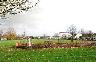
Colcot is a northern district of Barry, Vale of Glamorgan, in the Dyfan ward of South Wales. Dyfan ward is situated in the north west of Barry and its most northern edge is on the green belt of the town. Port Road West runs through the ward and is the main route to Cardiff and Cardiff International Airport in Rhoose. Dyfan benefits from a sports centre and Buttrills recreation field and The Barry Hospital is located on Colcot Road. It also contains the Colcot Primary School, the Colcot Arms pub, the St David's Methodist Church, Coastlands Family Church, a fish and chip shop/Chinese takeaway, Barry Arts Centre and Merthyr Dyfan Cemetery.
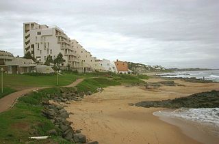
Shelly Beach is a coastal resort town on the South Coast of the KwaZulu-Natal province of South Africa, located more or less halfway between Margate and Port Shepstone.
Walmer Estate is a suburb of Cape Town in the Western Cape province of South Africa. It lies at the foot of Table Mountain and is bordered to the south by Table Mountain National Park, to the north-east by Woodstock and to the west by Zonnebloem. It covers an area of 0.47 km2.

Lightsview is a suburb in the City of Port Adelaide Enfield. It was created in April 2016 from parts of Northgate, Greenacres and Northfield. It is in the inner northeast, bounded by Hampstead Road, Redward Avenue, Fosters Road and Folland Avenue.

Summerstrand is a seaside suburb of Port Elizabeth, South Africa. It is located 6 km (3.7 mi) south-east of the Port Elizabeth city centre. It is primarily a residential suburb along with shopping and business facilities. It is also home to three Nelson Mandela University campuses.
Bluewater Bay is a small seaside suburb located along the Algoa Bay between Port Elizabeth and Coega in the Eastern Cape, South Africa.
Craigieburn is a small town located on the South Coast of KwaZulu-Natal, South Africa and 53 km south-west of Durban.

