Location | |
---|---|
Location | San Emigdio Canyon |
State | California |
Country | United States |
Coordinates | 34°55′23″N119°10′39″W / 34.922956°N 119.177594°W Coordinates: 34°55′23″N119°10′39″W / 34.922956°N 119.177594°W |
Production | |
Products | Silver |
Type | Hard rock, downwards shaft |
Greatest depth | 60 feet |
History | |
Active | circa 1824 |
The Lost Padre Mine is a legend about Spanish or Mexican mining activity along the "big bend" section of the San Andreas Fault during California's colonial period between 1769 and 1848. [1]
There are a number of legends from former Spanish colonies around the world that refer to a Lost Padre Mine or by names similar to this. The mine referred to in this short treatise is in southern Kern County in California.
The Lost Padre Mine is the most common name found in documentation however the mine is also known by other names including the Los Padres Mine, Lost Los Padres Mine, Lost Padres Mine, and the San Emigdio silver mine.
Stories of lost or hidden mines have been intriguing successive generations for one and a half centuries since being popularized in 19th century newspapers such as stories featured in The Ventura Signal starting the same year the newspaper was founded in 1871. [2]
There are multiple stories describing lost mines in southern Kern County and northern Los Angeles County. The different stories refer to different mines since there is more than one mine that falls under the umbrella of the Lost Padre Mine, be it real or imagined. [1]
Priests from the Franciscan Order of the Catholic Church are thought to have established a number of secret mines along the San Andreas fault zone during the period of Spanish and later Mexican rule of California. By the time California was admitted as the thirty-first State of the Union in 1850, these early mines had effectively disappeared casting doubt that they had ever existed. [1]
Some believe priests from the Jesuit Order of the Catholic Church were exploiting mineral wealth in pre-colonial California before 1768. However, this claim is unsupported in the historical record and is discounted or debunked by scholars. [1]
Very few stories about southern California's Lost Padre Mines can be substantiated and therefore appear to be apocryphal accounts arising from folklore. However, some have a basis in fact.[ citation needed ]
Spanish knowledge of the interior of California was sketchy during the first decades of coastal settlement. Much of this knowledge was learned from expeditions in search of military deserters and runaway mission neophytes. [3]
On August 24, 1790, Commandante Felipe de Goycochea dispatched nine soldiers headed by Sergeant Jose Ignacio Olivera to search for a neophyte named Domingo who had run away from Mission San Buenaventura. The military dispatch was also ordered to search for mineral outcroppings (silver) reported to be in San Emigdio Canyon. While prospecting the troupe was attacked by Indians and two soldiers were killed. [3]
In 1792, a Spanish naturalist, José Longinos Martínez, visited the canyon. He reported the existence of silver ore but advised mining would be too dangerous an undertaking. [4]
A pioneering, fur trapper and trader from Tennessee named Ewing Young (1799–1841) found physical evidence of early mining activity in southern California in the form of abandoned smelter ovens. His party made this discovery in October 1832 which was during the latter part of the Californian mission era (1769–1836). The location of the smelter works was near the Chumash village of Tashlipun (pronounced Tash-lé-poon) located in the mouth of San Emigdio Canyon (now part of The Wildlands Conservancy Wind Wolves Preserve west of Grapevine, CA). [5] [6]
Hidden in the mountains above the smelting ovens were two mines that were in operation during the mission era (c. 1824). Non-mission records suggest these smelters may have been managed by Mission San Buenaventura and/or Mission Santa Barbara [7] which were both secularized by 1836. However, there is no direct evidence indicating any of the California missions were involved in mining activity. [8]
A different "forge or furnace" used for processing antimony ore (stibnite) was discovered at the base of the southern slopes of Antimony Peak. It was documented by the renowned geologist and mineralogist William Phipps Blake who made a thorough investigation of the site on September 21, 1853, at a place his Indian guide called "Campo de los Americanos". This discovery provided further evidence of early mining activity in the area although not mission related. [9]
An elderly Native American named José el Venadero knew the location of the mines that supplied the old smelters. There are newspaper reports from 1860 describing how he led an interested party to the mines. [10] [11]
A mission Indian from the San Buenaventura Mission named Carlos Juan Capena also knew of the smelters and the location of the mines supplying them with ore. He described one as being an antimony mine and the other a silver mine. Like most Native Americans, Capena believed in the padres' curse that would cost him his life if he revealed the secret location of the mines.
Late in his life, Capena was persuaded to lead an expedition to the silver mine on behalf of the Hon. Angel G. Escandon (a Senator of Ventura County elected in 1874). Capena, now over eighty years of age, felt he was near the end of his life and had little to lose by revealing the location of the Franciscan mine. In August 1871, Capena led a party to the mine site where everything was found to be exactly as he had described it. [12] [6]
Juan Esteban Pico (1841–1901) made a concerted effort to chronicle details about this historic mine. Between 1860 and 1876, Pico recorded a series of eye-witness accounts from various Native Americans who worked at the mine and from others who visited the site. In December 1871, Pico recorded an interview with Carlos Juan Capena describing the mine. It took the form of a transcript of an oral interview given in the spoken Indian language of Mizkanaltan that was subsequently translated into Spanish. Pico was expert in translating indigenous languages into Spanish. In the interview, Carlos Juan Capena told us: "...the mine has sixty paces that one may walk into the mountain and it has ladders". [7]
This rediscovery prompted a number of individuals to lay claim to the mine. One of them was Jonathan Trumbull Warner aka Juan Jose Warner (1807–1890) of Warner’s Ranch fame. Warner was one of the original discovers of the smelters near the mouth of San Emigdio Canyon in October 1832. All those trying to claim rightful ownership were unsuccessful. [6]
In April/May 1884, Pico himself led an expedition to this silver mine on behalf of an Italian, Prospero Calli from Bakersfield who financed the venture. Their guide was a reluctant neophyte from the Tejon reservation named Maria Ventura. She was terrified of the curse and continually avoided or stalled in revealing what she knew. Pico wrote a detailed report describing the expedition and the mine. [7]
It was a secret mining-operation and most of the details that have survived come from Native Americans who had worked at the mine or had visited the site after it was closed. [7]
The year the mine was established and when it was subsequently concealed and abandoned remains unknown. However, there is clear evidence that the mine was operating in early 1824 during the widespread Chumash revolt of that year. [7]
In cyclic fashion, this historic mine keeps being rediscovered and then lost again through time. Documented visits to the mine site occurred in 1837, in 1860, in August 1871, in May 1884, and possibly again in 1915 when a map surfaced in Bakersfield. Two peons, C. F. Salazar and J. A. Miklas, sold a map to ex-Sheriff J. W. Kelly and two associates for $500. [13] [14] [15] It is not clear if the partners who purchased the map ever found the mine.
There is sufficient evidence to establish this was a real mine and therefore the quintessential "Lost Padre Mine" that arose from stories circulating in the mid-to-late 1800s.
The most recent rediscovery was made by Peter C. Gray on September 23, 2017, after a twelve-year search. [16]
A request has been made for The United States Forest Service to conduct an archaeological study of the site.
The Spanish missions in California comprise a series of 21 religious outposts or missions established between 1769 and 1833 in what is now the U.S. state of California. Founded by Catholic priests of the Franciscan order to evangelize the Native Americans, the missions led to the creation of the New Spain province of Alta California and were part of the expansion of the Spanish Empire into the most northern and western parts of Spanish North America.
Mission San Luis Obispo de Tolosa is a Spanish mission founded September 1, 1772 by Father Junípero Serra in San Luis Obispo, California. Named after Saint Louis of Anjou, the bishop of Toulouse, the mission is the namesake of San Luis Obispo. The mission offers public tours of the church and grounds.
Mission San Buenaventura, formally known as the Mission Basilica of San Buenaventura, is a Catholic parish and basilica in the Archdiocese of Los Angeles. The parish church in the city of Ventura, California, United States, is a Spanish mission founded by the Order of Friars Minor. Founded on March 31, 1782, it was the ninth Spanish mission established in Alta California and the last to be established by the head of the Franciscan missions in California, Junípero Serra. Designated a California Historical Landmark, the mission is one of many locally designated landmarks in downtown Ventura.
Mission San Fernando Rey de España is a Spanish mission in the Mission Hills community of Los Angeles, California. The mission was founded on 8 September 1797, and was the seventeenth of the twenty-one Spanish missions established in Alta California. Named for Saint Ferdinand, the mission is the namesake of the nearby city of San Fernando and the San Fernando Valley.
Ventura County is a county in the southern part of the U.S. state of California. As of the 2020 census, the population was 843,843. The largest city is Oxnard, and the county seat is the city of Ventura.
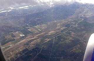
The Santa Clara River Valley is a rural, mainly agricultural, valley in Ventura County, California that has been given the moniker Heritage Valley by the namesake tourism bureau. The valley includes the communities of Santa Paula, Fillmore, Piru and the national historic landmark of Rancho Camulos. Named for the Santa Clara River, which winds through the valley before emptying into the Pacific Ocean between the cities of Ventura and Oxnard, the tourist bureau describes it as ".... Southern California's last pristine agricultural valley nestled along the banks of the free-flowing Santa Clara River."
Francisco Hermenegildo Tomás GarcésO.F.M. was a Spanish Franciscan friar who served as a missionary and explorer in the colonial Viceroyalty of New Spain. He explored much of the southwestern region of North America, including present day Sonora and Baja California in Mexico, and the U.S. states of Arizona and California. He was killed along with his companion friars during an uprising by the Native American population, and they have been declared martyrs for the faith by the Catholic Church. The cause for his canonization was opened by the Church.
José Francisco Ortega was an indigenous Californio soldier and early settler of Alta California. A member of the Portolá expedition in 1769, Ortega stayed on to become the patriarch of an important Californio family.
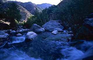
Piru Creek is a major stream, about 71 miles (114 km) long, in northern Los Angeles County and eastern Ventura County, California. It is a tributary of the Santa Clara River, the largest stream system in Southern California that is still relatively natural.
The Cuyama Valley is a valley along the Cuyama River in central California, in northern Santa Barbara, southern San Luis Obispo, southwestern Kern, and northwestern Ventura counties. It is about two hours driving time from both Los Angeles and the Santa Barbara area.
The San Buenaventura Mission Aqueduct was a seven-mile long, stone and mortar aqueduct built in the late 18th and/or early 19th century to transport water from the Ventura River to the Mission San Buenaventura in Ventura, California.
Rancho Ex-Mission San Buenaventura was a 48,823-acre (197.58 km2) Mexican land grant in present-day Ventura County, California given in 1846 by Governor Pio Pico to José de Arnaz. The grant derives its name from the secularized Mission San Buenaventura, and was called ex-Mission because of a division made of the lands held in the name of the Mission — the church retaining the grounds immediately around, and all of the lands outside of this are called ex-Mission lands. The grant extended east from present day Ventura, excluding the Rancho San Miguel (Olivas) lands, inland up the Santa Clara River to Santa Paula, between the north bank of the River and Sulphur Mountain.
Rancho Boca de la Playa was a 6,607-acre (26.74 km2) Mexican land grant in present-day Orange County, California given in 1846 by Governor Pío Pico to Emigdio Vejar. The name refers to the wetlands estuary at the 'mouth of the beach,' or 'boca de la playa' in Spanish. This is the most southerly grant in Orange County, and extended along the Pacific coast from San Juan Creek in the south of present-day San Juan Capistrano south to San Clemente.
Lockwood Valley is an unincorporated community located in an eponymous valley in northeastern Ventura County, southern California, and part of the Mountain Communities of the Tejon Pass.
Cuddy Canyon is a canyon running along the boundary line between Kern County and Ventura County, California. It lies inside the Los Padres National Forest and southern San Emigdio Mountains.
Ortega Adobe is a historic adobe house built in 1857 and located on Main Street on the west side of Ventura, California, not far from the mouth of the Ventura River. It was designated in 1974 as the City of Ventura's Historic Landmark No. 2. It is owned by the City and operated as a self-guided historical site.
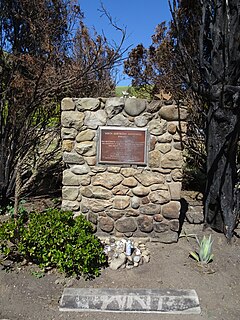
The Santa Gertrudis Asistencia, also known as the Santa Gertrudis Chapel, was an asistencia ("sub-mission") to the Mission San Buenaventura, part of the system of Spanish missions in Las Californias—Alta California. Built at an unknown date between 1792 and 1809, it was located approximately five miles from the main mission, inland and upstream along the Ventura River. The site was buried in 1968 by the construction of California State Route 33. Prior to the freeway's construction, archaeologists excavated and studied the site. A number of foundation stones were moved and used to create the Santa Gertrudis Asistencia Monument which was designated in 1970 as Ventura County Historic Landmark No. 11.
Annie Lydia Rose was a gold prospector and mining entrepreneur active between 1910 and 1972 in Bear Canyon and adjoining Pine Canyon in the north-west corner of the Angeles National Forest. She was uncharacteristically bold beyond her age, gender, and the restraints of the late Victorian era in which she grew up. During her life and now through her legacy, she is considered an authority on the legendary Lost Horse Mine also referred to as the Lost Padre Mine.
Chief Tecuya was an Emigdiano Chumash elder said to be the last living soul to have known the precise whereabouts of an exposed gold ledge that spawned the legend of the Lost Padre Mine.
The Battle of San Buenaventura was a battle fought on March 27 and March 28, 1838, between forces representing competing claims to the governorship of California, then a Mexican territory. The opposing forces consisted of supporters of Juan Bautista Alvarado based in Northern California and supporters of Carlos Antonio Carrillo from Southern California. The major action consisted of a cannon siege on the Carrillo loyalists who were encamped at the Mission San Buenaventura in Ventura, California. The Alvarado forces won the battle, as the Carrillo forces fled from the Mission under cover of darkness following the first day of the battle. Most of the Carillo forces were captured the following day at Saticoy, California. One person was killed in the battle, an Alvarado loyalist who was shot by a rifleman stationed in the Mission's bell tower.