
Mount Whitney is the highest mountain in the contiguous United States, with an elevation of 14,505 feet (4,421 m). It is in East–Central California, in the Sierra Nevada, on the boundary between California's Inyo and Tulare counties, and 84.6 miles (136.2 km) west-northwest of North America's lowest topographic point, Badwater Basin in Death Valley National Park, at 282 ft (86 m) below sea level. The mountain's west slope is in Sequoia National Park and the summit is the southern terminus of the John Muir Trail, which runs 211.9 mi (341.0 km) from Happy Isles in Yosemite Valley. The eastern slopes are in Inyo National Forest in Inyo County. Mount Whitney is ranked 18th by topographic isolation.

The San Emigdio Mountains are a part of the Transverse Ranges in Southern California, extending from Interstate 5 at Lebec and Gorman on the east to Highway 33–166 on the west. They link the Tehachapis and Temblor Range and form the southern wall of the San Joaquin Valley. The range is named after Emygdius, an early Christian martyr.

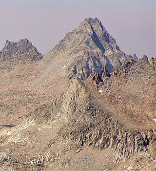
North Palisade is the third-highest mountain in the Sierra Nevada range of California, and one of the state's small number of peaks over 14,000 feet, known as fourteeners. It is the highest peak of the Palisades group of peaks in the central part of the Sierra range. It sports a small glacier and several highly prized rock climbing routes on its northeast side.

Mount Kaweah is a mountain in California's Sequoia National Park and forms part of the Kaweah Peaks Ridge, a spur of the Great Western Divide which extends south from Triple Divide Peak. It has a summit elevation of 13,807 ft (4,208 m), the highest along the Kaweah Peaks Ridge.

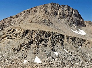
Mount Sill is one of the fourteeners of the Sierra Nevada in California. It is located in the Palisades, a group of prominent rock peaks with a few small glaciers on their flanks. Mount Sill is located 0.6 miles (1 km) east of North Palisade, the high point of the group. The two peaks are connected by a high, rocky ridge, on the north side of which lies the Palisade Glacier. Mount Sill lies on the main Sierra Crest, but is at a point where the crest turns sharply, giving it particularly striking summit views. On one side is Kings Canyon National Park and Fresno County; on the other is the John Muir Wilderness, Inyo National Forest and Inyo County.

Mount Langley is a mountain located on the crest of the Sierra Nevada, on the boundary between Inyo and Tulare counties in eastern California, in the United States. To the east is the Owens Valley, and to the west is the Kern River Valley. It is the ninth-highest peak in the state and the seventh-highest in the Sierra. Mount Whitney, the highest peak in the contiguous United States, lies 4.8 miles (7.7 km) to the northwest. Mount Langley also has the distinction of being the southernmost fourteener in the United States.

Banner Peak is the second tallest peak in the Ritter Range of California's Sierra Nevada. The mountain is 12,942 feet (3,945 m) tall, and there are several glaciers on its slopes. It lies within the boundaries of the Ansel Adams Wilderness; at the foot of the peak lie Garnet Lake, Lake Ediza, and the famous Thousand Island Lake. Banner Peak is near the town of Mammoth Lakes; from there, climbers can hike to the foot of the mountain where various routes reach the summit, the easiest of which is a class 2 from the west end of Thousand Island Lake and then the saddle between Banner Peak and the slightly taller Mount Ritter. Other nearby lakes include Lake Catherine and Shadow Lake.

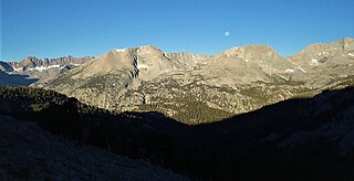
Mount Winchell, a thirteener, is among the thirty highest peaks of California. It is in the Palisades region of the Sierra Nevada, on the Sierra Crest between Mount Agassiz and Thunderbolt Peak.
Mount Le Conte is a mountain located in the Sierra Nevada of California. The boundary between Inyo and Tulare counties runs along the crest of the Sierra, across Mount Le Conte. The mountain was named in 1895 for Joseph Le Conte (1823–1901), the first professor of geology and natural history at the University of California.
Triple Divide Peak is a mountain along the Great Western Divide in the Sierra Nevada range on the boundary between Kings Canyon and Sequoia national parks, in Tulare County, California. It rises to 12,640 feet (3,853 m).

Mount Stanford, at an elevation of 13,979 feet (4,261 m), is on the Kings-Kern Divide in Kings Canyon National Park. It is named for Stanford University. It is the fifteenth tallest mountain in California and is located about 3.6 miles (5.8 km) from University Peak which was named for the University of California.
Thunder Mountain is located in the northern part of the Great Western Divide, a sub-range of the Sierra Nevada in California. The summit marks a point on the boundary between Sequoia and Kings Canyon national parks and is 0.6 miles (1 km) north of Table Mountain and south 2.8 miles (4.5 km) Mount Brewer. Thunder pass, on the mountains east side, has an elevation of 12,720+ feet. This pass marks the western end of the Kings-Kern Divide.

Kern Peak is a mountain peak in Tulare County, California, in the southern Sierra Nevada. At 11,510 ft (3,508 m) in elevation and about 2,560 ft (780 m) of prominence, it is the 49th most prominent peak in California. It is west of Olancha Peak, which is in the same mountain range. The climb to the summit involves a long hike from any trailhead. The best time to climb the mountain is May to October.

Mount Hitchcock is a 13,186-foot-elevation (4,019-meter) mountain summit located west of the crest of the Sierra Nevada mountain range in Tulare County, California. It is situated in Sequoia National Park, and is two miles (3.2 km) south-southwest of Mount Whitney, 1.3 miles (2.1 km) southwest of Mount Muir, and 1.1 miles (1.8 km) west of Trail Crest. Topographic relief is significant as it rises approximately 1,500 feet above Hitchcock Lakes in less than one-half mile. Mt. Hitchcock ranks as the 112th highest summit in California.

Tunnabora Peak is a 13,563-foot-elevation (4,134-meter) mountain summit located on the crest of the Sierra Nevada mountain range in California. It is situated on the common border of Tulare County with Inyo County, as well as the shared boundary of Sequoia National Park and John Muir Wilderness. It is set above the north shore of Tulainyo Lake, 13 miles (21 km) west of the community of Lone Pine, 1.86 miles (2.99 km) north-northeast of Mount Whitney, and 0.9 miles (1.4 km) north-northwest of Mount Carillon. Tunnabora ranks as the 51st-highest peak in California. Topographic relief is significant as it rises approximately 5,200 feet above Whitney Portal in approximately three miles.
Caltech Peak is a 13,832-foot-elevation (4,216 meter) mountain summit located in Sequoia National Park in Tulare County, California. It is situated one mile west of the crest of the Sierra Nevada mountain range, just one-half mile south of the Kings–Kern Divide, one mile south of line parent Mount Stanford, and 9.3 miles northwest of Mount Whitney. Caltech Peak ranks as the 24th-highest summit in California. Topographic relief is significant as the southwest aspect rises nearly 1,900 feet above Lake South America in 0.7 miles (1.1 km). The John Muir Trail traverses below the east aspect of the mountain, providing an approach option for climbers.

Picket Guard Peak is a 12,302-foot-elevation (3,750 meter) mountain summit located west of the crest of the Sierra Nevada mountain range in Tulare County, California. It is situated in Sequoia National Park, two miles southwest of Kern Point, 3.4 miles (5.5 km) north of Mount Kaweah, and three miles east of the junction of Kaweah Peaks Ridge with Great Western Divide. Picket Guard Peak ranks as the 345th-highest summit in California, and topographic relief is significant as the summit rises 4,265 feet above Kern Canyon in approximately three miles.
Kern Point is a 12,763-foot-elevation (3,890 meter) mountain summit located west of the crest of the Sierra Nevada mountain range in Tulare County, California. It is situated in Sequoia National Park, two miles northeast of Picket Guard Peak, and seven miles east of Mount Whitney. Kern Point ranks as the 220th-highest summit in California, and topographic relief is significant as the summit rises over 4,700 feet above Kern River in two miles. Kern Point is the southernmost peak on Kern Ridge, and precipitation runoff from this mountain drains to the Kern River. The river was named by John C. Frémont for Edward Kern, the artist and topographer of Frémont's third expedition in 1845. The Kern Point toponym was officially adopted in 1928 by the U.S. Board on Geographic Names.


