
Cley next the Sea is a village and civil parish on the River Glaven in the English county of Norfolk.

Chesterfield is a market and industrial town in the county of Derbyshire, England. It is 24 miles (39 km) north of Derby and 11 miles (18 km) south of Sheffield at the confluence of the Rivers Rother and Hipper. In 2011, the built-up-area subdivision had a population of 88,483, making it the second-largest settlement in Derbyshire, after Derby. The wider Borough of Chesterfield had a population of 103,569 in the 2021 Census. In 2021, the town itself had a population of 76,402.

Bakewell is a market town and civil parish in the Derbyshire Dales district of Derbyshire, England, known for Bakewell pudding. It lies on the River Wye, 15 miles (23 km) south-west of Sheffield. It is the largest settlement and only town within the boundaries of the Peak District National Park. At the 2011 census, the population of the civil parish was 3,949. It was estimated at 3,695 in 2019. The town is close to the tourist attractions of Chatsworth House and Haddon Hall.

Dronfield is a town in North East Derbyshire, England, which includes Dronfield Woodhouse and Coal Aston. It lies in the valley of the River Drone between Chesterfield and Sheffield. The Peak District National Park is three miles (4.8 km) to the west. The name comes from the Old English Dranfleld, probably meaning an open land infested with drone bees.

Whitchurch is a village in Herefordshire situated on the A40, connecting nearby Ross-on-Wye to Welsh town Monmouth. It is located within the Wye Valley Area of Outstanding Natural Beauty.

Bristol, the largest city in South West England, has an eclectic combination of architectural styles, ranging from the medieval to 20th century brutalism and beyond. During the mid-19th century, Bristol Byzantine, an architectural style unique to the city, was developed, and several examples have survived.

Blo' Norton is a village and civil parish in the Breckland district of the English county of Norfolk.

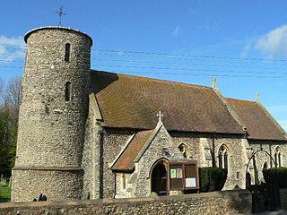
Boughton is a village and civil parish in the English county of Norfolk.
Burnham Deepdale is a village and former civil parish, now in the parish of Brancaster, in the English county of Norfolk.

Brimington is a large village and civil parish in the Borough of Chesterfield in Derbyshire, England. The population of the parish taken at the 2011 census was 8,788. The town of Staveley is to the east, and Hollingwood is nearby. The parish includes Brimington Common along the Calow Road, and New Brimington, a late 19th-century extension towards the Staveley Iron Works.

Briston is a village, civil parish and electoral ward in the English county of Norfolk.

Wookey Hole is a village in Somerset, England. It is the location of the Wookey Hole show caves.
There are 212 Grade II* listed buildings in Bristol, England.

CZWG Limited is a British architecture practice established in 1975 by Nick Campbell, Roger Zogolovitch, Rex Wilkinson and Piers Gough. The practice's work includes community and public buildings, residential and mixed use projects, student housing and retail, leisure and workplace uses. The practice is known for its work in the postmodern style.

Buxton Town Hall was opened in 1889 on the Market Place in Buxton, Derbyshire, England. It lies in the town's central Conservation Area overlooking The Slopes. It is a Grade-II-listed building.

The Borough of Chesterfield is a non-metropolitan district with borough status in Derbyshire, England. It is named after the town of Chesterfield, its largest settlement, and also contains the town of Staveley and the large village of Brimington. In 2022 it had a population of 104,110.

Market Place is a pedestrianised public square in the market town of Poulton-le-Fylde, Lancashire, England. Dating to the Middle Ages, it has historically been a site of weekly markets, today taking place on Mondays. It is now mostly used as a shopping precinct, along with the adjacent indoor Teanlowe Centre. It is bounded by Church Street to the north and Blackpool Old Road to the south.

Low Pavement is a short street located in Nottingham, England. It connects Castle Gate and Middle Pavement, which in turn connects to High Pavement.

2 Market Place is a Grade II listed building in the English market town of Poulton-le-Fylde, Lancashire. Built in the late 17th or early 18th century, it stands immediately to the south of St Chad's Church, itself Grade II* listed and dating to the 17th century, in the northeastern corner of Market Place. It was formerly a custom house, later a residence.

The Peacock Inn is a grade-II listed building located on Low Pavement in Chesterfield, Derbyshire.


