
Lower Burlington in Nova Scotia
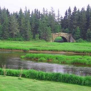
Lower Burlington is a community in the Canadian province of Nova Scotia, located in the Municipality of West Hants.
Coordinates: 45°5′16.16″N64°8′36″W / 45.0878222°N 64.14333°W
Lower Burlington is a community in the Canadian province of Nova Scotia, located in the Municipality of West Hants.
Coordinates: 45°5′16.16″N64°8′36″W / 45.0878222°N 64.14333°W

Blomidon Provincial Park is a camping and day-use provincial park located at Cape Blomidon on the shores of the Minas Basin in Nova Scotia, Canada. It is known for its hiking and for views over the world's highest tides. Blomidon is located on 1,875 acres (7.6 km2) of land with 600 ft high cliffs. It is accessible via Nova Scotia Route 358.

Kings South is a provincial electoral district in Nova Scotia, Canada, that elects one member of the Nova Scotia House of Assembly. It includes the town of Wolfville, the village of New Minas, the community of Coldbrook, and Glooscap First Nation.
Aylesford, since its formation, has always been a farming community. It is situated in western Kings County in the Annapolis Valley of Nova Scotia, Canada. The settlement was named after the fourth Earl of Aylesford, Heneage Finch, who was Lord Of The Bedchamber to George III from 1772-1777. The community is located between the North and South Mountains, and is roughly a 15 minute to Canadian Forces Base Greenwood, and a 10 minute drive to its closest neighbour, the Town Of Berwick. Aylesford is located on the Evangeline Trail scenic tourist route, which was named after the epic 1847 H.W. Longfellow poem entitled Evangeline, A Tale of Acadie.
The Fundy Shore Ecotour is a former scenic drive and network of tourist destinations in the Canadian province of Nova Scotia and encircles several sub-basins of the Bay of Fundy, which contains the highest tidal range on the planet.
The River Hebert is a small tidal river that empties into the Cumberland Basin, and is contained completely within Cumberland County, Nova Scotia. According to estimates by the Province of Nova Scotia, there were 9,092 people resident within the Maccan/Kelley/Hebert watershed in 2011.

The Kennetcook River is a river that flows through Hants County, Nova Scotia. From headwaters near the mouth of the Shubenacadie River, the Kennetcook traverses about 45 kilometres of mostly rural terrain, discharging into the Avon River at Windsor. The Kennetcook cuts through fossiliferous limestone rocks for part of its length. A tidal river near its mouth, the Kennetcook experiences a tidal bore which may be seen at Scotch Village. It is a known salmon river popular with anglers.

The St. Croix River is a river in Nova Scotia entirely contained in Hants and Halifax Counties. Its headwaters are Panuke Lake. The river has been exploited for water power. There were water mills in the nineteenth century and in the 1930s three hydroelectric dams were built; they still operate.
Hamburg was a three masted barque built in 1886 at Hantsport, Nova Scotia. She was the largest three masted barque ever built in Canada.
Spectacle Lake could mean the following :
Second Lake could mean the following

Harbourville is a community in the Canadian province of Nova Scotia, located in Kings County on the Minas Channel of the Bay of Fundy.
Tidnish Bridge is a community in the Canadian province of Nova Scotia, located in Cumberland County on the interprovincial border with New Brunswick between Upper Tidnish, and Lower Tidnish on the Tidnish River. Tidnish Bridge is home to the Chignecto Ship Railway Keystone Bridge and would have been the Baie Verte terminus. Tidnish Dock Provincial Park is where the last piece of the project remained. The name Tidnish is of Mi'kmaqi origin, said to signify "A Paddle".
Centre Burlington is a small community in the Canadian province of Nova Scotia, located in The Municipality of the District of West Hants in Hants County.
Upper Burlington is a community in the Canadian province of Nova Scotia, located in the Municipality of West Hants.
Burlington is a community in the Canadian province of Nova Scotia, located in Kings County.
There are various Black Lakes in Nova Scotia, Canada. They vary widely in size, depth and usability. Many counties, such as Cumberland, Halifax, Inverness, and Pictou Counties have more than one Black Lake so named, while other counties mentioned in this article have only one named Black Lake.

The Gaspereau River is a river in Kings County, Nova Scotia, Canada.

A township in Nova Scotia, Canada, was an early form of land division and local administration during British colonial settlement in the 18th century. They were created as a means of populating the colony with people loyal to British rule. They were typically rural or wilderness areas of around 100,000 acres (400 km2) that would eventually include several villages or towns. Some townships, but not all, returned a member to the General Assembly of Nova Scotia; others were represented by the members from the county. Townships became obsolete by 1879 by which time towns and counties had become incorporated.
Lower Cove is a small community located in Cumberland County, Nova Scotia, Canada. It is the site of historic sandstone quarrying and grindstone production.
| | This Hants County, Nova Scotia location article is a stub. You can help Wikipedia by expanding it. |