Lower Wood

Last updated
Lower Wood
Lower Wood, Cambridgeshire 9.jpg
Type Nature reserve
Location Weston Colville, Cambridgeshire
OS grid TL625528
Area 9 hectares
Managed by Wildlife Trust for Bedfordshire, Cambridgeshire and Northamptonshire

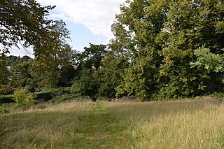
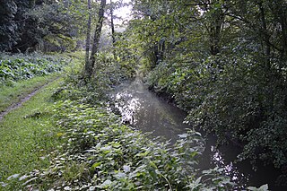
Lower Wood is a 9 hectare nature reserve east of Weston Colville in Cambridgeshire. It is managed by the Wildlife Trust for Bedfordshire, Cambridgeshire and Northamptonshire. [1]

Weston Colville village in United Kingdom

Weston Colville is a village in South Cambridgeshire, 10 miles southeast of Cambridge and 6 miles south of Newmarket, close to the border with Suffolk.

Cambridgeshire County of England

Cambridgeshire is a county in the East of England, bordering Lincolnshire to the north, Norfolk to the north-east, Suffolk to the east, Essex and Hertfordshire to the south, and Bedfordshire and Northamptonshire to the west. The city of Cambridge is the county town. Modern Cambridgeshire was formed in 1974 as an amalgamation of the counties of Cambridgeshire and Isle of Ely and Huntingdon and Peterborough, the former covering the historic county of Cambridgeshire and the latter covering the historic county of Huntingdonshire and the Soke of Peterborough, historically part of Northamptonshire. It contains most of the region known as Silicon Fen.

Wildlife Trust for Bedfordshire, Cambridgeshire and Northamptonshire registered charity which manages 126 nature reserves covering 3,945 hectares across Bedfordshire, Cambridgeshire and Northamptonshire in the United Kingdom

The Wildlife Trust for Bedfordshire, Cambridgeshire and Northamptonshire (WTBCN) is a registered charity which manages 126 nature reserves covering 3,945 hectares. It has over 35,000 members, and 95% of people in Bedfordshire, Cambridgeshire and Northamptonshire live within five miles of a reserve. In the year to 31 March 2016 it employed 105 people and had an income of £5.1 million. It aims to conserve wildlife, inspire people to take action for wildlife, offer advice and share knowledge. The WTBCN is one of 36 wildlife trusts covering England, and 47 covering the whole of the United Kingdom.

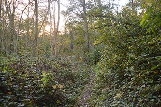
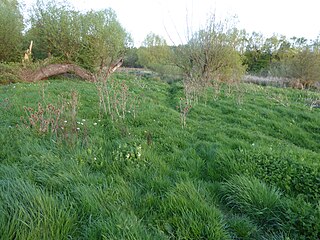
This ancient woodland has a variety of flora such as oxlips and early-purple orchids in the spring and water avens and germander speedwells in the summer. Muntjac and roe deer use the site and birds include goldcrests, great spotted woodpeckers and tawny owls. [1]

Muntjac A genus of mammals belonging to the deer, muntjac, roe deer, reindeer, and moose family of ruminants

Muntjacs, also known as barking deer and Mastreani deer, are small deer of the genus Muntiacus native to south Asia. Muntjacs are thought to have begun appearing 15–35 million years ago, with remains found in Miocene deposits in France, Germany and Poland. It is listed as Least Concern by the IUCN.

Roe deer species of mammal

The European roe deer, also known as the western roe deer, chevreuil, or simply roe deer or roe, is a species of deer. The male of the species is sometimes referred to as a roebuck. The roe deer is relatively small, reddish and grey-brown, and well-adapted to cold environments. The species is widespread in Europe, from the Mediterranean to Scandinavia, from Scotland to the Caucasus, and east to northern Iran and Iraq. It is distinct from the somewhat larger Siberian roe deer.

Goldcrest A small passerine bird in the kinglet family

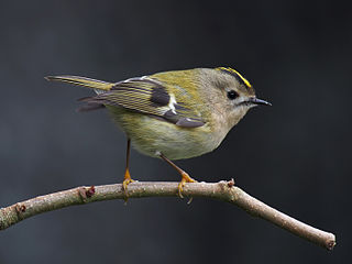
The goldcrest is a very small passerine bird in the kinglet family. Its colourful golden crest feathers gives rise to its English and scientific names, and possibly to it’s being called the "king of the birds" in European folklore. The scientific name, R. regulus, means king or knight. Several subspecies are recognised across the very large distribution range that includes much of Eurasia and the islands of Macaronesia and Iceland. Birds from the north and east of its breeding range migrate to winter further south.

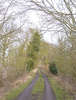
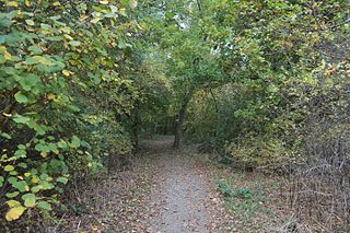
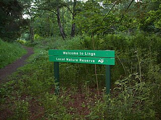
There is access from a footpath along the eastern boundary.

Related Research Articles

Cut-throat Meadow nature reserve in the United Kingdom

Cut-throat Meadow is a 1.5 hectare nature reserve in Ampthill in Bedfordshire. It is managed by the Wildlife Trust for Bedfordshire, Cambridgeshire and Northamptonshire.

Flitwick Moor nature reserve in the United Kingdom

Flitwick Moor is a 59.8 hectare biological Site of Special Scientific Interest between Flitwick and Greenfield in Bedfordshire. It was notified under Section 28 of the Wildlife and Countryside Act 1981 in 1984 and the local planning authority is Central Bedfordshire Council. The site is managed by the Wildlife Trust for Bedfordshire, Cambridgeshire and Northamptonshire.

Buff Wood nature reserve in the United Kingdom

Buff Wood is a 15.8 hectare biological Site of Special Scientific Interest in Hatley in Cambridgeshire. It is managed by the Wildlife Trust for Bedfordshire, Cambridgeshire and Northamptonshire.

Doghouse Grove nature reserve in the United Kingdom

Doghouse Grove is a 0.8 hectare nature reserve in Wilburton in Cambridgeshire. It is managed by the Wildlife Trust for Bedfordshire, Cambridgeshire and Northamptonshire.

Gamlingay Wood nature reserve in the United Kingdom

Gamlingay Wood is a 48.4 hectare biological Site of Special Scientific Interest (SSSI) north of Gamlingay in Cambridgeshire. It is managed by the Wildlife Trust for Bedfordshire, Cambridgeshire and Northamptonshire.

Gamsey Wood nature reserve in the United Kingdom

Gamsey Wood is a 4 hectare nature reserve north-east of Woodwalton in Cambridgeshire. It is managed by the Wildlife Trust for Bedfordshire, Cambridgeshire and Northamptonshire.

Waresley and Gransden Woods nature reserve in the United Kingdom

Waresley and Gransden Woods is a 50 hectare nature reserve between Waresley and Great Gransden in Cambridgeshire, England. It is managed by the Wildlife Trust for Bedfordshire, Cambridgeshire and Northamptonshire. The site is a 54.2 hectare biological Site of Special Scientific Interest called Waresley Wood, with slightly different boundaries.

Hardwick Wood nature reserve in the United Kingdom

Hardwick Wood is a 15.5 hectare biological Site of Special Scientific Interest south of Caldecote in Cambridgeshire. It is managed by the Wildlife Trust for Bedfordshire, Cambridgeshire and Northamptonshire.

Hayley Wood nature reserve in the United Kingdom

Hayley Wood is a 51.7 hectare biological Site of Special Scientific Interest south-east of Great Gransden in Cambridgeshire. It is a Nature Conservation Review site, Grade 1, and it is managed by the Wildlife Trust for Bedfordshire, Cambridgeshire and Northamptonshire.

Ladys Wood nature reserve in the United Kingdom

Lady's Wood is a 7.1 hectare nature reserve west of Upwood in Cambridgeshire. It is managed by the Wildlife Trust for Bedfordshire, Cambridgeshire and Northamptonshire.

Raveley Wood nature reserve in the United Kingdom

Raveley Wood is a 5.6 hectare nature reserve south-west of Upwood in Cambridgeshire. It is managed by the Wildlife Trust for Bedfordshire, Cambridgeshire and Northamptonshire.

Shepherds Close nature reserve in the United Kingdom

Shepherd's Close is a 1.2 hectare nature reserve south of Spaldwick in Cambridgeshire. It is managed by the Wildlife Trust for Bedfordshire, Cambridgeshire and Northamptonshire.

Thorpe Wood nature reserve in the United Kingdom

Thorpe Wood is a 10 hectare nature reserve on the western outskirts of Peterborough in Cambridgeshire. It is managed by the Wildlife Trust for Bedfordshire, Cambridgeshire and Northamptonshire.

Lings Wood Nature Reserve nature reserve in the United Kingdom

Lings Wood is a 20.1 hectare Local Nature Reserve in eastern Northampton. It is owned by Northampton Borough Council and managed by the Wildlife Trust for Bedfordshire, Cambridgeshire and Northamptonshire.

Brackland Rough nature reserve in the United Kingdom

Brackland Rough is a 10.7 hectare biological Site of Special Scientific Interest in Fordham in Cambridgeshire. It is managed by the Wildlife Trust for Bedfordshire, Cambridgeshire and Northamptonshire as Fordham Woods.

Warboys and Wistow Woods nature reserve in the United Kingdom

Warboys and Wistow Woods is a 44.5 hectare biological Site of Special Scientific Interest north of Warboys and west of Wistow in Cambridgeshire. Wistow Wood is an 8.5 hectare nature reserve owned and managed by the Wildlife Trust for Bedfordshire, Cambridgeshire and Northamptonshire.

Stoke Wood End Quarter nature reserve in the United Kingdom

Stoke Wood End Quarter is a 0.7 hectare nature reserve west of Corby in Northamptonshire. It is managed by the Wildlife Trust for Bedfordshire, Cambridgeshire and Northamptonshire, and is part of the Stoke and Bowd Lane Woods Site of Special Scientific Interest.

Barford Wood and Meadows nature reserve in the United Kingdom

Barford Wood and Meadows or Barford Meadow Nature Reserve is a 36 hectare nature reserve east of Rushton in Northamptonshire. It is managed by the Wildlife Trust for Bedfordshire, Cambridgeshire and Northamptonshire. The north-eastern end is part of the River Ise and Meadows Site of Special Scientific Interest.

Southfield Farm Marsh nature reserve in the United Kingdom

Southfield Farm Marsh is an 8.6 hectare biological Site of Special Scientific Interest in Kettering in Northamptonshire. An area of 2.8 hectares is managed as a nature reserve by the Wildlife Trust for Bedfordshire, Cambridgeshire and Northamptonshire.

References

  1. 1 2 "Lower Wood". Wildlife Trust for Bedfordshire, Cambridgeshire and Northamptonshire. Retrieved 23 January 2017.

Coordinates: 52°09′00″N0°22′26″E / 52.15°N 0.374°E / 52.15; 0.374

Geographic coordinate system Coordinate system

A geographic coordinate system is a coordinate system that enables every location on Earth to be specified by a set of numbers, letters or symbols. The coordinates are often chosen such that one of the numbers represents a vertical position and two or three of the numbers represent a horizontal position; alternatively, a geographic position may be expressed in a combined three-dimensional Cartesian vector. A common choice of coordinates is latitude, longitude and elevation. To specify a location on a plane requires a map projection.