Kołaki is a village in the administrative district of Gmina Rajgród, within Grajewo County, Podlaskie Voivodeship, in north-eastern Poland. It lies approximately 9 kilometres (6 mi) west of Rajgród, 11 km (7 mi) north-east of Grajewo, and 78 km (48 mi) north-west of the regional capital Białystok.
Kalska Wola is a village in the administrative district of Gmina Czarnocin, within Piotrków County, Łódź Voivodeship, in central Poland. It lies approximately 4 kilometres (2 mi) east of Czarnocin, 19 km (12 mi) north of Piotrków Trybunalski, and 30 km (19 mi) south-east of the regional capital Łódź.
Lisice Nowe is a village in the administrative district of Gmina Mochowo, within Sierpc County, Masovian Voivodeship, in east-central Poland.
Gębarzewo is a village in the administrative district of Gmina Czerniejewo, within Gniezno County, Greater Poland Voivodeship, in west-central Poland. It lies approximately 7 kilometres (4 mi) north-east of Czerniejewo, 8 km (5 mi) south of Gniezno, and 45 km (28 mi) east of the regional capital Poznań.
Kosowo is a village in the administrative district of Gmina Czerniejewo, within Gniezno County, Greater Poland Voivodeship, in west-central Poland. It lies approximately 6 kilometres (4 mi) east of Czerniejewo, 12 km (7 mi) south of Gniezno, and 44 km (27 mi) east of the regional capital Poznań.
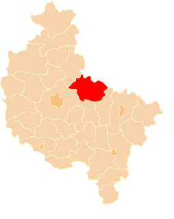
Jankowo Dolne is a village in the administrative district of Gmina Gniezno, within Gniezno County, Greater Poland Voivodeship, in west-central Poland. It lies approximately 8 kilometres (5 mi) east of Gniezno and 56 km (35 mi) east of the regional capital Poznań.
Kalina is a village in the administrative district of Gmina Gniezno, within Gniezno County, Greater Poland Voivodeship, in west-central Poland. It lies approximately 10 kilometres (6 mi) east of Gniezno and 58 km (36 mi) east of the regional capital Poznań.
Obora is a village in the administrative district of Gmina Gniezno, within Gniezno County, Greater Poland Voivodeship, in west-central Poland. It lies approximately 6 kilometres (4 mi) north-west of Gniezno and 46 km (29 mi) north-east of the regional capital Poznań.
Osiniec is a village in the administrative district of Gmina Gniezno, within Gniezno County, Greater Poland Voivodeship, in west-central Poland. It lies approximately 3 kilometres (2 mi) south-east of Gniezno and 51 km (32 mi) east of the regional capital Poznań.
Pyszczyn is a village in the administrative district of Gmina Gniezno, within Gniezno County, Greater Poland Voivodeship, in west-central Poland. It lies approximately 4 kilometres (2 mi) north of Gniezno and 50 km (31 mi) east of the regional capital Poznań.
Głębokie is a village in the administrative district of Gmina Kiszkowo, within Gniezno County, Greater Poland Voivodeship, in west-central Poland. It lies approximately 6 kilometres (4 mi) south-east of Kiszkowo, 19 km (12 mi) west of Gniezno, and 34 km (21 mi) north-east of the regional capital Poznań.
Nowa Wieś Niechanowska is a village in the administrative district of Gmina Niechanowo, within Gniezno County, Greater Poland Voivodeship, in west-central Poland. It lies approximately 4 kilometres (2 mi) north-east of Niechanowo, 10 km (6 mi) south-east of Gniezno, and 56 km (35 mi) east of the regional capital Poznań.
Mijanowo is a village in the administrative district of Gmina Trzemeszno, within Gniezno County, Greater Poland Voivodeship, in west-central Poland. It lies approximately 6 kilometres (4 mi) east of Trzemeszno, 21 km (13 mi) east of Gniezno, and 70 km (43 mi) east of the regional capital Poznań.
Miława is a village in the administrative district of Gmina Trzemeszno, within Gniezno County, Greater Poland Voivodeship, in west-central Poland. It lies approximately 8 kilometres (5 mi) south-east of Trzemeszno, 22 km (14 mi) east of Gniezno, and 70 km (43 mi) east of the regional capital Poznań.
Popielewo is a village in the administrative district of Gmina Trzemeszno, within Gniezno County, Greater Poland Voivodeship, in west-central Poland. It lies approximately 4 kilometres (2 mi) east of Trzemeszno, 19 km (12 mi) east of Gniezno, and 68 km (42 mi) east of the regional capital Poznań.
Zieleń is a village in the administrative district of Gmina Trzemeszno, within Gniezno County, Greater Poland Voivodeship, in west-central Poland. It lies approximately 3 kilometres (2 mi) south-east of Trzemeszno, 18 km (11 mi) east of Gniezno, and 66 km (41 mi) east of the regional capital Poznań.
Odrowąż is a village in the administrative district of Gmina Witkowo, within Gniezno County, Greater Poland Voivodeship, in west-central Poland. It lies approximately 5 kilometres (3 mi) south-west of Witkowo, 16 km (10 mi) south-east of Gniezno, and 55 km (34 mi) east of the regional capital Poznań.
Orzeszkowo is a village in the administrative district of Gmina Kwilcz, within Międzychód County, Greater Poland Voivodeship, in west-central Poland. It lies approximately 14 kilometres (9 mi) east of Kwilcz, 28 km (17 mi) east of Międzychód, and 47 km (29 mi) north-west of the regional capital Poznań.
Rudziny is a village in the administrative district of Gmina Niegosławice, within Żagań County, Lubusz Voivodeship, in western Poland. It lies approximately 3 kilometres (2 mi) south of Niegosławice, 29 km (18 mi) east of Żagań, and 44 km (27 mi) south of Zielona Góra.
Cianowo is a settlement in the administrative district of Gmina Drawsko Pomorskie, within Drawsko County, West Pomeranian Voivodeship, in north-western Poland. It lies approximately 7 kilometres (4 mi) north-west of Drawsko Pomorskie and 77 km (48 mi) east of the regional capital Szczecin.