Ganina is a village in the administrative district of Gmina Gniezno, within Gniezno County, Greater Poland Voivodeship, in west-central Poland. It lies approximately 11 kilometres (7 mi) north-east of Gniezno and 58 km (36 mi) north-east of the regional capital Poznań.

Mączniki is a village in the administrative district of Gmina Gniezno, within Gniezno County, Greater Poland Voivodeship, in west-central Poland. It lies approximately 9 kilometres (6 mi) north-west of Gniezno and 49 km (30 mi) north-east of the regional capital Poznań.
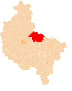
Pyszczyn is a village in the administrative district of Gmina Gniezno, within Gniezno County, Greater Poland Voivodeship, in west-central Poland. It lies approximately 4 kilometres (2 mi) north of Gniezno and 50 km (31 mi) east of the regional capital Poznań.
Brudzewko is a village in the administrative district of Gmina Kiszkowo, within Gniezno County, Greater Poland Voivodeship, in west-central Poland. It lies approximately 4 kilometres (2 mi) east of Kiszkowo, 22 km (14 mi) west of Gniezno, and 35 km (22 mi) north-east of the regional capital Poznań.
Myszki is a village in the administrative district of Gmina Kiszkowo, within Gniezno County, Greater Poland Voivodeship, in west-central Poland. It lies approximately 6 kilometres (4 mi) east of Kiszkowo, 20 km (12 mi) west of Gniezno, and 36 km (22 mi) north-east of the regional capital Poznań.
Bojanice is a village in the administrative district of Gmina Kłecko, within Gniezno County, Greater Poland Voivodeship, in west-central Poland. It lies approximately 7 kilometres (4 mi) south-east of Kłecko, 10 km (6 mi) north-west of Gniezno, and 47 km (29 mi) north-east of the regional capital Poznań.
Czechy is a village in the administrative district of Gmina Kłecko, within Gniezno County, Greater Poland Voivodeship, in west-central Poland. It lies approximately 4 kilometres (2 mi) south of Kłecko, 15 km (9 mi) north-west of Gniezno, and 41 km (25 mi) north-east of the regional capital Poznań.

Zakrzewo is a village in the administrative district of Gmina Kłecko, within Gniezno County, Greater Poland Voivodeship, in west-central Poland. It lies approximately 6 kilometres (4 mi) south-west of Kłecko, 17 km (11 mi) north-west of Gniezno, and 39 km (24 mi) north-east of the regional capital Poznań.
Dziadkowo is a village in the administrative district of Gmina Mieleszyn, within Gniezno County, Greater Poland Voivodeship, in west-central Poland. It lies approximately 7 kilometres (4 mi) east of Mieleszyn, 17 km (11 mi) north of Gniezno, and 56 km (35 mi) north-east of the regional capital Poznań.
Mielno is a village in the administrative district of Gmina Mieleszyn, within Gniezno County, Greater Poland Voivodeship, in west-central Poland. It lies approximately 8 kilometres (5 mi) east of Mieleszyn, 15 km (9 mi) north of Gniezno, and 56 km (35 mi) north-east of the regional capital Poznań.
Gurówko is a village in the administrative district of Gmina Niechanowo, within Gniezno County, Greater Poland Voivodeship, in west-central Poland. It lies approximately 5 kilometres (3 mi) west of Niechanowo, 8 km (5 mi) south of Gniezno, and 49 km (30 mi) east of the regional capital Poznań.
Jarząbkowo is a village in the administrative district of Gmina Niechanowo, within Gniezno County, Greater Poland Voivodeship, in west-central Poland. It lies approximately 7 kilometres (4 mi) south-west of Niechanowo, 13 km (8 mi) south of Gniezno, and 48 km (30 mi) east of the regional capital Poznań.
Grabowo is a village in the administrative district of Gmina Trzemeszno, within Gniezno County, Greater Poland Voivodeship, in west-central Poland. It lies approximately 6 kilometres (4 mi) north of Trzemeszno, 16 km (10 mi) north-east of Gniezno, and 64 km (40 mi) east of the regional capital Poznań.

Jastrzębowo is a village in the administrative district of Gmina Trzemeszno, within Gniezno County, Greater Poland Voivodeship, in west-central Poland. It lies approximately 7 kilometres (4 mi) north-west of Trzemeszno, 15 km (9 mi) north-east of Gniezno, and 63 km (39 mi) north-east of the regional capital Poznań.
Kruchowo is a village in the administrative district of Gmina Trzemeszno, within Gniezno County, Greater Poland Voivodeship, in west-central Poland. It lies approximately 6 kilometres (4 mi) north of Trzemeszno, 17 km (11 mi) north-east of Gniezno, and 65 km (40 mi) east of the regional capital Poznań.
Smolary is a village in the administrative district of Gmina Trzemeszno, within Gniezno County, Greater Poland Voivodeship, in west-central Poland. It lies approximately 8 kilometres (5 mi) north-west of Trzemeszno, 14 km (9 mi) north-east of Gniezno, and 62 km (39 mi) north-east of the regional capital Poznań.
Wydartowo is a village in the administrative district of Gmina Trzemeszno, within Gniezno County, Greater Poland Voivodeship, in west-central Poland. It lies approximately 6 kilometres (4 mi) north of Trzemeszno, 20 km (12 mi) north-east of Gniezno, and 68 km (42 mi) east of the regional capital Poznań.
Kępa is a village in the administrative district of Gmina Szamotuły, within Szamotuły County, Greater Poland Voivodeship, in west-central Poland. It lies approximately 3 kilometres (2 mi) east of Szamotuły and 31 km (19 mi) north-west of the regional capital Poznań.
Krasne Dłusko is a village in the administrative district of Gmina Przytoczna, within Międzyrzecz County, Lubusz Voivodeship, in western Poland. It lies approximately 6 kilometres (4 mi) north-west of Przytoczna, 17 km (11 mi) north of Międzyrzecz, and 29 km (18 mi) south-east of Gorzów Wielkopolski.
Jeleń is a village in the administrative district of Gmina Borne Sulinowo, within Szczecinek County, West Pomeranian Voivodeship, in north-western Poland. It lies approximately 6 kilometres (4 mi) north-east of Borne Sulinowo, 13 km (8 mi) south-west of Szczecinek, and 136 km (85 mi) east of the regional capital Szczecin.