Lunderskov | |
|---|---|
Town | |
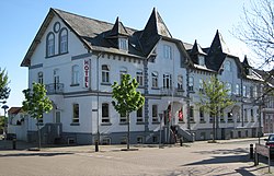 Hotel Lunderskov | |
 Lunderskov Location in Denmark  Lunderskov Lunderskov (Region of Southern Denmark) | |
| Coordinates: 55°29′01″N9°18′01″E / 55.483632°N 9.3002816°E | |
| Country | Denmark |
| Region | Southern Denmark (Syddanmark) |
| Municipality | Kolding |
| Area | |
• Total | 3 km2 (1 sq mi) |
| Population (2025-01-01) [1] | |
• Total | 2,985 |
| • Density | 1,000/km2 (2,600/sq mi) |
| Time zone | UTC+1 (CET) |
| • Summer (DST) | UTC+2 (CEST) |
| Postal code | DK-6640 Lunderskov |
Lunderskov is a railway town, with a population of 2,985 (1 January 2025), [1] in Kolding Municipality, Region of Southern Denmark in Denmark. It is situated 13 km west of Kolding, 8 km north of Vamdrup and 12 km east of Vejen.
Contents
Lunderskov was the municipal seat of the former Lunderskov Municipality until 1 January 2007.
Drabæks Mølle is a former watermill located in the northern part of Lunderskov. Drabæks Mølle is the oldest business, driven under the same name since ca. 1100. It was closed in 2008 and is now a private residential property. [2]


