Lusk, Tennessee

Last updated
Lusk
Atpontley
Lusk-Community-Center-tn1.jpg
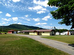
Lusk Community Center
USA Tennessee location map.svg
Red pog.svg
Lusk
Location within the state of Tennessee
Usa edcp location map.svg
Red pog.svg
Lusk
Lusk (the United States)
Coordinates: 35°30′5″N85°17′55″W / 35.50139°N 85.29861°W / 35.50139; -85.29861
Country United States
State Tennessee
County Bledsoe
Elevation
[1]
797 ft (243 m)
Time zone UTC-6 (Central (CST))
  Summer (DST) UTC-5 (CDT)
GNIS feature ID1647452 [1]

Lusk (also Atpontley) is an unincorporated community in Bledsoe County, Tennessee. It lies along U.S. Route 127 southwest of the city of Pikeville, the county seat of Bledsoe County. [2]

The variant name Atpontley is a compound of the names of three coal miners: Atkinson, Dupont, and Finley. [3]

Related Research Articles

<span class="mw-page-title-main">Bledsoe County, Tennessee</span> County in Tennessee, United States

Bledsoe County is a county located in the U.S. state of Tennessee. As of the 2020 census, the population was 14,913. Its county seat is Pikeville.

Peytonsburg is an unincorporated community in Cumberland County, Kentucky, United States.

Stacy Fork is an unincorporated community in Morgan County, Kentucky, United States. It lies along Route 191 south of the city of West Liberty, the county seat of Morgan County. Its elevation is 823 feet (251 m).

Lovelady is an unincorporated community in Pickett County, Tennessee, United States. It lies near State Route 111 west of the town of Byrdstown, the county seat of Pickett County. Its elevation is 1,027 feet (313 m).

<span class="mw-page-title-main">Pailo, Tennessee</span> Unincorporated community in Tennessee, United States

Pailo is an unincorporated community in Bledsoe County, Tennessee. It lies along U.S. Route 127 southwest of the city of Pikeville, the county seat of Bledsoe County.

<span class="mw-page-title-main">Lees Station, Tennessee</span> Unincorporated community in Tennessee, United States

Lees Station is an unincorporated community in Bledsoe County, Tennessee. It lies along U.S. Route 127 southwest of the city of Pikeville, the county seat of Bledsoe County. Its elevation is 853 feet (260 m), and it is at 35°33′27″N85°15′3″W. The various forms of its names led the Board on Geographic Names officially to designate it Lees in 1916. In 1969, the official name was changed to Lees Station.

Summer City is an unincorporated community that sits on the border of Bledsoe County, and Rhea County, Tennessee, United States. It lies between the cities of Pikeville and Dayton, at the intersection of Tennessee State Route 30 and Tennessee State Route 443.

Dill is an unincorporated community in Bledsoe County, Tennessee. It lies west of the city of Pikeville, the county seat of Bledsoe County. Its elevation is 1,742 feet (531 m).

Mount Crest is an unincorporated community in Bledsoe County, Tennessee. It lies along State Route 30 northwest of the city of Pikeville, the county seat of Bledsoe County.

<span class="mw-page-title-main">Cold Spring, Tennessee</span> Unincorporated community in Tennessee, United States

Cold Spring is an unincorporated community in Bledsoe County, Tennessee. It lies along U.S. Route 127 northeast of the city of Pikeville, the county seat of Bledsoe County. Its elevation is 876 feet (267 m).

Melvine is an unincorporated community in Bledsoe County, Tennessee. It lies near U.S. Route 127 northeast of the city of Pikeville, the county seat of Bledsoe County.

New Harmony is an unincorporated community in Bledsoe County, Tennessee. It lies in eastern Bledsoe County, south of Summer City and southeast of the city of Pikeville, the county seat of Bledsoe County. New Harmony is located along Tennessee State Route 443.

<span class="mw-page-title-main">Gallant, Alabama</span> Unincorporated community in Alabama, United States

Gallant, also known as Clear Springs or Greasy Cove, is a census-designated place and unincorporated community in Etowah, and St. Clair counties, Alabama, United States. It lies west of the city of Gadsden, the county seat of Etowah County. As of the 2010 census, its population was 855. It has a post office with the ZIP code 35972.

<span class="mw-page-title-main">Gordonsburg, Tennessee</span> Unincorporated community in Tennessee, United States

Gordonsburg is an unincorporated community in northeastern Lewis County, Tennessee. It lies at the intersection of U.S. Route 412 with the Natchez Trace Parkway, east of the city of Hohenwald, the county seat of Lewis County. Its elevation is 610 feet (186 m).

Lone Oak is an unincorporated community and census-designated place (CDP) in southern Sequatchie County, Tennessee, United States. It lies along U.S. Route 127 south of the city of Dunlap, the county seat of Sequatchie County. Its elevation is 2,001 feet (610 m). As of the 2020 census, its population was 1,198, down from 1,206 at the 2010 census.

<span class="mw-page-title-main">U.S. Route 70 in Tennessee</span>

U.S. Route 70 enters the state of Tennessee from Arkansas via the Memphis & Arkansas Bridge in Memphis, and runs west to east across 21 counties in all three Grand Divisions of Tennessee, with a total length of 478.48 miles (770.04 km), to end at the North Carolina state line in eastern Cocke County. Along the route, US 70 is accompanied with various U.S. and state highways, including those in three of the state's four major cities.

<span class="mw-page-title-main">U.S. Route 79 in Tennessee</span>

U.S. Route 79 in Tennessee enters the state from Arkansas via the Memphis & Arkansas Bridge in Memphis, and runs northeast through western and the northwestern portions of middle Tennessee, and leaving the state into Kentucky northeast of Clarksville. Along the route, US 79 is accompanied with several concurrencies, including hidden designations, throughout its alignment in Tennessee.

Time in Tennessee, as in all U.S. states, is regulated by the United States Department of Transportation.

The roads in Nashville, Tennessee include Interstates 24, 65 and 40, with interchanges near the city center. There are nine U.S. highways serving the city. Two beltways surround Nashville.

References

  1. 1 2 U.S. Geological Survey Geographic Names Information System: Lusk, Tennessee
  2. Rand McNally. The Road Atlas '08. Chicago: Rand McNally, 2008, p. 95.
  3. Miller, Larry L. (2001). Tennessee Place-names. Indiana University Press. p. 9. ISBN   0-253-21478-5.