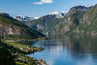
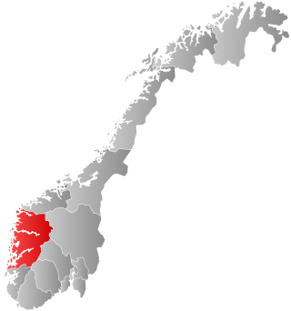
Sogn og Fjordane was a county in western Norway, up to 1 January 2020 when it was merged to become part of Vestland county. Bordering previous counties Møre og Romsdal, Oppland, Buskerud, and Hordaland, the county administration was in the village of Hermansverk in Leikanger municipality. The largest town in the county was Førde.

is a municipality in the county of Vestland, Norway. It is located in the traditional district of Nordhordland. The administrative centre is the village of Dalekvam. Other villages in Vaksdal include Dalegarden, Flatkvål, Helle, Nesheim, Stamneshella, Stanghelle, and Vaksdal.
Luster is a municipality in Vestland county, Norway. It is located at the end of the Sognefjorden in the traditional district of Sogn. The administrative centre is the village of Gaupne. Other villages in Luster include Fortun, Hafslo, Indre Hafslo, Jostedal, Luster, Nes, Ornes, Skjolden, Solvorn, and Veitastrond.

The Sognefjord or Sognefjorden, nicknamed the King of the Fjords, is the largest and deepest fjord in Norway. Located in Vestland county in Western Norway, it stretches 205 kilometres (127 mi) inland from the ocean to the small village of Skjolden in the municipality of Luster.

Gaupne is the administrative center of the municipality of Luster in Vestland county, Norway. The village is located along the Gaupnefjorden, an arm of the Lustrafjorden, about 10 kilometres (6.2 mi) north of the village of Hafslo. The village of Veitastrond is located across the mountains 20 kilometres (12 mi) to the northwest. The Sognefjellsvegen road passes through here on its way to the village of Skjolden and beyond.

Hafslo is a former municipality in the old Sogn og Fjordane county, Norway. The 538-square-kilometre (208 sq mi) municipality existed from 1838 until its dissolution in 1963. It is located in the present-day Luster Municipality in the traditional district of Sogn. The former municipality included the villages of Kinsedalen, Ornes, and Kroken on the east side of the Lustrafjorden. It also included the villages of Solvorn, Hafslo, Joranger, and the whole Veitastrond valley on the west side of the Lustrafjorden. The municipality surrounded the lakes Hafslovatnet and Veitastrondvatnet. The administrative centre of the municipality was the village of Hafslo, where Hafslo Church was located.

Skjolden is a village in the municipality of Luster in Vestland county, Norway. It is located at the end of the Lustrafjorden, a branch of the Sognefjorden. Skjolden is located at the innermost point of the Sognefjorden, Norway's longest fjord, and the length of the Sognefjorden is measured from Skjolden to the island of Ytre Sula where the fjord meets the ocean—over 200 km. The valleys of Mørkridsdal and Fortunsdal meet at Skjolden, just west of the Hurrungane mountains. Skjolden is home to about 200 people.

Jostedal is a former municipality in the old Sogn og Fjordane county in Norway. The 533-square-kilometre (206 sq mi) municipality existed from 1838 until its dissolution in 1963. It was located in the Jostedalen valley in the northern part of the present-day municipality of Luster, in Vestland county, north of the village of Gaupne. The administrative centre was also located near the Jostedal Church in the central part of the valley.

Jervvasstind is Norway's ninth-highest mountain. The 2,351-metre-tall (7,713 ft) mountain lies in the Hurrungane mountains in the eastern part of the municipality of Luster in Vestland county, Norway. It lies on the eastern end of a mountain ridge including the mountains Store Skagastølstind-Vetle Skagastølstind-Sentraltind-Store Styggedalstind-Jervvasstind. The village of Skjolden is located 16 kilometres (9.9 mi) to the west.
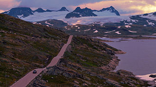
The Sognefjellsvegen or Sognefjellsveien is the highest mountain pass road in Northern Europe. Part of County Road 55, it is located in Innlandet and Vestland counties in Norway. It is a national tourist road and starts in the village of Lom in the municipality of Lom, it then travels over the Sognefjell mountain area, and it ends in the village of Gaupne in the municipality of Luster. The road was opened on 16 July 1938. The road passes through the Jotunheimen, Hurrungane, and Breheimen mountains. The highest point is Fantesteinen at 1,434 metres (4,705 ft). During the winters there is a lot of snow, and so the road is closed from November through May. The road passes between Jotunheimen National Park and Breheimen National Park.

Sogn is a traditional district in Western Norway (Vestlandet). It is located in the county of Vestland, surrounding the Sognefjord, the largest/longest fjord in Norway. The district of Sogn consists of the municipalities of Aurland, Balestrand, Hyllestad, Høyanger, Gulen, Leikanger, Luster, Lærdal, Sogndal, Solund, Vik, and Årdal. The district covers 10,675 square kilometres (4,122 sq mi) and contains about 35% of the county's population. The largest urban area in Sogn is the village of Sogndalsfjøra, with 3,455 residents. The second largest urban area is the village Øvre Årdal, with 3,397 people.

Sognefjellet is a mountainous area and mountain pass which connects Lustrafjorden and its surrounding valley with the Ottadalen valley in the Jotunheimen area. Sognefjellet is located in Luster Municipality and Lom Municipality in Norway. Sognefjellsvegen, part of County Road 55, runs through the mountains and over the pass.
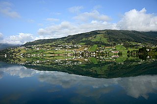
Hafslo is a village in Luster Municipality in Vestland county, Norway. The village is located on the northern shore of the lake Hafslovatnet, about 3 kilometres (1.9 mi) northwest of the village of Solvorn which sits on the shores of the Lustrafjorden. The lake Veitastrondvatnet is located to the northwest of Hafslo. The village of Sogndalsfjøra lies 15 kilometres (9.3 mi) to the south; the village of Gaupne lies about 15 kilometres (9.3 mi) to the north; and the village of Veitastrond lies about 25 kilometres (16 mi) to the northwest. The Norwegian County Road 55 runs through the village on its way from Sogndalsfjøra to Gaupne.
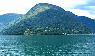
Ornes or Urnes is a village in Luster Municipality in Vestland county, Norway. The village is located on a small peninsula that juts out into the Lustrafjorden, the innermost part of the Sognefjorden. The village sits on the east side of the fjord, directly across the fjord from the village of Solvorn. Ornes is notable because it is the site of the 12th century Urnes Stave Church.
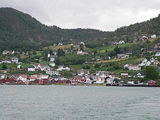
Solvorn is a village in Luster Municipality in Vestland county, Norway. The village is located on the western shore of the Lustrafjorden, the innermost part of the Sognefjorden. The village sits directly across the fjord from the village of Ornes, where the famous 12th-century Urnes Stave Church is located. The village of Hafslo lies about 4 kilometres (2.5 mi) to the northwest.
Nes is a village in Luster Municipality in Vestland county, Norway. The village is located on the western shore of the Lustrafjorden, about 5 kilometres (3.1 mi) east of the municipal centre of Gaupne. The village sits along Norwegian County Road 55, which follows the coastline of the fjord. Nes Church is located in the village.
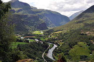
Fortun is a village in Luster Municipality in Vestland county, Norway. The village is located in the Fortundalen valley, just east of Skjolden, at the innermost part of the Lustrafjorden. The Sognefjellsvegen road passes through the village. Fortun is an old church site, having a stave church on the site since the 12th century. The present Fortun Church was built in 1879 in the village, and it serves the eastern part of the municipality. The Hurrungane mountains lie just to the south of the village. The area is known for its scenery and attracts many tourists.

Dale Church is a parish church of the Church of Norway in Luster Municipality in Vestland county, Norway. It is located in the village of Luster on the western shore of the Lustrafjorden. It is the church for the Dale parish which is part of the Sogn prosti (deanery) in the Diocese of Bjørgvin. The red and white, stone church was built in a long church design around the year 1240 using designs by an unknown architect. The church seats about 200 people.

Nes Church is a parish church of the Church of Norway in Luster Municipality in Vestland county, Norway. It is located in the village of Nes, on the western shore of the Lustrafjorden. It is the church for the Nes parish which is part of the Sogn prosti (deanery) in the Diocese of Bjørgvin. The white, wooden church was built in a long church design in 1836 using plans drawn up by the architect Hans Ditlev Franciscus Linstow. The church seats about 110 people.
Jostedalen is a river valley in Luster Municipality in Vestland county, Norway. The 60-kilometre (37 mi) long valley runs from the Lustrafjorden at the village of Gaupne, to the north along the river Jostedøla and along the eastern side of the Jostedal Glacier. The valley is deep, but the valley floor lies over long stretches of flat river plains interrupted by steep steps. In the north, the landscape gets pretty wild. The Jostedalsbreen National Park surrounds the valley, which brings a lot of tourism to the area. The Nigardsbreen glacier is also accessible from the valley.


