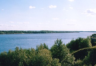
The Svir is a river in Podporozhsky, Lodeynopolsky, and Volkhovsky districts in the north-east of Leningrad Oblast, Russia. It flows westwards from Lake Onega to Lake Ladoga, thus connecting the two largest lakes of Europe. It is the largest river flowing into Lake Ladoga. The length of the Svir is 224 kilometres (139 mi), whereas the area of its drainage basin is 84,400 square kilometres (32,600 sq mi). The towns of Podporozhye and Lodeynoye Pole, as well as urban-type settlements Voznesenye, Nikolsky, Vazhiny, and Svirstroy are located at the banks of the Svir.

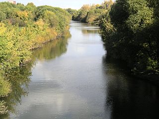
The Izhora, also known as the Inger River, is a left tributary of the Neva River on its run through Ingria in northwestern Russia from Lake Ladoga to Gulf of Finland. The Izhora flows through Gatchinsky and Tosnensky Districts of Leningrad Oblast as well as through Pushkinsky and Kolpinsky Districts of the federal city of Saint Petersburg. The settlement of Ust-Izhora is situated at the confluence of Izhora and Neva, halfway between Saint Petersburg and Schlisselburg. The towns of Kommunar and Kolpino are located on the Izhora as well. The river is noted as the farthest Swedish forces ever reached between the Viking Age and the Time of Troubles.
The Sviyaga (Russian: Свияга, Tatar: Зөя, Chuvash: Сĕве) is a river in the Ulyanovsk Oblast and Tatarstan, a right tributary of the Volga River. It is 375 kilometres (233 mi) long, and its drainage basin covers 16,700 square kilometres (6,400 sq mi). The Sviyaga River flows into the Sviyaga Cove of the Kuybyshev Reservoir, west of Kazan. It freezes up in November or December and stays under the ice until April or May. Major tributaries are the Arya, Bula, Karla, Kubnya, and Tosha rivers.

Ufa River is a river in the Urals, Chelyabinsk Oblast, Sverdlovsk Oblast, and the Republic of Bashkortostan; a tributary of the Belaya River. It is 918 kilometres (570 mi) long, and its basin covers 53,100 square kilometres (20,500 sq mi). It freezes up between late October and early December and stays under the ice until April or May. Pavlovka Hydroelectric Station is along the Ufa. The river's water is widely used for water supply. The main ports are Krasnoufimsk and Ufa.
Vychegda is a river in the European part of Russia, tributary to the Northern Dvina. Its length is about 1,100 kilometres (680 mi). Its source is approximately 310 kilometres (190 mi) west of the northern Ural Mountains. It flows roughly in western direction, through Komi Republic and Arkhangelsk Oblast. The largest city along the Vychegda is Syktyvkar, the capital of Komi Republic. The Viled, the Yarenga, and the Vym are among its main tributaries. The Vychegda flows into the Northern Dvina in Kotlas.

The Pakhra River is a river in Moscow Oblast and the city of Moscow, Russia, a right tributary of the Moskva River. It is 135 km in length. The area of its basin is 2580 km². The Pakhra River freezes up in November–December and stays under the ice until the late March–April. Main tributaries: Mocha, Desna. Gorki Leninskiye and Podolsk stand on the Pakhra River.

The Tvertsa is a river in Vyshnevolotsky, Spirovsky, Torzhoksky, and Kalininsky Districts, as well as in the cities of Torzhok and Tver in Tver Oblast, Russia, a left tributary of the Volga River. It is 188 kilometres (117 mi) long, and the area of its basin 6,510 square kilometres (2,510 sq mi). The principal tributaries of the Tvertsa are the Tigma River (left), the Shchegrinka River (right), the Osuga River (right), the Logovyazh River (left), and the Kava River (left).

Uzola River, also spelled as Usola River is a river in Nizhny Novgorod Oblast in Russia. It is a left tributary of the Volga. The length of the river is 147 km (91 mi). The area of its basin is 1,920 km2 (740 sq mi). The Uzola River freezes up in November and stays under the ice until April.

Lama River is a river in the Moscow and Tver Oblasts in Russia, a tributary of the Shosha River. The river is 139 kilometres (86 mi) long. The area of its drainage basin is 2,330 square kilometres (900 sq mi). The Lama River freezes up in November and stays under the ice until late March or early April. Historically, the river was a part of the important waterway from the Volga River to the Moskva River. The city of Volokolamsk that has been standing on the Lama River since the 12th century was previously known as Volok Lamsky after the process of a watercraft portage.

Ruza River is a river in the Moscow Oblast in Russia, left tributary of the Moscow River. The length of the river is 145 km. The area of its basin is 1,990 km². It usually freezes in November and stays under the ice until April.

The Sestra River is a river in Moscow Oblast, Russia. It is a left tributary of the Dubna River. Its source is the Senezh Lake. The length of the river is 138 km (86 mi). The area of its basin is 2,680 km2 (1,030 sq mi). The river freezes in November to early January and stays under the ice until late March or April. Its main tributary is the Yakhroma River. The town of Klin is located on the Sestra River.

The Nerl River is a river in Pereslavsky District of Yaroslavl and Kalyazinsky District of Tver Oblast in Russia, a right tributary of the Volga River. The length of the river is 112 kilometres (70 mi). The area of its drainage basin is 3,270 square kilometres (1,260 sq mi). Its main tributary is the Kubr River (left).

Shosha River is a river in Zubtsovsky, Staritsky, Kalininsky and in Konakovsky Districts of Tver Oblast and Lotoshinsky District of Moscow Oblast in Russia. It is a right tributary of the Volga River. The length of the Shosha River is 163 kilometres (101 mi). The area of its basin is 3,080 square kilometres (1,190 sq mi). The river flows into the Ivankovo Reservoir. The Shosha freezes up in November through early January and stays icebound until late March or early April.

Bityug River is a river in Voronezh Oblast, Russia, a left tributary of the Don. Its upper reaches are located in Tambov Oblast. The Bityug is 379 kilometres (235 mi) long, with a basin of 8,840 square kilometres (3,410 sq mi). There are more than 400 lakes in the Bityug basin. The river freezes up in mid-December and stays icebound until late March or early April.
Shuya is a river in Kostroma Oblast in Russia, a left tributary of the Noymda River. The river is 170 kilometres (110 mi) long, and its drainage basin covers 1,700 square kilometres (660 sq mi). It freezes up in November and stays icebound until April.
The Bolshoy Irgiz or Irgiz (Ирги́з) is a river in Samara and Saratov Oblast, Russia, the left tributary of the Volga River, south of the Samara River. It is 675 km (419 mi) long and the area of its drainage basin is 24,000 km2 (9,266 sq mi). Its headwaters are at the Obshchy Syrt adjoining the Ural River basin. It flows west and joins the Volga south of Samara. Irgiz's meandering riverbed passes the steppes. The river has snow feeding. The town of Pugachyov is located along the Irgiz. The river flows to the Volgograd Reservoir of the Volga downstream Balakovo, near Volsk.

The Kolp is a river in Boksitogorsky District of Leningrad Oblast and in Babayevsky and Kaduysky Districts of Vologda Oblast in Russia. It is a right tributary of the Suda River and belongs to the river basin of the Volga. It is 254 kilometres (158 mi) long, with a drainage basin of 3,730 square kilometres (1,440 sq mi) and an average discharge of 25.2 cubic metres per second (890 cu ft/s) measured 30 kilometres (19 mi) upstream from its mouth. Its main tributaries are the Vesyarka and the Krupen. The town of Babayevo is located by the Kolp.
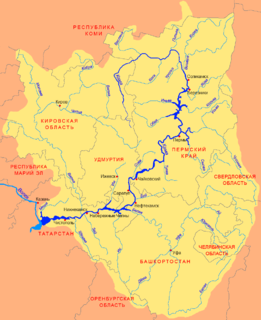
Tulva is a river in Perm Krai, Russia, a left tributary of the Kama River. The river is 118 kilometres (73 mi) long, and its drainage basin covers 5,530 square kilometres (2,140 sq mi).

Wikielec is a settlement in the administrative district of Gmina Iława, within Braniewo County, Warmian-Masurian Voivodeship, in northern Poland, close to the border with the Kaliningrad Oblast of Russia. It lies approximately 3 kilometres (2 mi) west of Braniewo and 81 km (50 mi) north-west of the regional capital Olsztyn.
The Ileksa is a river in Onezhsky District of Arkhangelsk Oblast and Pudozhsky District of the Republic of Karelia in Russia. It is the principal tributary of Lake Vodlozero, and thus belongs to the basins of Lake Onega and of the Baltic Sea. It is 155 kilometres (96 mi) long, and the area of its basin 3,950 square kilometres (1,530 sq mi). The main tributary of the Ileksa is the Chusreka River (left).