Løding | |
|---|---|
Village | |
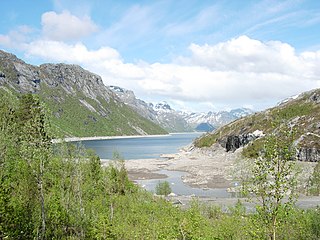
 View of the village | |
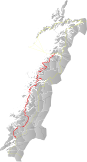
 Løding Location of the village  Løding Løding (Norway) | |
| Coordinates: 67°18′02″N14°44′19″E / 67.3006°N 14.7385°E Coordinates: 67°18′02″N14°44′19″E / 67.3006°N 14.7385°E | |
| Country | Norway |
| Region | Northern Norway |
| County | Nordland |
| District | Salten |
| Municipality | Bodø Municipality |
| Area | |
| • Total | 1.29 km2 (0.50 sq mi) |
| Elevation | 20 m (70 ft) |
| Population (2018) [1] | |
| • Total | 3,117 |
| • Density | 2,416/km2 (6,260/sq mi) |
| Time zone | UTC+01:00 (CET) |
| • Summer (DST) | UTC+02:00 (CEST) |
| Post Code | 8050 Tverlandet |
Løding is a village in the municipality of Bodø in Nordland county, Norway. It is located about 17 kilometres (11 mi) east of the town of Bodø, and is connected to the town by the Tverlandet Bridge. The village is mostly referred to as Tverlandet, which also encompasses the areas Hopen, Vatne, Heggmoen, Mjønes, Vågan, Holand, Skålbunes, Elstad, Oddan, Allmenningen, Godøynes (Gaunes), and Naurstad, all of which lies around the village.

Bodø is a municipality in Nordland county, Norway. It is part of the traditional region of Salten. The administrative centre of the municipality is the town of Bodø. Some of the notable villages in Bodø include Misvær, Skjerstad, Saltstraumen, Løding, Løpsmarka, Kjerringøy, Sørvær, and Fenes.

Nordland is a county in Norway in the Northern Norway region, bordering Troms in the north, Trøndelag in the south, Norrbotten County in Sweden to the east, Västerbotten County to the southeast, and the Atlantic Ocean to the west. The county was formerly known as Nordlandene amt. The county administration is in Bodø. The remote Arctic island of Jan Mayen has been administered from Nordland since 1995.

Norway, officially the Kingdom of Norway, is a Nordic country in Northern Europe whose territory comprises the western and northernmost portion of the Scandinavian Peninsula; the remote island of Jan Mayen and the archipelago of Svalbard are also part of the Kingdom of Norway. The Antarctic Peter I Island and the sub-Antarctic Bouvet Island are dependent territories and thus not considered part of the kingdom. Norway also lays claim to a section of Antarctica known as Queen Maud Land.
The 1.29-square-kilometre (320-acre) village has a population (2018) of 3,117 and a population density of 2,416 inhabitants per square kilometre (6,260/sq mi). [1]

Population density is a measurement of population per unit area or unit volume; it is a quantity of type number density. It is frequently applied to living organisms, and most of the time to humans. It is a key geographical term. In simple terms population density refers to the number of people living in an area per kilometer square.
The village lies at the northern terminus of Norwegian County Road 17 and along the Nordland Line railway. The Tverlandet Church is located in Løding, and the local sports club is Tverlandet IL. In the centre of the village, there is a doctor's office, dentist office, and grocery stores, along with the country's first Nikita hair salon. There is a pizza restaurant, building material store and a specialist store within caravan and equipment. Within the village there is a retirement home, several kindergartens, and school up and until the Ungdomsskole, which are divided between the Løding skole (grades 1-4) and the Tverlandet Skole (grades 5-10).
County Road 17, also known as the Coastal Highway, is a Norwegian highway that runs from the town of Bodø in Nordland county to the town of Steinkjer in Trøndelag county. It is 630 kilometres (390 mi) long and includes six ferry crossings. The road runs along the coast of Nordland and Trøndelag counties through 28 different municipalities. This road is a much more scenic, albeit longer and more time-consuming, route than the inland European Route E6 highway.

The Nordland Line is a 729-kilometer (453 mi) railway line between Trondheim and Bodø, Norway. It is the longest in Norway and lacks electrification. The route runs through the counties of Trøndelag and Nordland, carrying a combination of commuter, long-haul passenger and freight trains. From Trondheim Central Station to Steinkjer Station the line is most heavily used, with hourly services by the Trøndelag Commuter Rail. There are three branch lines—the Stavne–Leangen Line at Leangen Station, the Meråker Line at Hell Station and the Namsos Line at Grong Station.

Tverlandet Church is a parish church of the Church of Norway in Bodø Municipality in Nordland county, Norway. It is located in the village of Løding. It is one of the two churches for the Saltstraumen parish which is part of the Bodø domprosti (deanery) in the Diocese of Sør-Hålogaland. The modern, brick church was built in a fan-shaped style in 1983 by the architect Reidar Berg. The church seats about 320 people.
The lake Vatnvatnet lies north of the village.