M7 (Johannesburg)

Last updated

Joburg road M7.svg
Metropolitan route M7
Route information
Maintained by Johannesburg Roads Agency and Gauteng Department of Roads and Transport
Length37.2 km (23.1 mi)
Major junctions
South endHill Road, Zonkizizwe
Major intersectionsM53 ZAF jct.svg M53 Kaunda Street, Zonkizizwe
M61 ZAF jct.svg M61 Vereeniging Road, Alrode South
M80 ZAF jct.svg M80 J.G. Strydom Rd Albertsdal
SA road R59.svg R59 Sybrand van Niekerk Freeway, Brakendowns
SA road R554.svg R554 Swartkoppies Road, Mulbarton
M68 ZAF jct.svg M68 True North Road, Mulbarton
M95 ZAF jct.svg M95 Bellairs Drive, Glenvista
M68 ZAF jct.svg M68 Columbine Avenue, Suideroord
SA road N12 jct.svg N12 Southern Bypass, Suideroord
M38 ZAF jct.svg M38 South Rand Road, Gillview
M34 ZAF jct.svg M34 Turf Club Street, Turffontein
M27 ZAF jct.svg M27 Booysens Road, Booysens
M70 ZAF jct.svg M70 Ophir Booysens Rd, Booysens
SA road R41.svg R41 Main Reef Road, Fordsburg
SA road R24.svg R24 Albertina Sisulu Road, Mayfair
M10 ZAF jct.svg M10 Smit Street, Pageview
M18 ZAF jct.svg M18 Enoch Sontonga Avenue, Vrededorp
North endM17 ZAF jct.svgM71 ZAF jct.svg M17  / M71 Barry Hertzog Avenue, Cottesloe
Location
Country South Africa
Highway system
M6 ZAF jct.svg M6 M8 ZAF jct.svg M8

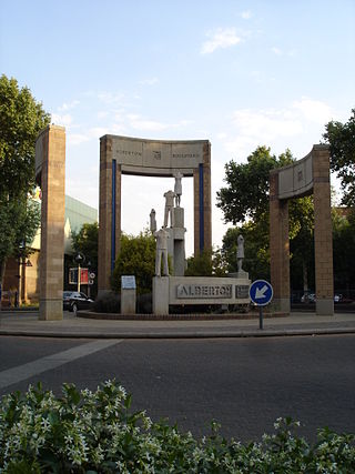
M7 is a metropolitan route in the Greater Johannesburg metropolitan area. The road connects Thokoza and the southern suburbs of Alberton with suburbs to the west of the Johannesburg CBD. [1] [2]

Route

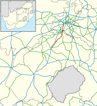
The M7 begins at a t-junction with Hill Road east of Zonkizizwe. It goes westwards as Dihlabakela Road, meeting the southern terminus of the M53 route, to pass through the southern part of Katlehong and Thokoza. It flies over a railway and over the M61 route (Vereeniging Road) to enter the Alrode South suburb of Alberton, where it reaches a T-junction with Kliprivier Drive. [3] :175 It then heads west-north-west as Kliprivier Drive to intersect with the R59 highway (Sybrand van Niekerk Freeway), where it enters the Brakendowns suburb of Alberton. [3] :174 The M7 turns to the north-west and leaves Alberton to enter Johannesburg South, where it reaches a junction with the R554 Swartkoppies Road. [3] :173

From the R554 junction, the M7 continues north-west and passes through Mulbarton, where it meets the M68 route. [3] :151 Continuing north, it meets the western terminus of the M95 route and passes in-between the Klipriviersberg Nature Reserve to its west and Glenvista to its east. Continuing north, the M7 separates Glenanda to its east from Suideroord to its west, where it meets the M68 route (Columbine Avenue) again. [3] :129 Immediately after, the M7 forms an interchange with the N12 highway (Johannesburg Southern Bypass) and enters the Gillview suburb, where it meets the M38 route (Rifle Range Road). [3] :129

The M7 continues north, passing between the suburbs of Robertsham and Turffontein. [3] :129 It enters Booysens, where it reaches a T-junction with the M27 Booysens Road. [3] :107 The M7 joins the M27 and they are briefly co-signed for 400 m up to the Long Street junction, where the M7 becomes Long Street northwards. [3] :107 After 300 m, it meets the eastern terminus of the M70 route (Soweto Highway) and it turns left onto Ophir-Booysens Road, then right onto Ophir Road, then left into Treu Road, continuing north out of Booysens. [3] :107

It briefly follows the M1 North before crossing underneath it adjacent to the Crown Interchange and winding northwards to an intersection with the R41 route (Main Reef Road) in the suburb of Crown (just west of Selby). [3] :107 It now enters the western suburbs of Johannesburg, entering Mayfair as Park Drive and intersecting with the R24 (Albertina Sisulu Road). [3] :107

It enters Fordsburg and after 180 m, it turns right onto 6th Avenue and then left onto Mint Road where it T-junctions with Subway and Carr Street after 350 m. [3] :107 It turns left onto Subway Street, heading north and crossing under railway lines before reaching a T-junction with the M10 Smit Street. [3] :107 Turning right onto Smit Street, it is briefly co-signed with the M10 before turning left onto Solomon Street and entering Vrededorp, where it meets the M18 Enoch Sontonga Avenue and becomes Annet Road, passing the University of Johannesburg's Bunting Road Campus before ending at an intersection with the M71 Barry Hertzog Avenue and M17 Empire Road. [3] :81

Related Research Articles

<span class="mw-page-title-main">Alberton, South Africa</span> Place in Gauteng, South Africa

Alberton is a town situated on the southern part of the East Rand of the Gauteng Province in South Africa and is situated very close to the major urban centre of Johannesburg.

<span class="mw-page-title-main">R29 (South Africa)</span> Road in South Africa

The R29 is a provincial route in South Africa that connects Johannesburg with Leandra and Kinross via Germiston, Boksburg, Benoni and Springs. For much of its route it is named Main Reef Road. The R29 used to end near the Golela border post, however the section from Evander to Ermelo is now part of the N17 and the section from Ermelo to the Golela border post just after Pongola is now part of the N2.

<span class="mw-page-title-main">R59 (South Africa)</span> Road in South Africa

The R59 is a provincial route in South Africa that connects Hertzogville with Alberton via Bothaville, Parys and Vereeniging. The R59 is a freeway from the R57 Junction in Sasolburg until the N12 Reading Interchange in Alberton, signposted as the Sybrand van Niekerk Freeway.
<span class="mw-page-title-main">R82 (South Africa)</span> Road in South Africa

The R82 is a provincial route in South Africa that connects Johannesburg with Kroonstad via Vereeniging and Sasolburg. It starts just south of the M1 Johannesburg Municipal Highway's interchange with the N12 Southern Bypass, going south, meeting the R59, R54, R42 & R28 routes at Vereeniging before crossing the Vaal River into the Free State & proceeding to Kroonstad. It is an alternative, but longer route to the N1 National Route between Johannesburg & Kroonstad.

The R103 is a Regional Route in South Africa that is the designation for some of the old sections of roads that were previously the N3, prior to upgrading. It only has 3 sections, from Hillcrest to Ladysmith, from Warden to Villiers and from Heidelberg to Johannesburg.

The M10 is a metropolitan route in the Nelson Mandela Bay Municipality in South Africa that connects Port Elizabeth and Uitenhage.

The R550 is a Regional Route in Gauteng, South Africa that connects Johannesburg South with Devon via Katlehong and Nigel.

The R554 is a Regional Route in Gauteng, South Africa. The road connects the southern suburbs of Soweto with Springs on the East Rand via Lenasia, Alberton and Brakpan.

The M43 is a major metropolitan road in Greater Johannesburg, South Africa which begins in Vosloorus and heads northwards to Birchleigh, Kempton Park on the East Rand.

M27 is a major road in the City of Johannesburg, South Africa. A large part of the route is named Jan Smuts Avenue which is roughly 12 km long. It begins in the southern suburb of Booysens and heads northwards through the Johannesburg CBD and the northern suburbs of Randburg.

The M31 is a metropolitan route in the City of Johannesburg, South Africa. The road connects the southern suburbs of Alberton with Johannesburg's northern suburbs. The routes eastern bypass in the Johnannesburg CBD connects the M2 motorway at the Heidelberg Interchange with M1 North motorway in Houghton and then the route follows the M1 motorway northwards until the M31 ends in Bramley.

The M10 is a long metropolitan route in Greater Johannesburg, South Africa. It connects Lenasia with Johannesburg Central via Soweto.

The M18 is a long metropolitan route in Greater Johannesburg, South Africa. It connects Krugersdorp with Bruma via Constantia Kloof, Florida, Auckland Park, Braamfontein and Observatory.

The M38 is a short metropolitan route in Johannesburg, South Africa. The entire route is in the Johannesburg South area, connecting Southgate with Tulisa Park via Ridgeway. It is parallel to the Johannesburg Southern Bypass for its entire route.

The M53 is a short metropolitan route in Greater Johannesburg, South Africa. It connects Germiston with Vosloorus via Elsburg.

The M61 is a long metropolitan route in Gauteng, South Africa. It connects Vereeniging with Alberton via Meyerton. For its entire route, it is an alternative route to the R59 highway.

The M68 is a short metropolitan route in the City of Johannesburg, South Africa. It connects the south-western part of Soweto with Mulbarton via Diepkloof, Southgate and Glenvista.

The M70 road is a short metropolitan route in the City of Johannesburg, South Africa. It connects Booysens with Dobsonville via Diepkloof, Orlando and Meadowlands. For much of its route, it is known as the Soweto Highway.

The M80 is a short metropolitan route in Greater Johannesburg, South Africa.

The M18 road is a long metropolitan route in Gauteng, South Africa. It connects Pretoria with Thembisa via Centurion and Olifantsfontein.

References

  1. "Johannesburg Roads Agency - Company documents". www.jra.org.za. Retrieved 23 March 2021.
  2. "Johannesburg Road Agency Q2 2021 Report" (PDF). Johannesburg Road Agency Website. Retrieved 23 March 2021.
  3. 1 2 3 4 5 6 7 8 9 10 11 12 13 14 15 Street Guide Witwatersrand (8th ed.). MapStudio. 1996.