Mačevac | |
---|---|
Village | |
Coordinates: 44°06′00″N21°14′47″E / 44.10000°N 21.24639°E | |
Country | |
District | Pomoravlje District |
Municipality | Svilajnac |
Population (2002) | |
• Total | 217 |
Time zone | CET (UTC+1) |
• Summer (DST) | CEST (UTC+2) |
Mačevac is a village in the municipality of Svilajnac, Serbia. According to the 2002 census, the village has a population of 217 people. [1]
A village is a clustered human settlement or community, larger than a hamlet but smaller than a town, with a population ranging from a few hundred to a few thousand. Though villages are often located in rural areas, the term urban village is also applied to certain urban neighborhoods. Villages are normally permanent, with fixed dwellings; however, transient villages can occur. Further, the dwellings of a village are fairly close to one another, not scattered broadly over the landscape, as a dispersed settlement.
Svilajnac is a town and municipality located in the Pomoravlje District of central Serbia. The population of the town is 9,131 inhabitants, while the municipality has 23,391 inhabitants.
Serbia, officially the Republic of Serbia, is a country situated at the crossroads of Central and Southeast Europe in the southern Pannonian Plain and the central Balkans. The sovereign state borders Hungary to the north, Romania to the northeast, Bulgaria to the southeast, North Macedonia to the south, Croatia and Bosnia and Herzegovina to the west, and Montenegro to the southwest. The country claims a border with Albania through the disputed territory of Kosovo. Serbia's population is about seven million. Its capital, Belgrade, ranks among the oldest and largest citiеs in southeastern Europe.
The Suin Line (Suwon-Incheon) is a metro line of the Seoul Metropolitan Subway serving the Seoul Capital Area.
Kukljica is a village on the island of Ugljan in Croatia. According to the 2011 census, there are 714 inhabitants, 98% which are Croats.
Lúčka is a village and municipality in Svidník District in the Prešov Region of north-eastern Slovakia.
Lörick is an urban borough of Düsseldorf, Germany. It is located on the left side of the river Rhine, bordering to the river, Niederkassel, Heerdt and Meerbusch. Lörick was a small village belonging to the office of Heerdt until there was a connection via the Oberkassel Bridge to Düsseldorf in 1898. In 1909 Lörick became, together with Heerdt, a part of Düsseldorf.
Żuki is a village in the administrative district of Gmina Tykocin, within Białystok County, Podlaskie Voivodeship, in north-eastern Poland. It lies approximately 6 kilometres (4 mi) north-west of Tykocin and 33 km (21 mi) north-west of the regional capital Białystok.
Valea Mare is a commune located in Vâlcea County, Romania. It is composed of six villages: Bătășani, Delureni, Drăganu, Mărgineni, Pietroasa and Valea Mare.
Julianki is a village in the administrative district of Gmina Parzęczew, within Zgierz County, Łódź Voivodeship, in central Poland. It lies approximately 3 kilometres (2 mi) east of Parzęczew, 16 km (10 mi) north-west of Zgierz, and 24 km (15 mi) north-west of the regional capital Łódź.
Górna Niwa is a village in the administrative district of Gmina Biecz, within Gorlice County, Lesser Poland Voivodeship, in southern Poland. It lies approximately 6 kilometres (4 mi) south of Biecz, 7 km (4 mi) north-east of Gorlice, and 103 km (64 mi) south-east of the regional capital Kraków.
Nowe Święcice is a village in the administrative district of Gmina Mała Wieś, within Płock County, Masovian Voivodeship, in east-central Poland.
Micharzewo is a village in the administrative district of Gmina Wągrowiec, within Wągrowiec County, Greater Poland Voivodeship, in west-central Poland. It lies approximately 6 kilometres (4 mi) north-east of Wągrowiec and 54 km (34 mi) north-east of the regional capital Poznań.
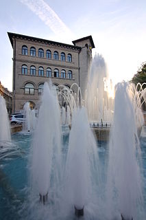
The Ion Mincu University of Architecture and Urbanism is a public university for architectural and urbanism studies in Bucharest, Romania, founded in 1952.
Kyšice is a village and municipality in Kladno District in the Central Bohemian Region of the Czech Republic.
Bir Ali Ben Khélifa is a town and commune in eastern Tunisia in the Sfax Governorate. It lies 60 kilometres from Sfax. As of 2004 the town had a population of 4460.
Dessa, Niger is a village and rural commune in Niger.
Bratiševac is a village in the municipality of Babušnica, Serbia. According to the 2002 census, the village has a population of 194 people.
Gulenovci is a village in the municipality of Dimitrovgrad, Serbia. According to the 2002 census, the village has a population of 60 people.
Marijina Voda is a village in the municipality of Kakanj, Bosnia and Herzegovina.
Silla is a village in Saaremaa Parish, Saare County in western Estonia.
Gornja Lijeska is a village in the municipality of Višegrad, Bosnia and Herzegovina.
Huổi Lèng is a commune (xã) and village of the Mường Chà District of Điện Biên Province, northwestern Vietnam.
Coordinates: 44°06′00″N21°14′47″E / 44.10000°N 21.24639°E
A geographic coordinate system is a coordinate system that enables every location on Earth to be specified by a set of numbers, letters or symbols. The coordinates are often chosen such that one of the numbers represents a vertical position and two or three of the numbers represent a horizontal position; alternatively, a geographic position may be expressed in a combined three-dimensional Cartesian vector. A common choice of coordinates is latitude, longitude and elevation. To specify a location on a plane requires a map projection.
This Pomoravlje District, Serbia location article is a stub. You can help Wikipedia by expanding it. |