
Bąki is a village in the administrative district of Gmina Kobierzyce, within Wrocław County, Lower Silesian Voivodeship, in south-western Poland. Prior to 1945 it was in Germany.

Bielany Wrocławskie is a village in the administrative district of Gmina Kobierzyce, within Wrocław County, Lower Silesian Voivodeship, in south-western Poland. Prior to 1945 it was in Germany.
Biskupice Podgórne is a village in the administrative district of Gmina Kobierzyce, within Wrocław County, Lower Silesian Voivodeship, in south-western Poland. Prior to 1945 it was in Germany.
Magnice is a village in the administrative district of Gmina Kobierzyce, within Wrocław County, Lower Silesian Voivodeship, in south-western Poland. Prior to 1945 it was in Germany. It lies approximately 4 kilometres (2 mi) north-east of Kobierzyce and 17 km (11 mi) south of the regional capital Wrocław.
Domasław is a village in the administrative district of Gmina Kobierzyce, within Wrocław County, Lower Silesian Voivodeship, in south-western Poland.
Damianowice is a village in the administrative district of Gmina Kobierzyce, within Wrocław County, Lower Silesian Voivodeship, in south-western Poland. Prior to 1945 it was in Germany.
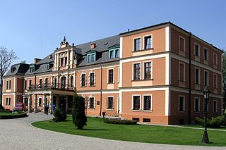
Kobierzyce is a village in Wrocław County, Lower Silesian Voivodeship, in south-western Poland. It is the seat of the administrative district (gmina) called Gmina Kobierzyce. Prior to 1945 it belonged to Germany. It lies approximately 20 kilometres (12 mi) south-west of the capital of Lower Silesian Voivodeship Wrocław.
Królikowice is a village in the administrative district of Gmina Kobierzyce, within Wrocław County, Lower Silesian Voivodeship, in south-western Poland. Prior to 1945 it was in Germany.
Nowiny is a village in the administrative district of Gmina Kobierzyce, within Wrocław County, Lower Silesian Voivodeship, in south-western Poland. Prior to 1945 it was in Germany. It lies approximately 4 kilometres (2 mi) north of Kobierzyce and 18 km (11 mi) south-west of the regional capital Wrocław.
Krzyżowice is a village in the administrative district of Gmina Kobierzyce, within Wrocław County, Lower Silesian Voivodeship, in south-western Poland. Prior to 1945 it was in Germany. It lies approximately 5 kilometres (3 mi) north-west of Kobierzyce and 19 km (12 mi) south-west of the regional capital Wrocław.
Księginice is a village in the administrative district of Gmina Kobierzyce, within Wrocław County, Lower Silesian Voivodeship, in south-western Poland. Prior to 1945 it was in Germany. It lies approximately 6 kilometres (4 mi) north-east of Kobierzyce and 15 km (9 mi) south of the regional capital Wrocław.
Kuklice is a village in the administrative district of Gmina Kobierzyce, within Wrocław County, Lower Silesian Voivodeship, in south-western Poland. Prior to 1945 it was in Germany. It lies approximately 3 kilometres (2 mi) south-east of Kobierzyce and 21 km (13 mi) south of the regional capital Wrocław.
Owsianka is a village in the administrative district of Gmina Kobierzyce, within Wrocław County, Lower Silesian Voivodeship, in south-western Poland. Prior to 1945 it was in Germany. It lies approximately 4 kilometres (2 mi) west of Kobierzyce and 21 km (13 mi) south-west of the regional capital Wrocław.
Pełczyce is a village in the administrative district of Gmina Kobierzyce, within Wrocław County, Lower Silesian Voivodeship, in south-western Poland. Prior to 1945 it was in Germany. It lies approximately 1 kilometre (0.62 mi) east of Kobierzyce and 13 km (8 mi) south of the regional capital Wrocław. It is inhabited by 285 people.

Pustków Wilczkowski is a village in the administrative district of Gmina Kobierzyce, within Wrocław County, Lower Silesian Voivodeship, in south-western Poland. Prior to 1945 it was in Germany. It lies approximately 8 kilometres (5 mi) south of Kobierzyce and 28 km (17 mi) south-west of the regional capital Wrocław.
Pustków Żurawski is a village in the administrative district of Gmina Kobierzyce, within Wrocław County, Lower Silesian Voivodeship, in south-western Poland. Prior to 1945 it was in Germany. It lies approximately 4 kilometres (2 mi) west of Kobierzyce and 23 km (14 mi) south-west of the regional capital Wrocław.
Rolantowice is a village in the administrative district of Gmina Kobierzyce, within Wrocław County, Lower Silesian Voivodeship, in south-western Poland. Prior to 1945 it was in Germany.
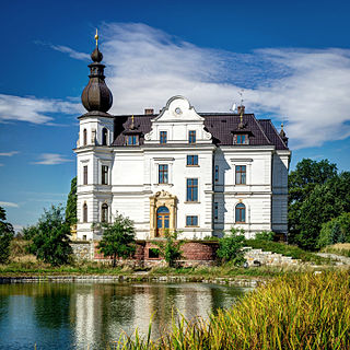
Tyniec Mały is a village in the administrative district of Gmina Kobierzyce, within Wrocław County, Lower Silesian Voivodeship, in south-western Poland. Prior to 1945 it was in Germany.
Wysoka is a village in the administrative district of Gmina Kobierzyce, within Wrocław County, Lower Silesian Voivodeship, in south-western Poland. Prior to 1945 it was in Germany. It lies approximately 11 kilometres (7 mi) north-east of Kobierzyce and 10 km (6 mi) south of the regional capital Wrocław.
Żerniki Małe is a village in the administrative district of Gmina Kobierzyce, within Wrocław County, Lower Silesian Voivodeship, in south-western Poland. Prior to 1945 it was in Germany. It lies approximately 5 kilometres (3 mi) north of Kobierzyce and 17 km (11 mi) south-west of the regional capital Wrocław.


