Givat HaMoreh, in Arabic: Jebel ed-Dahi, is a hill in northern Israel on the northeast side of the Jezreel Valley. The highest peak reaches an altitude of 515 metres (1,690 ft), while the bottom of the Jezreel Valley is situated at an altitude of 50–100 metres (160–330 ft). North of it are the plains of the Lower Galilee and Mount Tabor. To the east, Giv'at HaMoreh connects to the Issachar Plateau. To the southeast it descends into the Harod Valley, where the 'Ain Jalut flows eastwards into the Jordan Valley.

Hadera is a city located in the Haifa District of Israel, in the northern Sharon region, approximately 45 kilometers (28 miles) from the major cities of Tel Aviv and Haifa. The city is located along 7 km (5 mi) of the Israeli Mediterranean Coastal Plain. The city's population includes a high proportion of immigrants arriving since 1990, notably from Ethiopia and the former Soviet Union. In 2021 it had a population of 100,631.

Mount Gilboa, sometimes referred to as the Mountains of Gilboa, is the name for a mountain range in Israel. It overlooks the Harod Valley to the north, and the Jordan Valley and Hills to the southeast to the west, respectively.

Yehoshua Hankin was a Zionist activist who was responsible for most of the major land purchases of the Zionist Organization in Ottoman Palestine and Mandatory Palestine – in particular for the Sursock Purchase.
Ein Harod (Meuhad) (Hebrew: עֵין חֲרוֹד מְאֻחָד) is a kibbutz in northern Israel. Located in the Jezreel Valley near Mount Gilboa, it falls under the jurisdiction of Gilboa Regional Council. In 2021 it had a population of 780.

Beit She'arim necropolis is an extensive necropolis of rock-cut tombs near the remains of the ancient Jewish town of Beit She'arim. In early modern times the site was the Palestinian village of Sheikh Bureik; it was depopulated in the 1920s as a result of the Sursock Purchases, and identified as Beit She'arim in 1936 by historical geographer Samuel Klein.

Ein Harod was a kibbutz in northern Israel near Mount Gilboa. Founded in 1921, it became the center of Mandatory Palestine's kibbutz movement, hosting the headquarters of the largest kibbutz organisation, HaKibbutz HaMeuhad.

The Beit She'an Valley is a valley in Israel.
Gilboa Regional Council is a regional council in northern Israel, located on the slopes of the Gilboa mountain range. There are more than 22,000 residents in 38 settlements as of 2007. The size of the area is about 250,000 acres.
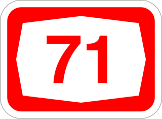
Highway 71 is an east-west highway that passes through the eastern Jezreel Valley and the Beit She'an Valley, below the north slopes of the Gilboa mountains, in northern Israel. The road follows a path parallel to the Harod Creek in the Harod Valley and to the Jezreel Valley railway. It is 35 kilometres (22 mi) long, and leads from Afula in the west, via Beit She'an, to the Jordan River Border Crossing in the east. The Navot interchange located approximately 10 km southeast of Afula provides a shortcut via Route 675 through the Ta'anakh region from Highway 71 and Beit She'an to Highway 65 and central Israel.
Bitan Aharon is a moshav in central Israel. Located in the Sharon plain between Hadera and Netanya, it falls under the jurisdiction of Hefer Valley Regional Council. In 2021 it had a population of 142.

Nuris was a Palestinian Arab village in the District of Jenin. In 1945, Nuris had 570 inhabitants. It was depopulated during the 1948 War on 29 May 1948 under Operation Gideon. The Israeli moshav of Nurit was built on Nuris' village land in 1950.

Adullam-France Park, also known as Parc de France-Adoulam, is a sprawling park of 50,000 dunams (ca. 12,350 acres) in the Central District of Israel, located south of Beit Shemesh. The park, established in 2008 for public recreation, features two major hiking and biking trails, and four major archaeological sites from the Second Temple period. It stretches between Naḥal Ha-Elah, its northernmost boundary, to Naḥal Guvrin, its southernmost boundary. To its west lies the Beit Guvrin-Beit Shemesh highway, and to its east the "green line" – now territories under joint Israeli-Palestinian Arab control – which marks its limit.
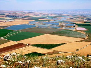
The Harod Valley is a valley in the Northern District of Israel. It is the eastern part of the Jezreel Valley,a transitional zone that extends to the Beit She'an Valley. From south it locked by Mount Gilboa and by the Issachar Plateau from north. It is named after the Ma'ayan Harod at the edge of the valley.
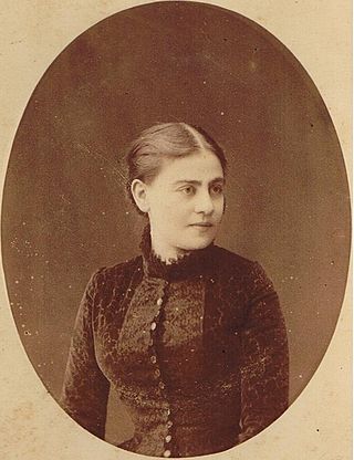
Olga Hankin was a feminist, professional midwife and Zionist activist who, together with her husband, Yehoshua Hankin, was responsible for most of the major land purchases of the Zionist Organization in Ottoman Palestine and Mandatory Palestine. While he became known as a prominent "redeemer of lands" (Hebrew) גואל האדמות she, too, was instrumental in this work.

Hadar Gad is an Israeli artist.

Giv'at Olga is a suburb of the Israeli city of Hadera.
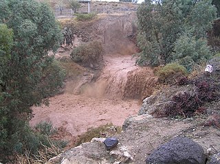
En Harod, or the Spring of Harod, is the name for a water source in the story of Gideon in the Hebrew Bible's Book of Judges. It is the location where Gideon's forces set up their camp ahead of battling the Midianites.