Bethlehem of Galilee or Bethlehem-in-the-Galilee is a moshav in northern Israel. Located in the Galilee near Kiryat Tivon, around 10 kilometres north-west of Nazareth and 30 kilometres east of Haifa, it falls under the jurisdiction of the Jezreel Valley Regional Council. As of 2022 it had a population of 824.

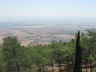
Afula is a city in the Northern District of Israel, often known as the "Capital of the Valley" due to its strategic location in the Jezreel Valley. As of 2022, the city had a population of 61,519.

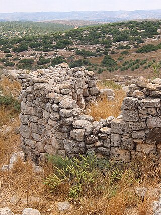
Tell Qasile is an archaeological site near the Yarkon River in Tel Aviv, Israel. Over 3,000 years old, the site contains the remains of a port city founded by the Philistines in the 12th century BC.

Nein — also Nain or Naim in English — is an Arab village in northern Israel. Located in the Lower Galilee, 14 kilometers (8.7 mi) south of Nazareth, Nein covers a land area of approximately 1,000 dunams and falls under the jurisdiction of Bustan al-Marj Regional Council, whose headquarters it hosts. Its total land area consisted of 3,737 dunums prior to 1962. According to the Israeli Central Bureau of Statistics, in 2022 it had a population of 1,994.

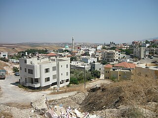
Mashhad is an Arab town located 5 kilometers (3.1 mi) northeast of Nazareth in Israel's Northern District. In 2022 it had a population of 8,771, most of whom were Muslims.
Na'ura is an Arab village in northern Israel. Located to the east of Afula, it falls under the jurisdiction of the Gilboa Regional Council. In 2022 it had a population of 2,421.

Ilut, also spelt ʿAilut, is an Arab local council in the Northern District of Israel. It was declared a local council in 1991. In 2022 its population was 8,863.

Yavne'el is a moshava and local council in the Northern District of Israel. Founded in 1901, it is one of the oldest rural Jewish communities in the country. According to the Israel Central Bureau of Statistics (CBS), in 2022 it had a population of 4,542. In 2008 the population had been 3,100, with a growth rate of 1.4%.
Bu'eine Nujeidat is an Arab local council in the Northern District of Israel. Made up of two villages, Bu'eine and Nujeidat, they merged in 1987 and were recognized as one local council in 1996. In 2022 its population was 10,289, the majority of which is Muslim.
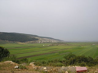
Sulam is an Arab village in north-eastern Israel. Known in ancient times as Shunama and Shunem, it is first mentioned in the Amarna Letters in the 14th century BCE. Archaeological excavations in the village attest to habitation extending from the Bronze Age through to modern times. Located near Afula, it falls under the jurisdiction of Bustan al-Marj Regional Council. In 2022 it had a population of 2,710.

Taibe, meaning "The goodly", or colloquially al-Tayiba al-Zu'biyya after its main clan, is a Muslim Arab village in northeastern Israel on the Issachar Plateau. It falls under the jurisdiction of Gilboa Regional Council. In 2022 it had a population of 1,986.

Tamra is an Arab village in north-eastern Israel. Located in the Jezreel Valley, it falls under the jurisdiction of Gilboa Regional Council. In 2022 it had a population of 1,677.
Khirbat Umm Burj was a Palestinian Arab village in the Hebron Subdistrict, sometimes designated in modern maps as Burgin. Its ruins are today located within the borders of Israel. It occupied an extensive site, stretching about 30 dunams on the crest of a hill, rising some 430 metres (1,410 ft) above sea level, and commanding a good prospect of the surrounding region. It was depopulated during the 1948 Arab–Israeli War on October 28, 1948, during the third stage of Operation Yo'av under the command of Yigal Allon. The site is located 17 km northwest of Hebron.

Tell Beit Mirsim is an archaeological site in Israel, on the border between the lowlands of Shfela and Mount Hebron. It is located in the eastern region of Lachish about 20 kilometers southwest of Hebron and about 13 kilometers southeast of Lachish.

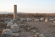
Huqoq or Hukkok was an ancient Jewish village, located 12.5 km north of Tiberias. The area had been settled since ancient times and is mentioned in the Book of Joshua. The Palestinian village of Yaquq later stood at Huqoq's location, and a fort named Hukok was built near the site on 11 July 1945, later followed by a kibbutz.

Khirbet Almit is an archaeological site in the West Bank, occupied from the Middle Bronze Age to the Ottoman period. It is located in the Judaean Desert about 4 km northeast of Mount Scopus and about 1.5 km southeast of 'Anata. The site is situated on the top of two peaks of one hill at an altitude of 638 meters above sea level, near Nahal Zimri and on the border of the Nahal Prat Nature Reserve.

'En Esur, also En Esur or Ein Asawir, is an ancient site located on the northern Sharon Plain, at the entrance of the Wadi Ara pass leading from the Coastal Plain further inland. The site includes an archaeological mound (tell), called Tel Esur or Tell el-Asawir, another unnamed mound, and two springs, one of which gives the site its name.
Beit Qufa is an archaeological site in the Lod Valley, near the modern Israeli settlement of Beit Nehemia in Israel's Central District.

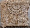
Umm el-Umdan or Khirbet Umm el-Umdan is a Jewish archaeological site within the municipal boundaries of the Israeli city of Modi'in, between the city of Modi'in and Latrun. Archaeological excavations at the site discovered the remains of a Jewish village. The findings show that the place was inhabited during the Persian, Hellenistic, Roman, Byzantine, and Early Muslim periods. The village was destroyed during the Bar Kokhba revolt.