Macarao National Park

Last updated
Macarao National Park
Parque Nacional Macarao
Macarao.jpg
Venezuela relief location map (+claimed).jpg
Red pog.svg
Location
LocationFlag of Venezuela.svg  Venezuela
Coordinates 10°25′N67°01′W / 10.417°N 67.017°W / 10.417; -67.017 Coordinates: 10°25′N67°01′W / 10.417°N 67.017°W / 10.417; -67.017
Area150 km2 (58 sq mi)
EstablishedDecember 5, 1973 (1973-12-05)

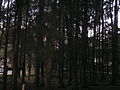
The Macarao National Park [1] (Spanish : Parque nacional Macarao) [2] Is a protected area with the status of a national park located in the Macarao, San Pedro and Jarillo rivers, in the north of the South American country of Venezuela. [3] [4] Its extension of 15,000 hectares covers part of the Capital District and Miranda State. The area was declared National Park in 1973.

Contents

It constitutes a zone of protection of hydrographic resources that contributes to satisfy the drinking water needs of the city of Caracas.

It is characterized by a mountainous relief that forms part of the Cordillera de la Costa, the highest point of which is the Alto de Ño León. It has facilities to facilitate sports, scientific and educational excursions.

See also

Related Research Articles

<span class="mw-page-title-main">Los Roques Archipelago</span> Federal dependency of Venezuela

The Los Roques Archipelago is a federal dependency of Venezuela consisting of approximately 350 islands, cays, and islets in a total area of 40.61 square kilometers. The archipelago is located 128 kilometers (80 mi) directly north of the port of La Guaira, in the Caribbean Sea.

Sima Martel is an enormous sinkhole located on the summit of plateau of Sarisariñama tepui, in Bolívar State, Venezuela. It is unusual due to several factors including its enormous size and depth, location on the top of the only forested tepui and having a patch of forest on its base. Named after speleologist Édouard-Alfred Martel.

Sima Humboldt is an enormous sinkhole located on the summit of the plateau of Sarisariñama tepui in Bolívar State, Venezuela. It is unusual for several reasons, including its enormous size and depth, its location on the top of the only forested tepui, having a patch of forest on its base and also due to the weathering process that formed this sinkhole. The feature is named after scientist and explorer Alexander von Humboldt.

<span class="mw-page-title-main">Tapo-Caparo National Park</span> Protected area in Venezuela

The Tapo-Caparo National Park, or National Park Tapo Caparo, is a protected area with national park status in Venezuela. The park covers 2,050 square kilometres (790 sq mi) in the western states of Barinas, Mérida, and Táchira.

<span class="mw-page-title-main">Tirgua National Park</span> National park in Venezuela

Tirgua National Park, also known as General Manuel Manrique National Park, is a national park in Venezuela. It protects the headwaters of several waterways, especially the river Tirgua, which gives its name to the park.

<span class="mw-page-title-main">Ciénagas del Catatumbo National Park</span>

The Ciénagas del Catatumbo National Park Also Catatumbo Marshes National Park or Ciénagas de Juan Manuel National Park Is a protected area of Venezuela.

<span class="mw-page-title-main">Mariusa National Park</span> Venezuelan national park

The Mariusa National Park is a protected area of Venezuela with national park status.

<span class="mw-page-title-main">Sierra La Culata National Park</span> National Park in the Venezuelan Andes

The Sierra La Culata National Park Also Sierra de la Culata National Park is a national park of Venezuela that is located in the northeastern branch of the Venezuelan Andes, in the states Mérida and Trujillo. It was decreed a national park on December 7, 1989. It has a high mountain climate, with temperatures ranging between −2 and 24 °C, and its surface area is 200,400 hectares (774 sq mi).

<span class="mw-page-title-main">General Juan Pablo Peñaloza National Park</span>

The General Juan Pablo Peñaloza National Park Also Páramos Batallón y La Negra National Park Is a national park of Venezuela that is formed by several páramos: Among them Batallón and La Negra, which are an important source of water supply. It is located between the states Mérida and Táchira, northwest of the Táchira depression in the Páramos de El Batallón and La Negra in Venezuela.

<span class="mw-page-title-main">Dinira National Park</span>

The Dinira National Park is a protected area with the national park status located between the states Lara, Portuguesa and Trujillo in the South American country of Venezuela. It was created on November 30, 1988.

<span class="mw-page-title-main">El Tamá National Park</span>

The El Tamá National Park It is a protected area with the status of a national park that is located between the Andes and plains of Venezuela. It protects part of the Tamá Massif. It has an area of 139,000 hectares and is located in the states of Táchira and Apure, near the border with Colombia. Created as a National Park on December 12, 1978, by the then President Carlos Andrés Pérez.

<span class="mw-page-title-main">Yapacana National Park</span>

The Yapacana National Park Also Cerro Yapacana National Park Is a protected area with the status of national park in the South American country of Venezuela which was formed on December 12, 1978 by executive decree of President Carlos Andres Perez. It is located southwest of the confluence of the Ventuari River on the Orinoco River, in the jurisdiction of the Atabapo municipality of Amazonas state.

<span class="mw-page-title-main">Terepaima National Park</span>

The Terepaima National Park Is a protected area with the status of national park in the South American country of Venezuela located in the mountainous region of the Lara and Portuguesa States. Specifically southeast of the city of Barquisimeto, capital of the Lara State, it covers areas belonging to the municipalities Iribarren, Palavecino and Simón Planas.

<span class="mw-page-title-main">Aguaro-Guariquito National Park</span>

The Aguaro-Guariquito National Park, also rendered as Aguaro Guariquito National Park, is a protected area with the status of national park in the South American country of Venezuela. Located in the region of the Llanos, it extends over the municipalities of Francisco de Miranda and Jose Rondon in Guárico state.

<span class="mw-page-title-main">Cerro El Copey National Park</span>

The Cerro El Copey National Park Also Cerro El Copey-Jóvito Villalba National Park Is a protected area with the status of a national park located to the east of the Caribbean island of Margarita, in the highest mountainous region of Nueva Esparta State in Venezuela. It was created in 1974 with the purpose of protecting an outstanding physiographic feature with an ecosystem that includes several plant formations, high levels of endemism and the only permanent water sources of the island.

<span class="mw-page-title-main">Yurubí National Park</span> National park in the north of Venezuela

The Yurubí National Park is a protected area with the status of national park in the north of the South American country of Venezuela. It was founded on March 18, 1960 in Yaracuy State created to protect the Yurubí river basin, which is the source of fresh water for the city of San Felipe. The Yurubí National Park is located in the mountains of the Sierra de Aroa. The park includes cloud forests and low montane forests and is surrounded by cultivated areas. The park is crossed by small trails, which are used mainly by poachers or by a small number of visitors and researchers. The park is not inhabited; The former settlers of the area were relocated many years ago.

<span class="mw-page-title-main">Laguna de Las Marites Natural Monument</span> Protected natural environment in Venezuela

The Laguna de las Marites Natural Monument Also Las Marites Lagoon Natural Monument Is a protected area with natural monument status located on the southeast coast of the coastal plain of Margarita Island in Nueva Esparta state in the northwest of the South American country of Venezuela. It was declared a monument on February 27, 1974. It has an extension of 3674 ha, an altitude of 40 msnm and an average temperature of 26 ° C, with hypersaline waters.

The Abra de Río Frío Natural Monument Is a protected natural space located in the municipality of San Cristóbal, in the state of Táchira, Venezuela. Received the status of natural monument on February 18, 1993.

<span class="mw-page-title-main">Pico Basilé National Park</span> National park in Equatorial Guinea

The Pico Basilé National Park is a protected area with the status of national park on the island of Bioko in the northern part of the African country of Equatorial Guinea, near the Gulf of Guinea, in the Atlantic Ocean. It stands out for its diversity of landscapes and vegetation and especially for its population of primates, that are threatened by the illegal hunting. Although in 2007 the government of that country prohibited the hunting of diverse species, international organizations have shown concern for the noncompliance of the decree.

<span class="mw-page-title-main">Cayos Bequevé</span> Venezuelan islands in the Caribbean Sea

Cayos Bequevé is the name given to a group of Venezuelan islands in the southeast of the Caribbean Sea that is part of the Los Roques Archipelago, and of the Lesser Antilles that is administered as part of the Federal Dependencies of Venezuela and the National Park Archipelago of Los Roques, and is also part of the so-called Miranda Island Territory. Not to be confused with an inn of the same name but located on the island of Gran Roque.

References

  1. (Venezuela), Instituto Nacional de Parques; (Venezuela), Fundación de Educación Ambiental (1983-01-01). Los Parques nacionales de Venezuela (in Spanish). Instituto Nacional de Parques. ISBN   9788449967818.
  2. Boyla, Kerem; Estrada, Angélica; International, BirdLife (2017-03-16). Áreas importantes para la conservación de las aves en los Andes tropicales: sitios prioritarios para la conservación de la biodiversidad (in Spanish). BirdLife International. ISBN   9789978441961.
  3. Nweihed, Kaldone G. (1992-01-01). Frontera y límite en su marco mundial: una aproximación a la "fronterología" (in Spanish). Equinoccio. ISBN   9789802370641.
  4. Cunill, Pedro (1990-01-01). Venezuela: opciones geográficas (in Spanish). Fundación Eugenio Mendoza. ISBN   9789806017481.