Related Research Articles

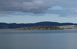
Sentinel Island is a granite island, with an area of 10 ha, in south-eastern Australia. It is part of Tasmania’s Sentinel Island Group, lying in eastern Bass Strait off the north-west coast of Flinders Island in the Furneaux Group. Until 1985 it was used for grazing sheep.
Marriott Reef is a small group of granite islets, with a combined area of 3.4 ha, in south-eastern Australia. It forms part of Tasmania’s Pasco Island Group, lying in eastern Bass Strait off the north-west coast of Flinders Island in the Furneaux Group.
The Low Islets are two small, flat, adjacent, granite islands, with a combined area of about 2 ha, in south-eastern Australia. They are part of Tasmania’s Prime Seal Island Group, lying in eastern Bass Strait west of Flinders in the Furneaux Group. The larger of the two islets has been used for grazing sheep, cattle and horses.
Wybalenna Island comprises four round granite islands with a combined area of about 16 ha, in south-eastern Australia. It is part of Tasmania’s Prime Seal Island Group, lying in eastern Bass Strait west of Flinders in the Furneaux Group. The island is a conservation area.

The Thumbs is a small and jagged island, with three prominent spires and an area of 4,500 square metres, in south-eastern Australia. It is part of the Tasman Island Group, lying close to the south-eastern coast of Tasmania around the Tasman Peninsula, and is in the Tasman National Park.
Spectacle Island is a 3.5-hectare (8.6-acre) island in south-eastern Australia. It is part of the Sloping Island Group, lying close to the south-eastern coast of Tasmania around the Tasman and Forestier Peninsulas. Recorded breeding seabird and wader species are little penguin, short-tailed shearwater and pied oystercatcher.
Barren Island is a small island, with an area of 0.53 ha, in south-eastern Australia. It is part of the Sloping Island Group, lying close to the south-eastern coast of Tasmania around the Tasman and Forestier Peninsulas.

Sloping Island, incorporating the adjacent Sloping Reef, is an island nature reserve, with an area of 117 ha, in Tasmania in south-eastern Australia. It is part of the Sloping Island Group, lying close to the south-eastern coast of Tasmania around the Tasman and Forestier Peninsulas.
Visscher Island is an island, with an area of 3.4 ha, in south-eastern Tasmania, in Australia.
Arch Rock is a sandstone islet, with an area of 0.44 ha and containing a natural arch, in south-eastern Australia. It is part of the Partridge Island Group, lying close to the south-eastern coast of Tasmania, in the D'Entrecasteaux Channel between Bruny Island and the mainland.
Charity Island is an islet with an area of 0.6 ha in south-eastern Australia. It is part of the Partridge Island Group, lying close to the south-eastern coast of Tasmania, in the D'Entrecasteaux Channel between Bruny Island and the mainland. Its neighbouring islets are named "Faith" and "Hope".
Blanche Rock is a 0.07 ha dolerite islet in south-eastern Australia. It is part of the Actaeon Island Group, lying close to the south-eastern coast of Tasmania, at the southern entrance to the D'Entrecasteaux Channel between Bruny Island and the mainland. It is part of the South Bruny National Park.
Dart Island, part of the Tasman Island Group, lies close to the south-eastern coast of Tasmania, Australia. It is located in Norfolk Bay, situated off the Tasman Peninsula.
Clydes Island is an island in south-eastern Australia. It is part of the Tasman Island Group, lying close to the south-eastern coast of Tasmania around the Tasman Peninsula, and is easily accessible from mainland Tasmania.

King George Island is an island in south-eastern Australia. It is part of the Sloping Island Group, lying close to the south-eastern coast of Tasmania around the Tasman and Forestier Peninsulas. The island was once inhabited and farmed and contains the ruins of two buildings on its eastern side. A conservation covenant is in place on this island.
Woody Island is an island in south-eastern Australia. It is part of the Sloping Island Group, lying close to the south-eastern coast of Tasmania around the Tasman and Forestier Peninsulas.
The Hope Island, part of the Partridge Island Group, is a small island that lies close to the south-eastern coast of Tasmania, Australia. The island is located in the D'Entrecasteaux Channel between Bruny Island and the Tasmanian mainland. Its neighbouring islets are named Faith and Charity, and also the Arch Rock.
The Faith Island, part of Partridge Island Group, is a low, flat islet in south-eastern Tasmania, Australia. The islet lies in the D'Entrecasteaux Channel between Bruny Island and the Tasmania mainland. It contains two gravestones, concealed in the scrub in the north-east of the island. Its neighbouring islets are named Charity and Hope and also the Arch Rock.
Seagull Rock is a small islet in south-eastern Australia. It is part of the Partridge Island Group, lying close to the south-eastern coast of Tasmania, in the D'Entrecasteaux Channel between Bruny Island and the mainland.
The Sloping Island Group is a group of small islands in south-eastern Tasmania in Australia. They lie close to the south-eastern coast of Tasmania around the Tasman and Forestier Peninsulas.
References
Notes
Sources
- Brothers, Nigel; Pemberton, David; Pryor, Helen; & Halley, Vanessa. (2001). Tasmania’s Offshore Islands: seabirds and other natural features. Tasmanian Museum and Art Gallery: Hobart. ISBN 0-7246-4816-X
Coordinates: 43°00′S147°50′E / 43.000°S 147.833°E
| | This Tasmania geography article is a stub. You can help Wikipedia by expanding it. |