
Abbé Nicolas-Louis de Lacaille, formerly sometimes spelled de la Caille, was a French astronomer and geodesist who named 14 out of the 88 constellations. From 1750 to 1754, he studied the sky at the Cape of Good Hope in present-day South Africa. Lacaille observed over 10,000 stars using just a half-inch refracting telescope.

Table Mountain is a flat-topped mountain forming a prominent landmark overlooking the city of Cape Town in South Africa. It is a significant tourist attraction, with many visitors using the cableway or hiking to the top. Table Mountain National Park is the most visited national park in South Africa, attracting 4.2 million people every year for various activities. The mountain has 8,200 plant species, of which around 80% are fynbos, meaning fine bush. It forms part of the Table Mountain National Park, and part of the lands formerly ranged by Khoe-speaking clans, such as the !Uriǁʼaes. It is home to a large array of mostly endemic fauna and flora.
Monkey Bay or Lusumbwe is a town in Mangochi which is in the Mangochi District in the Southern Region of Malawi. The town is on the shore of Lake Malawi and is one of the main ports on Lake Malawi. The population of Monkey Bay was 14,955 according to the 2018 census. Monkey Bay is 206 kilometres (128 mi) from Lilongwe, Malawi's capital city, and 253 kilometres (157 mi) from Blantyre. Monkey Bay is a tourist resort and is often travelled through on the road to Cape Maclear.

Maclear is a lava-flooded crater on the northwest part of the Mare Tranquillitatis, a lunar mare in the eastern half of the Moon. Its diameter is 20 km. The crater is located to the southwest of the slightly larger Ross. To the southwest of Maclear is Sosigenes, while farther to the south-southeast is Arago.

The R56 is a provincial route in South Africa that connects Middelburg with Pietermaritzburg via Molteno, Maclear and Kokstad. It is co-signed with the N2 between Kokstad and Stafford's Post for 39 kilometres.
The R396 is a Regional Route in South Africa that connects the N2 north of Mthatha to Lady Frere via Maclear, Rhodes, Barkly East, and Indwe.
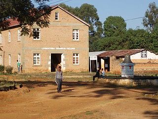
Livingstonia or Kondowe is a town located in the Northern Region district of Rumphi in Malawi. It is 430 kilometres north of the capital, Lilongwe, and connected by road to Chitimba on the shore Lake Malawi.

Sir Thomas Maclear was an Irish-born South African astronomer who became Her Majesty's astronomer at the Cape of Good Hope.

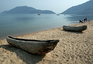
Cape Maclear or Chembe is a town in the Mangochi District of Malawi's Southern Region. The town, on the Nankumba Peninsula, is on the southern shore of Lake Malawi and is the busiest resort on Lake Malawi. Cape Maclear is close to the islands of Domwe, Thumbwe and Mumbo Island on Lake Malawi, and is in Lake Malawi National Park.
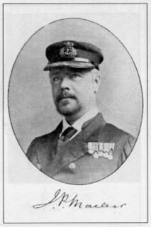
John Fiot Lee Pearse Maclear was an admiral in the Royal Navy, known for his leadership in hydrography.
Moordenaarsnek Pass, or just Moordenaarsnek, is situated in the Eastern Cape, province of South Africa, on the regional road R56, between Mount Fletcher and Maclear, Eastern Cape.
Pot River Pass is a mountain pass situated in the Eastern Cape province of South Africa, on the regional road R396, between Maclear, Eastern Cape and Barkly East.
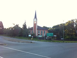
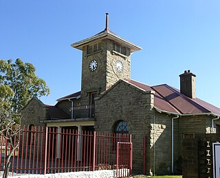
Maclear is a small town situated in the Eastern Cape province of South Africa, near the Mooi River, 172 km north of East London and 80 km north-east of Elliot. It was founded in 1876 as a military camp, called Nqanqaru Drift and developed rapidly, reaching municipal status in 1916. Nqanqarhu was previously named after Sir Thomas Maclear (1794-1879), a famous astronomer who laid the foundation for a trigonometrical survey of the Cape Colony.
Elliot, officially known as Khowa, is a town in Chris Hani District Municipality in the Eastern Cape province of South Africa, and lies 80 km south-west of Maclear and 65 km south-east of Barkly East on the R56 road.
Qumbu is a town in O.R.Tambo District Municipality in the Eastern Cape province of South Africa.
Ugie is a town in Joe Gqabi District Municipality in the Eastern Cape province of South Africa.
Mount Fletcher is a town in Joe Gqabi District Municipality in the Eastern Cape province of South Africa, 69 km north-north-east of Maclear.

Maclear's Beacon is a triangulation station used in Maclear's arc measurement for Earth's circumference determination.

The following outline is provided as an overview of and topical guide to Cape Town:
