Joe Gqabi District Municipality

Last updated

Joe Gqabi
Joe Gqabi CoA.png
Map of South Africa with Ukhahlamba highlighted (2011).svg
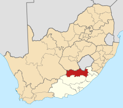
Location in the Eastern Cape
Coordinates: 30°58′S27°36′E / 30.967°S 27.600°E / -30.967; 27.600
Country South Africa
Province Eastern Cape
Seat Barkly East
Local municipalities
Government
[1]
  Type Municipal council
  MayorNP Mposelwa
Area
  Total25,663 km2 (9,909 sq mi)
Population
 (2011) [2]
  Total349,768
  Density14/km2 (35/sq mi)
Racial makeup (2011)
[2]
   Black African 93.8%
   Coloured 3.5%
   Indian/Asian 0.2%
   White 2.4%
First languages (2011)
[3]
   Xhosa 70.5%
   Sotho 20.2%
   Afrikaans 5.9%
   English 1.6%
  Other1.8%
Time zone UTC+2 (SAST)
Municipal codeDC14

The Joe Gqabi District Municipality (Xhosa : uMasipala weSithili sase Joe Gqabi; Sotho : Masepala wa Setereke wa Joe Gqabi) is one of the seven districts of the Eastern Cape province of South Africa. The seat is Barkly East. As of 2011, the majority of its 349,768 inhabitants spoke isiXhosa.

Contents

Before 1 February 2010, it was known as the Ukhahlamba District Municipality; [4] its name was changed in recognition of Joe Gqabi (19291981), [5] an African National Congress member who was a journalist for the New Age , a member of the Umkhonto we Sizwe, and one of the Pretoria Twelve. [6]

Geography

Local municipalities

The district contains the following local municipalities:

Local municipalityCodePopulation%
Elundini EC141138 14139.50%
Senqu EC142134 15038.35%
Walter Sisulu EC14577 47722.15%

Neighbours

Joe Gqabi is surrounded by the following districts:

Demographics

The following statistics are from the 2011 census:

LanguagePopulation%
Xhosa 244 02170.47%
Sotho 69 88920.18%
Afrikaans 20 3295.87%
English 5 6961.64%
Sign language 2 1240.61%
Other 1 3190.38%
Zulu 8750.25%
Ndebele 6030.17%
Northern Sotho 5920.17%
Tswana 4710.14%
Tsonga 1530.04%
Venda 1410.04%
Swati 770.02%

Gender

GenderPopulation%
Female184 32552.70%
Male165 44347.30%

Ethnic group

Ethnic groupPopulation%
Black African328 00293.78%
Coloured12 1773.48%
White8 2772.37%
Indian/Asian6320.18%

Age

AgePopulation%
000 - 00435 27910.34%
005 - 00945 32113.28%
010 - 01451 41015.06%
015 - 01946 35513.58%
020 - 02428 5438.36%
025 - 02919 5335.72%
030 - 03416 2744.77%
035 - 03915 5844.57%
040 - 04414 9154.37%
045 - 04912 9973.81%
050 - 05411 0733.24%
055 - 0599 1312.68%
060 - 0649 8282.88%
065 - 0699 7002.84%
070 - 0746 6941.96%
075 - 0793 8241.12%
080 - 0843 3120.97%
085 - 0899620.28%
090 - 0944020.12%
095 - 0991380.04%
100 plus620.02%

Politics

Election results

Election results for Joe Gqabi (prev. Ukhahlamba) in the South African general election, 2004.

PartyVotes%
African National Congress 97 56085.18%
United Democratic Movement 7 9246.92%
Democratic Alliance 4 3573.80%
Pan African Congress 1 3441.17%
African Christian Democratic Party 7320.64%
Independent Democrats 5840.51%
New National Party 4340.38%
Freedom Front Plus 4290.37%
SOPA 1560.14%
Inkhata Freedom Party 1530.13%
Azanian People's Organisation 1500.13%
EMSA 1250.11%
PJC 1160.10%
United Christian Democratic Party 1160.10%
NA 840.07%
TOP 650.06%
UF 650.06%
CDP 440.04%
Minority Front 370.03%
NLP 280.02%
KISS 270.02%
Total114 530100.00%

Related Research Articles

<span class="mw-page-title-main">Sarah Baartman District Municipality</span> District municipality in Eastern Cape, South Africa

The Sarah Baartman District Municipality, formerly the Cacadu District Municipality, is situated in the western part of the Eastern Cape province of South Africa, covering an area of 58,242 square kilometres. The area of the district municipality includes seven local municipalities. The seat is the city of Gqeberha, although Gqeberha is not itself in the district. As of 2011, the languages most spoken among the 388,201 inhabitants were isiXhosa and Afrikaans. The district code is DC10.

<span class="mw-page-title-main">Lejweleputswa District Municipality</span> District municipality in Free State, South Africa

The Lejweleputswa District Municipality is one of the 5 districts of the Free State province of South Africa. The seat of the municipality is Welkom. As of 2011, a majority of its 657,019 residents speak Sotho. The district code is DC18. Lejweleputswa is a Sesotho word meaning "grey rock".

<span class="mw-page-title-main">Xhariep District Municipality</span> District municipality in Free State, South Africa

The Xhariep District Municipality is one of the 5 districts of the Free State province of South Africa. The municipality is the largest in the Free State geographically and is known for its vast land. It is home to the largest dam in the county, the Gariep Dam, and has two mines, situated in Jagersfontein and Koffiefontein. The natural resources and the geographical position of the municipality make it a site with good potential for investment and development. The seat is Trompsburg. As of 2011, the largest language group is Sotho who make up 45.3% of the total population of 146,259. The district code is DC16.

<span class="mw-page-title-main">Harry Gwala District Municipality</span> District municipality in KwaZulu-Natal, South Africa

The Harry Gwala District Municipality, formerly the Sisonke District Municipality, is one of the 11 districts of the KwaZulu-Natal province of South Africa. The seat is Ixopo. The majority of its 298,392 inhabitants spoke isiZulu as of 2011. The district code is DC43. The district's name was changed in November 2015 in honor of African National Congress leader Harry Gwala.

<span class="mw-page-title-main">Pixley ka Seme District Municipality</span> District municipality in Northern Cape, South Africa

The Pixley ka Seme District Municipality is one of the five districts of the Northern Cape province of South Africa. The seat of Pixley ka Seme is De Aar. As of 2011, a majority (77%) of its 186,351 residents speak Afrikaans as a first language. The district code is DC7. It is named after Pixley ka Isaka Seme, one of the founders of the African National Congress.

<span class="mw-page-title-main">Alfred Nzo District Municipality</span> District municipality in Eastern Cape, South Africa

The Alfred Nzo District Municipality is one of the 6 districts of the Eastern Cape province of South Africa. The seat is Mount Ayliff. The majority of its 801,344 residents speak isiXhosa. The district code is DC44.

<span class="mw-page-title-main">OR Tambo District Municipality</span> District municipality in Eastern Cape, South Africa

The OR Tambo District Municipality is one of the seven districts of the Eastern Cape province of South Africa. It is within the Wild Coast Region. The seat is Mthatha. As of 2011, the vast majority (94%) of its 1,364,943 inhabitants spoke isiXhosa. The district is named after Oliver Tambo. The district code is DC15.

<span class="mw-page-title-main">Amathole District Municipality</span> District municipality in Eastern Cape, South Africa

The Amathole District Municipality is one of the 7 districts of the Eastern Cape province of South Africa. The seat is East London. As of 2011, over 90% of its 892,637 inhabitants spoke isiXhosa. The district code is DC12. Amathole means "calves", the name of the mountain range and forest which forms the northern boundary of the district.

<span class="mw-page-title-main">Dr Kenneth Kaunda District Municipality</span> District municipality in North West, South Africa

The Dr Kenneth Kaunda District Municipality, formerly the Southern District Municipality, is one of the 4 districts of the North West province of South Africa. The seat of the municipality is Klerksdorp. As of 2016, a plurality of its 742,821 residents speak Setswana. The majority of its residents live in the City of Matlosana. The district code is DC40. The district was formerly known as the Southern District Municipality. It is named after Kenneth Kaunda, the first President of Zambia.

<span class="mw-page-title-main">Mbhashe Local Municipality</span> Local municipality in Eastern Cape, South Africa

Mbhashe Municipality is a local municipality in the Eastern Cape province of South Africa. The municipality was constituted in terms of the Municipal Structures Act of 1998 and comprises the areas that previously formed the Elliotdale, Willowvale and Dutywa town councils. The municipality is located in the north eastern part of the Amathole District Municipality. The main administrative office is situated in Dutywa.

<span class="mw-page-title-main">Mangaung Metropolitan Municipality</span> Metropolitan municipality in Free State, South Africa

The Mangaung Metropolitan Municipality is a metropolitan municipality which governs Bloemfontein and surrounding towns in the Free State province of South Africa. Mangaung is a Sesotho word meaning "place of cheetahs", as it was not uncommon for the Basotho to name warrior regiments after ferocious animals.

<span class="mw-page-title-main">Tswelopele Local Municipality</span> Local municipality in Free State, South Africa

Tswelopele Municipality is a local municipality within the Lejweleputswa District Municipality, in the Free State province of South Africa. Tswelopele is a Sesotho word meaning "progress".

<span class="mw-page-title-main">Blue Crane Route Local Municipality</span> Local municipality in Eastern Cape, South Africa

Blue Crane Route Municipality is a local municipality within the Sarah Baartman District Municipality, in the Eastern Cape of South Africa. The municipality is named after the South African national bird, the blue crane.

<span class="mw-page-title-main">Elundini Local Municipality</span> Local municipality in Eastern Cape, South Africa

Elundini Municipality is a local municipality within the Joe Gqabi District Municipality, in the Eastern Cape province of South Africa. The name originates from isiZulu and refers to the Drakensberg Mountains.

<span class="mw-page-title-main">Emalahleni Local Municipality, Eastern Cape</span> Local municipality in Eastern Cape, South Africa

Emalahleni Municipality is a local municipality within the Chris Hani District Municipality, in the Eastern Cape province of South Africa. Emalahleni is an isiXhosa word meaning "a place of coal".

<span class="mw-page-title-main">Maletswai Local Municipality</span> Former local municipality in Eastern Cape, South Africa

Maletswai Local Municipality was an administrative area in the Joe Gqabi District of the Eastern Cape in South Africa. The municipality was merged with Gariep Local Municipality immediately after the August 2016 Local Municipal Elections to form the new Walter Sisulu Local Municipality.

<span class="mw-page-title-main">Senqu Local Municipality</span> Local municipality in Eastern Cape, South Africa

Senqu Municipality is a local municipality within the Joe Gqabi District Municipality, in the Eastern Cape province of South Africa. Senqu is the Sesotho name for the Orange River.

<span class="mw-page-title-main">Masilonyana Local Municipality</span> Local municipality in Free State, South Africa

Masilonyana Municipality is a local municipality within the Lejweleputswa District Municipality, in the Free State province of South Africa. Masilonyana is a Setswana word meaning "freedom".

<span class="mw-page-title-main">Walter Sisulu Local Municipality</span> Local municipality in Eastern Cape, South Africa

Walter Sisulu Municipality is a local municipality within the Joe Gqabi District Municipality, in the Eastern Cape province of South Africa. The municipality was formed by merging the Maletswai and Gariep local municipalities immediately after the August 2016 local municipal elections.

Joe Nzingo Gqabi was a South African African National Congress activist who was the ANC's chief representative in Zimbabwe at the time of his assassination by the South African Defence Force in Harare, Zimbabwe, in 1981.

References

  1. "Contact list: Executive Mayors". Government Communication & Information System. Archived from the original on 14 July 2010. Retrieved 22 February 2012.
  2. 1 2 "Statistics by place". Statistics South Africa. Retrieved 27 September 2015.
  3. "Statistics by place". Statistics South Africa. Retrieved 27 September 2015.
  4. "Name Change". Joe Gqabi District Municipality. The name of Ukhahlamba District Municipality changed on the 1st of February 2010 to Joe Gqabi District Municipality.[ permanent dead link ]
  5. T. L. Marawu (Executive Mayor) (25 February 2010). "State of the District Address Joe Gqabi DM" (PDF). Joe Gqabi District Municipality. Retrieved 5 October 2012. Our people must be aware that we are changing the name of this municipality to Joe Gqabi District Municipality This takes place after the public consultation we have made in this regard. The public chose the name Joe Gqabi to honour the role played by this hero in fighting against apartheid.[ permanent dead link ]
  6. "Joe Nzingo Gqabi". South African History Online. Retrieved 5 October 2012.