Nyandeni Local Municipality

Last updated

Nyandeni
Nyandeni CoA.png
Map of the Eastern Cape with Nyandeni highlighted.svg
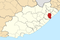
Location in the Eastern Cape
Coordinates: 31°27′S28°57′E / 31.450°S 28.950°E / -31.450; 28.950
Country South Africa
Province Eastern Cape
District OR Tambo
Seat Libode
Wards 31
Government
[1]
  Type Municipal council
  MayorMesuli Ngqodwana (ANC)
  SpeakerNoziphiwo Matanda (ANC)
  Chief WhipMcebisi Robert Mtobela (ANC)
Area
  Total2,474 km2 (955 sq mi)
Population
 (2011) [2]
  Total290,390
  Density120/km2 (300/sq mi)
Racial makeup (2011)
[2]
   Black African 99.4%
   Coloured 0.3%
   Indian/Asian 0.1%
   White 0.1%
First languages (2011)
[2]
   Xhosa 95.3%
   English 2.0%
  Other2.7%
Time zone UTC+2 (SAST)
Municipal codeEC155

Nyandeni Municipality (Xhosa : uMasipala wase Nyandeni) is a local municipality within the OR Tambo District Municipality, in the Eastern Cape province of South Africa. Its administrative seat is the town of Libode. The entire municipal area falls within the former Transkei Bantustan area. The urban population is mainly located in the two small towns of Libode and Ngqeleni. [3]

Contents

Scattered, low-density rural settlements dominate the municipality. 79% of households reside in traditional or village type settlements. These settlements are loosely scattered throughout the entire municipal area and are surrounded by communal grazing and arable lands. The majority of residential structures are self-built. Apart from a few trading stores, there is little sign of any significant economic activity within the rural settlements. [4] Many of the families in the rural regions of the municipality were formerly supported by men who worked as migrant labour in local mines. Subsequent retrenchment at the mines has left these communities with scant means to survive. [4] About 77% of households can be regarded as indigents with access to either no income or incomes of less than R800 (US$108) per month. [3]

Most of the education institutions in Nyandeni cater to lower level schooling. Of the 426 schools in the Nyandeni area, 64% are overcrowded or highly overcrowded, according to the OR Tambo District office. [4] The spread of HIV/AIDS is an extremely severe and urgent problem in the area. In 2009, the HIV/AIDS prevalence rate was as high as 50%-60% among tested cases; these cases were mainly females who participated in voluntary testing during their regular pregnancy visits to local clinics. [4]

Main places

The 2001 census divided the municipality into the following main places: [5]

PlaceCodeArea (km2)Population
Amasane 23401 26.593,244
Gibisela 23402 103.1013,723
Konjyaoyo 23403 380.4539,367
Libode 23404 33.683,835
Masizakhe 23405 6.71579
Mbalisweni 23406 121.536,333
Mcwebeni 23407 159.7916,614
Mhlanga 23408 709.6781,298
Ndluzula 23409 2.51578
Ngqeleni 23410 15.172,062
Ngqubusini 23411 292.5341,001
Ngxangule 23412 105.599,131
Nqabe 23413 17.072,388
Ntakatye 23414 310.7236,078
Qokolweni/Zimbane 23415 4.380
Simanzi 23416 309.3724,566
Tshomane 23417 7.030
Xesibe 23418 4.85464

Politics

The municipal council consists of sixty-four members elected by mixed-member proportional representation. Thirty-two councillors are elected by first-past-the-post voting in thirty-two wards, while the remaining thirty-two are chosen from party lists so that the total number of party representatives is proportional to the number of votes received. In the election of 1 November 2021 the African National Congress (ANC) won a majority of fifty-one seats on the council. The following table shows the results of the election. [6]

PartyWardListTotal
seats
Votes%SeatsVotes%Seats
African National Congress 43,44277.943244,39879.641951
African Transformation Movement 4,4317.9504,2267.5855
Economic Freedom Fighters 2,9205.2402,8525.1244
United Democratic Movement 8751.5701,9103.4322
Independent candidates 1,9853.5600
Democratic Alliance 9131.6408321.4911
Civic Independent 5791.0406131.1011
Pan Africanist Congress of Azania 2090.3703960.7100
Independent South African National Civic Organisation 1570.2802570.4600
Batho Pele Movement 1760.3201540.2800
Congress of the People 540.1001110.2000
Total55,741100.003255,749100.003264
Valid votes55,74197.8655,74997.90
Invalid/blank votes1,2192.141,1952.10
Total votes56,960100.0056,944100.00
Registered voters/turnout134,60142.32134,60142.31

Related Research Articles

<span class="mw-page-title-main">Stellenbosch Local Municipality</span> Local municipality in Western Cape, South Africa

Stellenbosch Municipality is the local municipality that governs the towns of Stellenbosch, Franschhoek and Pniel, and the surrounding rural areas, in the Western Cape province of South Africa. It covers an area of 831 square kilometres (321 sq mi), and as of 2011 had a population of 155,733 people in 43,420 households. It falls within the Cape Winelands District Municipality.

<span class="mw-page-title-main">Cape Agulhas Local Municipality</span> Local municipality in Western Cape, South Africa

Cape Agulhas Municipality is a municipality located in the Western Cape province of South Africa. As of 2011, it had a population of 33,038. Its municipality code is WC033. It is named after Cape Agulhas, the southernmost point of Africa. The largest town is Bredasdorp, which is the seat of the municipal headquarters. It also includes the villages of Napier, Struisbaai, Elim, Arniston and L'Agulhas, and the De Hoop Nature Reserve.

<span class="mw-page-title-main">Polokwane Local Municipality</span> Local municipality in Limpopo, South Africa

Polokwane Municipality is a local municipality within the Capricorn District Municipality, in the Limpopo province of South Africa. It shares its name with the city of Polokwane.

<span class="mw-page-title-main">Abaqulusi Local Municipality</span> Local municipality in KwaZulu-Natal, South Africa

AbaQulusi Local Municipality is a local municipality in Zululand in the KwaZulu-Natal province of South Africa. It is named after the AbaQulusi, a Zulu clan whose descendants live in the vicinities of Vryheid, Utrecht, eDumbe and Ngotshe. They hailed from different origins but were unified by their allegiance to local Zulu royal homesteads. Historically they were not drafted into ordinary "amabutho" regiments but rather into a royal section, and no "umnumzane" chief presented them in the Zulu king's council.

<span class="mw-page-title-main">Ulundi Local Municipality</span> Local municipality in KwaZulu-Natal, South Africa

Ulundi Local Municipality is a local municipality located on the southern boundary of the Zululand District Municipality in northeastern KwaZulu-Natal, South Africa. It is a mainly rural municipality that encompasses the town of Ulundi.

uPhongolo Local Municipality Local municipality in KwaZulu-Natal, South Africa

uPhongolo Local Municipality, is a local municipality in the northern area of Zululand, in the South African province of KwaZulu-Natal.

<span class="mw-page-title-main">Sunday's River Valley Local Municipality</span> Local municipality in Eastern Cape, South Africa

Sundays River Valley Local Municipality is a local municipality in Sarah Baartman District Municipality, Eastern Cape, South Africa. It has a total population of nearly 70,000 people. This area is one of the key production areas for citrus in South Africa. It also encompasses the Addo Elephant National Park and other significant areas of nature conservation.

<span class="mw-page-title-main">Winnie Madikizela-Mandela Local Municipality</span> Local municipality in Eastern Cape, South Africa

Winnie Madikizela-Mandela Local Municipality is a local municipality in Alfred Nzo District Municipality in the Wild Coast Region of the Eastern Cape Province in South Africa.

<span class="mw-page-title-main">Thembelihle Local Municipality</span> Local municipality in Northern Cape, South Africa

Thembelihle Municipality, formerly known as Oranje-Karoo Municipality, is a local municipality within the Pixley ka Seme District Municipality, in the Northern Cape province of South Africa. Thembelihle is a Xhosa word meaning "good hope".

uMhlabuyalingana Local Municipality Local municipality in KwaZulu-Natal, South Africa

uMhlabuyalingana Local Municipality is one of the five municipalities in the jurisdiction of uMkhanyakude District Municipality, situated in the northeastern part of KwaZulu-Natal Province in South Africa. The municipality is one of the poorest municipalities in the country; it encompasses a World Heritage Site and several areas under environmental protection.

Libode is a small town of 5000 inhabitants in the Eastern Cape province of South Africa. It is situated on the R61 road from Port St Johns in the east to Mthatha in the west and serves as the administrative seat of the Nyandeni Local Municipality, which is part of the OR Tambo District Municipality. As a small infrastructural hub for the surrounding rural area, Libode features a community college and a hospital, the St Barnabas Hospital.

<span class="mw-page-title-main">King Sabata Dalindyebo Local Municipality</span> Local municipality in Eastern Cape, South Africa

King Sabata Dalindyebo Municipality is a local municipality situated in the inland of the Eastern Cape province of South Africa. The municipality includes the towns of Mthatha and Mqanduli. The King Sabata Dalindyebo Municipality is one of the seven local municipalities within the OR Tambo District Municipality.

<span class="mw-page-title-main">Matatiele Local Municipality</span> Local municipality in Eastern Cape, South Africa

Matatiele Local Municipality is a Category B municipality located in the Alfred Nzo District of Eastern Cape in South Africa. It adjoins Lesotho to the north, Elundini to the south-west, and Greater Kokstad to the east and its 4,352 km² makes the Matatiele Local Municipality largest of four municipalities in the district at almost half of its geographical area. [1]

<span class="mw-page-title-main">Intsika Yethu Local Municipality</span> Local municipality in Eastern Cape, South Africa

Intsika Yethu Municipality is a local municipality within the Chris Hani District Municipality, in the Eastern Cape province of South Africa. The municipality is one of the six local municipality in this district. Intsika Yethu is an isiXhosa word meaning "our pillars".

<span class="mw-page-title-main">Ntabankulu Local Municipality</span> Local municipality in Eastern Cape, South Africa

Ntabankulu Local Municipality is a local municipality in Alfred Nzo District Municipality in the Wild Coast Region of the Eastern Cape Province in South Africa.

<span class="mw-page-title-main">Port St. Johns Local Municipality</span> Local municipality in Eastern Cape, South Africa

Port St. Johns Municipality is a local municipality within the OR Tambo District Municipality, in the Eastern Cape province of South Africa.

<span class="mw-page-title-main">Mhlontlo Local Municipality</span> Local municipality in Eastern Cape, South Africa

Mhlontlo Municipality is a local municipality within the OR Tambo District Municipality, in the Eastern Cape province of South Africa.

<span class="mw-page-title-main">Umzumbe Local Municipality</span> Local municipality in KwaZulu-Natal, South Africa

Umzumbe Local Municipality is an administrative area in the Ugu District of KwaZulu-Natal in South Africa.

<span class="mw-page-title-main">Ingquza Hill Local Municipality</span> Local municipality in Eastern Cape, South Africa

Ingquza Hill Municipality, previously known as Qaukeni Municipality, is a local municipality within the OR Tambo District Municipality, in the Eastern Cape province of South Africa.

St Barnabas Hospital is a Provincial government funded hospital for the Nyandeni Local Municipality area in Libode, Eastern Cape in South Africa.

References

  1. "Contact list: Executive Mayors". Government Communication & Information System. Archived from the original on 14 July 2010. Retrieved 22 February 2012.
  2. 1 2 3 "Statistics by place". Statistics South Africa. Retrieved 27 September 2015.
  3. 1 2 "NYANDENI LOCAL MUNICIPALITY (Serving Libode and Ngqeleni in the Eastern Cape Province)". www.nyandenilm.gov.za. Archived from the original on 26 October 2007.
  4. 1 2 3 4 "Nyandeni Integrated Development Plan: Review 2009/2010." Nyandeni Local Municipality. Retrieved 22 October 2009.
  5. Lookup Tables - Statistics South Africa
  6. "Election Result Table for LGE2021 — Nyandeni". wikitable.frith.dev. Retrieved 3 March 2022.