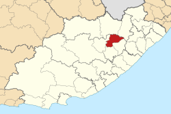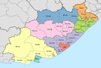
Inxuba Yethemba Municipality, formerly known as Cradock Municipality, is a local municipality within the Chris Hani District Municipality, in the Eastern Cape province of South Africa. The seat is Cradock.
Mbhashe Municipality is a local municipality in the Eastern Cape province of South Africa. The municipality was constituted in terms of the Municipal Structures Act of 1998 and comprises the areas that previously formed the Elliotdale, Willowvale and Dutywa town councils. The municipality is located in the north eastern part of the Amathole District Municipality. The main administrative office is situated in Dutywa.
Emthanjeni Municipality is a local municipality within the Pixley ka Seme District Municipality, in the Northern Cape province of South Africa. Emthanjeni is a Xhosa word meaning "vein", symbolising the importance of an underground water supply system to the area. It is also a translation of the name of the municipality's seat, De Aar.

Renosterberg Municipality is a local municipality within the Pixley ka Seme District Municipality, in the Northern Cape province of South Africa.

The City of Matlosana, formerly the City Council of Klerksdorp, is a local municipality within the Dr Kenneth Kaunda District Municipality, in the North West province of South Africa.

Kopanong Municipality is a local municipality within the Xhariep District Municipality, in the Free State province of South Africa. Kopanong is a Sesotho word meaning "meeting place or where people are invited". The name earmarks unity and seeks to encourage co-operation.

Umzimkhulu Municipality is a local municipality within the Harry Gwala District Municipality, in the KwaZulu-Natal province of South Africa. Umzimkhulu is an isiXhosa and isiZulu word meaning "big/great house". Prior to the Twelfth Amendment of the Constitution of South Africa in 2005, confirmed by the Thirteenth in 2007, it was part of the Eastern Cape.

Tswelopele Municipality is a local municipality within the Lejweleputswa District Municipality, in the Free State province of South Africa. Tswelopele is a Sesotho word meaning "progress".

Blue Crane Route Municipality is a local municipality within the Sarah Baartman District Municipality, in the Eastern Cape of South Africa. The municipality is named after the South African national bird, the blue crane.

Mnquma Municipality is a local municipality within the Amatole District Municipality, in the Eastern Cape of South Africa.

Letsemeng Municipality is a local municipality within the Xhariep District Municipality, in the Free State province of South Africa.

Emalahleni Municipality is a local municipality within the Chris Hani District Municipality, in the Eastern Cape province of South Africa. Emalahleni is an isiXhosa word meaning "a place of coal".
Great Kei Municipality is a local municipality within the Amathole District Municipality, in the Eastern Cape province of South Africa. The word Kei is of Khoekhoe origin, meaning "sand". The municipality is named after the Great Kei River.

Amahlathi Municipality is a local municipality within the Amatole District Municipality, in the Eastern Cape province of South Africa. Amahlati is an isiXhosa word meaning "a place where many trees are grouped together, a forest". Forests are a key feature of the area.
Ngqushwa Municipality is a local municipality within the Amatole District Municipality, in the Eastern Cape province of South Africa.

Umzimvubu Municipality is a local municipality within the Alfred Nzo District Municipality, in the Eastern Cape province of South Africa. Umzimvubu, the name of the Mzimvubu River, is an isiXhosa word meaning "home of the hippopotamus". The municipal area comprises an area of 2506 square kilometres. The municipality has undergone a number of amendments in terms of municipal and ward demarcation which has a profound impact on planning in the area.

Ntabankulu Municipality is a local municipality within the Alfred Nzo District Municipality, in the Wild Coast Region of the Eastern Cape province of South Africa. Ntabankulu is an isiXhosa word meaning "great or big mountain", since the municipal area is mountainous in character.

Dr AB Xuma Local Municipality is a local municipality within the Chris Hani District Municipality, in the Eastern Cape province of South Africa. Ngcobo is an isiXhosa word for a sweet grass found in the area.

Masilonyana Municipality is a local municipality within the Lejweleputswa District Municipality, in the Free State province of South Africa. Masilonyana is a Setswana word meaning "freedom".
Ingquza Hill Municipality, previously known as Qaukeni Municipality, is a local municipality within the OR Tambo District Municipality, in the Eastern Cape province of South Africa.
