Mnquma Local Municipality

Last updated

Mnquma
Mnquma CoA.png
Map of the Eastern Cape with Mnquma highlighted.svg
Location in the Eastern Cape
Country South Africa
Province Eastern Cape
District Amathole
Seat Butterworth
Wards 31
Government
[1]
  Type Municipal council
  MayorSithembiso Ncetezo (ANC)
  SpeakerThobeka Bikitsha (ANC)
  Chief WhipNomfundiso Tshona (ANC)
Area
  Total3,270 km2 (1,260 sq mi)
Population
 (2011) [2]
  Total252,390
  Density77/km2 (200/sq mi)
Racial makeup (2011)
[2]
   Black African 99.4%
   Coloured 0.2%
   Indian/Asian 0.1%
   White 0.2%
First languages (2011)
[2]
   Xhosa 96.1%
   English 1.4%
  Other2.5%
Time zone UTC+2 (SAST)
Municipal codeEC122

Mnquma Municipality (Xhosa : uMasipala wase Mnquma) is a local municipality within the Amatole District Municipality, in the Eastern Cape of South Africa.

Contents

Main places

The 2001 census divided the municipality into the following main places: [3]

PlaceCodeArea (km2)Population
Amabhele 21101 526.9532,672
Amahlubi 21102 631.5142,651
Amambalu 21103 21.211,562
Amazizi 21104 623.8754,406
Butterworth 21105 26.8845,900
Fingo 21106 105.706,481
Gcaleka 21107 61.935,898
Gqogqora 21108 39.392,302
Imidushane 21109 64.074,239
Jalamba 21110 90.717,795
Centane Part 1 21111 4.44784
Centane Part 2 21131 2.99528
Kwebulana 21112 9.66630
Lindinxiwa 21113 55.142,602
Mac Vigar 21114 134.746,410
Mazeppa Bay 21115 0.5742
Mazizini 21116 43.392,040
Mnquma 21117 56.03727
Mtoto 21118 52.884,260
Ngqwara 21119 193.3114,912
Ngubezulu 21120 17.931,793
Ngusi 21121 114.117,347
Nqadu 21122 3.71231
Nqamakwe 21123 16.091,405
Ntshatshongo 21124 0.720
Qolora Mouth 21126 0.3469
Qolora 21125 201.3920,265
Springs 21127 0.80116
Teko 21128 61.745,686
Tutura 21129 47.505,664
Tyhali 21130 113.688,359

Politics

The municipal council consists of sixty-three members elected by mixed-member proportional representation. Thirty-two councillors are elected by first-past-the-post voting in thirty-two wards, while the remaining thirty-one are chosen from party lists so that the total number of party representatives is proportional to the number of votes received. In the election of 1 November 2021 the African National Congress (ANC) won a majority of forty-five seats on the council. The following table shows the results of the election. [4]

PartyWardListTotal
seats
Votes%SeatsVotes%Seats
African National Congress 35,15070.003235,45870.581345
Economic Freedom Fighters 3,7667.5003,8457.6555
United Democratic Movement 3,6007.1703,8157.5955
Pan Africanist Congress of Azania 1,5793.1401,4232.8322
African Transformation Movement 1,1062.2001,1532.3022
Congress of the People 1,0202.0301,0832.1611
Democratic Alliance 9011.7909781.9511
Batho Pele Movement 9151.8208031.6011
Independent candidates 1,5063.0000
African Independent Congress 1380.2709141.8211
African People's Convention 1390.2802060.4100
African Democrats 1230.2401240.2500
African Christian Democratic Party 1020.2001090.2200
God Save Africa 810.1601140.2300
African Multicultural Economic Congress 650.1301140.2300
Independent South African National Civic Organisation 250.0501000.2000
Total50,216100.003250,239100.003163
Valid votes50,21698.2150,23998.07
Invalid/blank votes9151.799881.93
Total votes51,131100.0051,227100.00
Registered voters/turnout121,09942.22121,09942.30

Related Research Articles

<span class="mw-page-title-main">KwaDukuza Local Municipality</span> Local municipality in KwaZulu-Natal, South Africa

KwaDukuza Local Municipality is one of four municipalities under iLembe District Municipality, KwaZulu-Natal, South Africa.

<span class="mw-page-title-main">Emalahleni Local Municipality, Mpumalanga</span> Local municipality in Mpumalanga, South Africa

Emalahleni Municipality is a local municipality within the Nkangala District Municipality, in the Mpumalanga province of South Africa. eMalahleni is a Nguni word meaning place of coal.

<span class="mw-page-title-main">Moretele Local Municipality</span> Local municipality in North West, South Africa

Moretele Municipality is a local municipality within the Bojanala Platinum District Municipality, in the North West province of South Africa. As of 2011, its population was approximately 180,000, a majority of whom speak Setswana as a first language.

<span class="mw-page-title-main">Mogale City Local Municipality</span> Local municipality in Gauteng, South Africa

Mogale City Local Municipality is a local municipality within the West Rand District Municipality, in the Gauteng province of South Africa.

<span class="mw-page-title-main">Mogalakwena Local Municipality</span> Local municipality in Limpopo, South Africa

Mogalakwena Municipality is a local municipality within the Waterberg District Municipality, in the Limpopo province of South Africa. The seat is Mokopane.

<span class="mw-page-title-main">Thembisile Hani Local Municipality</span> Local municipality in Mpumalanga, South Africa

Thembisile Hani Municipality is a local municipality within the Nkangala District Municipality, in the Mpumalanga province of South Africa. It is a semi-urban local municipality consisting of 57 villages within which there are 5 established townships.

<span class="mw-page-title-main">Moses Kotane Local Municipality</span> Local municipality in North West, South Africa

Moses Kotane Municipality is a local municipality within the Bojanala Platinum District Municipality, in the North West province of South Africa. It is named in memory of Moses Kotane. The seat of the municipality is Mogwase.

<span class="mw-page-title-main">Mahikeng Local Municipality</span> Local municipality in North West, South Africa

Mahikeng Municipality is a local municipality within the Ngaka Modiri Molema District Municipality, in the North West province of South Africa. Mahikeng is a Setswana word meaning "place of rocks".

<span class="mw-page-title-main">King Sabata Dalindyebo Local Municipality</span> Local municipality in Eastern Cape, South Africa

King Sabata Dalindyebo Local Municipality is a municipality situated in the inland of Eastern Cape Province in South Africa. The municipality is made up of Mthatha and Mqanduli. The King Sabata Dalindyebo Local Municipality is one of the seven local municipalities within the Oliver Reginald Tambo District Municipality.

uMhlathuze Local Municipality Local municipality in KwaZulu-Natal, South Africa

uMhlathuze Local Municipality is an administrative area in the King Cetshwayo District Municipality of KwaZulu-Natal in South Africa. The municipality is named after the Mhlatuze River.

uMdoni Local Municipality Area in KwaZulu-Natal, South Africa

uMdoni Local Municipality is an administrative area in the Ugu District of KwaZulu-Natal in South Africa. Umdoni is an isiZulu name for the indigenous tree, Mdoni.

<span class="mw-page-title-main">Elundini Local Municipality</span> Local municipality in Eastern Cape, South Africa

Elundini Municipality is a local municipality within the Joe Gqabi District Municipality, in the Eastern Cape province of South Africa. The name originates from isiZulu and refers to the Drakensberg Mountains.

<span class="mw-page-title-main">Ngwathe Local Municipality</span> Local municipality in Free State, South Africa

Ngwathe Municipality is a local municipality within the Fezile Dabi District Municipality, in the Free State province of South Africa. Ngwathe is the Sesotho name for the Renoster River.

<span class="mw-page-title-main">Mtubatuba Local Municipality</span> Local municipality in KwaZulu-Natal, South Africa

Mtubatuba is an administrative area in the Umkhanyakude District of KwaZulu-Natal in South Africa.

<span class="mw-page-title-main">Amahlathi Local Municipality</span> Local municipality in Eastern Cape, South Africa

Amahlathi Municipality is a local municipality within the Amatole District Municipality, in the Eastern Cape province of South Africa. Amahlati is an isiXhosa word meaning "a place where many trees are grouped together, a forest". Forests are a key feature of the area.

uMlalazi Local Municipality Local municipality in KwaZulu-Natal, South Africa

uMlalazi Local Municipality is an administrative area in the King Cetshwayo District of KwaZulu-Natal in South Africa. The municipality is named after the uMlalazi River.

<span class="mw-page-title-main">Engcobo Local Municipality</span> Local municipality in Eastern Cape, South Africa

Engcobo Municipality is a local municipality within the Chris Hani District Municipality, in the Eastern Cape province of South Africa. Ngcobo is an isiXhosa word for a sweet grass found in the area.

uMfolozi Local Municipality Local municipality in KwaZulu-Natal, South Africa

uMfolozi Local Municipality is a local municipality within the King Cetshwayo District Municipality of KwaZulu-Natal in South Africa. It is situated around the town of KwaMbonambi, to the north of Richard's Bay, stretching from the Indian Ocean to the edge of the Hluhluwe–Imfolozi Park.

<span class="mw-page-title-main">Ingquza Hill Local Municipality</span> Local municipality in Eastern Cape, South Africa

Ingquza Hill Local Municipality, previously known as Qaukeni, is an administrative area in the OR Tambo District of Eastern Cape in South Africa.

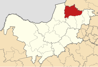
The Mnquma Local Municipality council consists of sixty-three members elected by mixed-member proportional representation. Thirty-two councillors are elected by first-past-the-post voting in thirty-two wards, while the remaining thirty-one are chosen from party lists so that the total number of party representatives is proportional to the number of votes received. In the election of 1 November 2021 the African National Congress (ANC) won a majority of forty-five seats.

References

  1. "Contact list: Executive Mayors". Government Communication & Information System. Archived from the original on 14 July 2010. Retrieved 22 February 2012.
  2. 1 2 3 "Statistics by place". Statistics South Africa. Retrieved 27 September 2015.
  3. Lookup Tables - Statistics South Africa
  4. "Election Result Table for LGE2021 — Mnquma". wikitable.frith.dev. Retrieved 12 February 2022.

32°19′S28°08′E / 32.317°S 28.133°E / -32.317; 28.133