Matatiele Local Municipality

Last updated

Matatiele
Matatiele CoA.png
Map of the Eastern Cape with Matatiele highlighted.svg
Location in the Eastern Cape
Coordinates: 32°10′S28°35′E / 32.167°S 28.583°E / -32.167; 28.583
Country South Africa
Province Eastern Cape
District Alfred Nzo
Seat Matatiele
Wards 26
Government
[1]
  Type Municipal council
  MayorSonwabile Mngenela (ANC) (ANC)
  SpeakerNomasomi Mshuqwana (ANC)
Area
  Total4,352 km2 (1,680 sq mi)
Population
 (2011) [2]
  Total203,843
  Density47/km2 (120/sq mi)
Racial makeup (2011)
   Black African 98.1%
   Coloured 0.9%
   Indian/Asian 0.3%
   White 0.7%
First languages (2011)
[2]
   Xhosa 57.4%
   Sotho 33.3%
   English 2.9%
   Zulu 1.9%
  Other4.5%
Time zone UTC+2 (SAST)
Municipal codeEC441

Matatiele Municipality (Xhosa : uMasipala wase Matatiele; Sotho : Masepala wa Matatiele) is a local municipality within the Alfred Nzo District Municipality, in the Eastern Cape province of South Africa. It adjoins Lesotho to the north, Elundini to the south-west, and Greater Kokstad to the east and its 4,352 km² makes the Matatiele Municipality largest of four municipalities in the district at almost half of its geographical area. According to the South African National Census of 2011, its 203,483 (46.84 per km²) residents and 49,527 (11.38 per km²) households makes Matatiele Municipality the second largest populated area in the Alfred Nzo District Municipality behind Mbizana.

Contents

Once dominated by dinosaurs, wetlands and marshes, Matatiele derives its name from a portmanteau word of the Sesotho words matata, meaning "wild ducks", and ile, meaning "gone", and the Phuthi language words mati meaning "water" and ayile meaning "dried out". When taken together, Matatiele conveys a message that "ducks have flown" because of a "dried out wetlands and marshes". [2] In Phuthi, the municipality is pronounced as Matatiyela. The common informal name in any of the languages mentioned, including English, is "Matat".

Today, the Matatiele Municipality is home to quaint towns, fertile farmlands, and rural villages scattered along its sparkling streams snuggled in the shadows of the Drakensberg Mountains. Route 56, known as the shortest and most scenic route between Cape Town in the Western Cape and Durban (South Africa's third largest city) in the province of KwaZulu-Natal, is the major arterial trade route that cuts through the heart of the Matatiele Municipality in an east-west direction.

Its main economic secotrs include community services (66.4%), trade (8.9%), finance, and agriculture.

Geography

The Matatiele Municipal District is mostly rural with the town of Matatiele serving as the main economic hub.

The area is located at the foothills of the Drakensberg Mountains. The settlement pattern is characterised by dispersed rural settlements surrounded by subsistence farmlands in the former Transkei region. The western parts of the area (commercial agricultural farms) form part of the high production potential land stretching from Matatiele and Kokstad in the south through the KwaZulu-Natal Midlands to the north-western parts of KwaZulu-Natal. The Matatiele Municipal district adjoins the World Heritage Site along its western boundary and was included in the Maloti-Drakensberg Transfrontier Conservation and Development Project (MDTP). The latter was a collaborative initiative between South Africa and the Kingdom of Lesotho to protect the exceptional biodiversity of the Drakensberg and Maloti Mountains through conservation, sustainable resource use, and land-use and development planning. [1]

Drakensberg Mountains have three passes that allow access from the Matatiele Municipal District to Lesotho. From west to east these are Ongeluksnek (4x4 only), then the bigger, more popular pass, which is Qachas Nek, but a little further to the east is the much more difficult and spectacular Ramatselitso Pass. All three passes end at the South Africa-Lesotho border posts of the same names and require a valid passport to cross. [4]

The Matatiele Nature Reserve is a core protected area within the Maloti Drakensberg Transfrontier Conservation Area. The north-eastern reserves reaches of the Eastern Cape near the border with KwaZulu-Natal. To the south is the town of Matatiele and to the north is the Drakensberg – the name given to the eastern portion of the Great Escarpment, which encloses the central Southern African plateau. Most of the reserve is pure grassland, although there is a meagre woodland and, along the high ridges and spurs, is the odd bit of scrub in amongst rocks and along drainage lines.

The Matatiele nature reserve was created to protect the important grasslands, wetlands and rare species of plants and includes bird-rich commonage and a wide valley known as the Cedarville Flats. It is the  only reserve to formally conserve the critically endangered Rudd's lark, which needs short, dense grass cover (usually no higher than 0.6 metres) to survive. It occurs in very few locations in South Africa. [5]

Main places

The 2011 census for the Matatiele Local Municipality states a population of 203,834 with these most populated main places: [3]

PlaceCodeArea (km2)PopulationMost spoken language
Cedarville 295185 12.44,412 Xhosa
Maluti 295117 4.217,223 Xhosa
Matatiele NU 295005 3,871.25,630 Xhosa
Matatiele 295171 11.212,466 Xhosa
Kgubetsoana 295094 5.633,761 Xhosa
Complete 2011 Census Data 295 4,352.31203,834 Xhosa

Politics

Municipal council

The municipal council consists of fifty-one members elected by mixed-member proportional representation. Twenty-six councillors are elected by first-past-the-post voting in twenty-six wards, while the remaining twenty-five are chosen from party lists so that the total number of party representatives is proportional to the number of votes received. In the election of 1 November 2021 the African National Congress (ANC) won a majority of forty seats on the council. The following table shows the results of the election. [4]

PartyWardListTotal
seats
Votes%SeatsVotes%Seats
African National Congress 36,87572.882736,98273.041340
Economic Freedom Fighters 6,03811.9305,95411.7677
Democratic Alliance 2,6165.1702,6405.2133
African Independent Congress 9591.9001,8013.5622
African Transformation Movement 8851.7508811.7411
United Democratic Movement 6601.3006681.3211
Independent candidates 1,1592.2900
9 other parties1,4032.7701,7073.3700
Total50,595100.002750,633100.002754
Valid votes50,59597.7050,63397.44
Invalid/blank votes1,1932.301,3282.56
Total votes51,788100.0051,961100.00
Registered voters/turnout99,23252.1999,23252.36

Conflict over provincial jurisdiction

The town of Matatiele was part of Cape Province until being transferred to Natal in 1978. In 2005, the municipality was moved from the KwaZulu-Natal province to the Eastern Cape as part of the Twelfth Amendment of the Constitution of South Africa, over the objections of the majority of residents, some of whom in response founded the African Independent Congress. On 18 August 2006 the Constitutional Court ruled that the part of the 12th Amendment dealing with the transfer of Matatiele from KwaZulu-Natal to the Eastern Cape was invalid due to insufficient consultation with stakeholders. [5] The situation was eventually resolved, and Matatiele was confirmed as part of Eastern Cape province under the 13th Amendment. [6]

Related Research Articles

<span class="mw-page-title-main">Geography of South Africa</span>

South Africa occupies the southern tip of Africa, its coastline stretching more than 2,850 kilometres from the desert border with Namibia on the Atlantic (western) coast southwards around the tip of Africa and then northeast to the border with Mozambique on the Indian Ocean. The low-lying coastal zone is narrow for much of that distance, soon giving way to a mountainous escarpment that separates the coast from the high inland plateau. In some places, notably the province of KwaZulu-Natal in the east, a greater distance separates the coast from the escarpment. Although much of the country is classified as semi-arid, it has considerable variation in climate as well as topography. The total land area is 1,220,813 km2 (471,359 sq mi). It has the 23rd largest Exclusive Economic Zone of 1,535,538 km2 (592,875 sq mi).

<span class="mw-page-title-main">KwaZulu-Natal</span> Province in South Africa

KwaZulu-Natal is a province of South Africa that was created in 1994 when the Zulu bantustan of KwaZulu and Natal Province were merged. It is located in the southeast of the country, with a long shoreline on the Indian Ocean and sharing borders with three other provinces and the countries of Mozambique, Eswatini and Lesotho. Its capital is Pietermaritzburg, and its largest city is Durban. It is the second-most populous province in South Africa, with slightly fewer residents than Gauteng.

<span class="mw-page-title-main">Drakensberg</span> Mountain range in South Africa

The Drakensberg is the eastern portion of the Great Escarpment, which encloses the central Southern African plateau. The Great Escarpment reaches its greatest elevation – 2,000 to 3,482 metres within the border region of South Africa and Lesotho.

<span class="mw-page-title-main">Maloti-Drakensberg Park</span> International park in Lesotho and South Africa

The Maloti-Drakensberg Park is a World Heritage Site, established on 11 June 2001 by linking the Sehlabathebe National Park in the Kingdom of Lesotho and the uKhahlamba Drakensberg Park in KwaZulu-Natal, South Africa. The highest peak is Thaba Ntlenyana rising to 3.482 m.

<span class="mw-page-title-main">Kokstad</span> A town in KwaZulu-Natal, South Africa

Kokstad is a town in the Harry Gwala District Municipality of KwaZulu-Natal Province, South Africa. Kokstad is named after the Griqua chief Adam Kok III who settled here in 1863. Kokstad is the capital town of the East Griqualand region, as it is also the biggest town in this region. It was built around Mount Currie, a local mountain range, by the city's founder Adam Kok III, for whom the town is named. Stad is the Dutch and Afrikaans word for "city".

Ezemvelo KZN Wildlife is a governmental organisation responsible for maintaining wildlife conservation areas and biodiversity in KwaZulu-Natal Province, South Africa. Their headquarters is in Queen Elizabeth Park situated on the northern slopes of Pietermaritzburg, the KwaZulu-Natal provincial capital. Prior to 1994, it was known as the Natal Parks Board.

KwaZulu-Natal is one of the most diverse provinces in South Africa in terms of its fauna and flora. Many of its wide variety of ecosystems have been preserved as parks and reserves, which are popular tourist attractions. Ezemvelo KZN Wildlife is a governmental agency that maintains the wildlife conservation areas in the province. 

<span class="mw-page-title-main">Matatiele</span> Place in Eastern Cape, South Africa

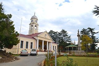
Matatiele is a town located in the northern part of the Eastern Cape Province of South Africa. According to the South African National Census of 2011, its 12,466 residents and 4,107 households make Matatiele the largest populated town in the Matatiele Local Municipality.

<span class="mw-page-title-main">Maloti Mountains</span> Mountain range in Lesotho

The Maloti Mountains are a mountain range of the highlands of the Kingdom of Lesotho. They extend for about 100 km into the South African Free State. The Maloti Range is part of the Drakensberg system that includes ranges across large areas of South Africa. “Maloti” is also the plural for Loti, the currency of the Kingdom of Lesotho. The range forms the northern portion of the boundary between the Butha-Buthe District in Lesotho and South Africa's Free State.

Maloti or Maluti may refer to:

Cedarville is a town in the Alfred Nzo District Municipality of Eastern Cape, South Africa.

uKhahlamba-Drakensberg Park Part of a world heritage site in KwaZulu-Natal, South Africa

The uKhahlamba-Drakensberg Park is a protected area in the KwaZulu-Natal province of South Africa, covering 2,428.13 km2 (938 sq mi), and is part of the Maloti-Drakensberg Park, a World Heritage Site. The park includes Royal Natal National Park, a provincial park, and covers part of the Drakensberg, an escarpment formation with the highest elevations in southern Africa.

<span class="mw-page-title-main">Twelfth Amendment of the Constitution of South Africa</span>

The Twelfth Amendment of the Constitution of South Africa altered the boundaries of seven of South Africa's nine provinces. It also redefined all of the provinces' geographical areas in terms of the areas of district and metropolitan municipalities, and repealed the provisions introduced by the Third Amendment that allowed municipal areas to cross provincial boundaries. A number of the boundary changes were highly controversial and led to popular protest and court challenges.

<span class="mw-page-title-main">Thirteenth Amendment of the Constitution of South Africa</span> Amendment of the South African constitution regarding provincial boundaries

The Thirteenth Amendment of the Constitution of South Africa re-enacted provisions of the Twelfth Amendment which the Constitutional Court ruled had not been validly enacted. These provisions transferred the Matatiele Local Municipality from KwaZulu-Natal province to the Eastern Cape province.

<span class="mw-page-title-main">Wolkberg</span>

The Wolkberg is a mountain range in Tzaneen, Limpopo Province, South Africa. It is a northern termination and a subrange of the Drakensberg mountain range which lines up from Eastern Cape, Lesotho, Kwazulu Natal and Mpumalanga. At 2200 m (7200 ft) above sea level, it is the highest mountain range in Limpopo, together with the Iron crown mountain. Its Meteorological significance is that it brings along cold fronts and is a source of cold winters throughout the Limpopo province, the cold front gets transferred from greater Drakensberg mountains in Kwazulu Natal all the way to the Wolkberg. Without the Wolkberg, Limpopo will not experience cold winters at all. The range extends for about 30 km (19 mi) in a NW/SE direction north of Sekhukhuneland. The nearest towns are Haenertsburg and Tzaneen.

Maloti,, is a middle-class township of Matatiele Local Municipality in Alfred Nzo District Municipality in the Eastern Cape province of South Africa.

The following index is provided as an overview of and topical guide to the protected areas of South Africa:

Ntsikeni Wildlife Reserve, in Griqualand East, is the largest wetland and one of the highest above sea level in South Africa.

<i>Dianthus basuticus</i> Species of plant in the genus Dianthus

Dianthus basuticus, called the Drakensberg carnation, Lesotho carnation, Lesotho pink, hlokoa‑la‑tsela in the Sesotho language and Lesothose wilde angelier in Afrikaans, is a species of Dianthus native to South Africa and Lesotho.

References

  1. "Contact list: Executive Mayors". Government Communication & Information System. Archived from the original on 14 July 2010. Retrieved 22 February 2012.
  2. 1 2 "Statistics by place". Statistics South Africa. Retrieved 27 September 2015.
  3. "Census 2011: Local Municipality: Matatiele". census2011.adrianfrith.com. Retrieved 13 August 2020.
  4. "Election Result Table for LGE2021 — Matatiele". wikitable.frith.dev. Retrieved 26 December 2021.
  5. "Matatiele redemarcation invalid: South Africa: Politics: News24". Archived from the original on 30 September 2007. Retrieved 19 July 2007.
  6. "Archived copy" (PDF). Archived from the original (PDF) on 5 July 2021. Retrieved 8 August 2020.{{cite web}}: CS1 maint: archived copy as title (link)