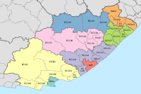
Mbhashe Local Municipality

Last updated

Mbhashe
Mbhashe CoA.png
Map of the Eastern Cape with Mbhashe highlighted.svg
Location in the Eastern Cape
Coordinates: 32°10′S28°35′E / 32.167°S 28.583°E / -32.167; 28.583
Country South Africa
Province Eastern Cape
District Amathole
Seat Dutywa
Wards 31
Government
[1]
  Type Municipal council
  MayorSamkelo Nicholas Janda (ANC)
  SpeakerBabalwa Majavu (ANC)
  Chief WhipMandla Sibingibingi (ANC)
Area
  Total3,169 km2 (1,224 sq mi)
Population
 (2011) [2]
  Total254,909
  Density80/km2 (210/sq mi)
Racial makeup (2011)
[2]
   Black African 99.4%
   Coloured 0.1%
   Indian/Asian 0.1%
   White 0.2%
First languages (2011)
[2]
   Xhosa 95.7%
   English 1.6%
  Other2.7%
Time zone UTC+2 (SAST)
Municipal codeEC121

Mbhashe Municipality (Xhosa : uMasipala wase Mbhashe) is a local municipality in the Eastern Cape province of South Africa. The municipality was constituted in terms of the Municipal Structures Act of 1998 and comprises the areas that previously formed the Elliotdale, Willowvale and Dutywa town councils. The municipality is located in the north eastern part of the Amathole District Municipality. The main administrative office is situated in Dutywa.

Contents

Its primary claim to fame is as the birthplace of former President Thabo Mbeki. The Mbanyana Falls, Mbhashe Cultural Village and Donald Wood's Snooker Room number among its attractions. [3] The word Mbashe is derived from isiXhosa. The municipality is named after the Mbashe River. [4] The area also boasts the head offices of the AmaXhosa Kingdom at the Nqadu Great Place.

Main places

The 2001 census divided the municipality into the following main places: [5]

PlaceCodeArea (km2)Population
Bashee 21001 213.8213,524
Bonkolo 21002 158.199,394
Cizela 21003 143.928,903
Ebongweni 21004 19.861,223
Ebotwe 21005 771.8049,869
Elliotdale 21006 8.211,012
Emvelini 21007 177.4417,348
Gcaleka-Ngchana 21008 146.5011,403
Hala 21009 22.361,442
Idutywa Part 1 21010 275.9728,957
Idutywa Part 2 21019 9.194,828
Jalamba 21011 277.4731,914
Kwamkoloza 21012 306.8718,655
Mpeko 21013 2.140
Ngqwangele 21014 105.6312,998
Ngubezulu 21015 238.1027,130
Ntonga 21016 101.368,466
Ntshatshongo 21017 48.533,779
Willowvale 21018 5.542,546

Politics

The municipal council consists of sixty-three members elected by mixed-member proportional representation. Thirty-two councillors are elected by first-past-the-post voting in thirty-two wards, while the remaining thirty-one are chosen from party lists so that the total number of party representatives is proportional to the number of votes received. In the election of 1 November 2021 the African National Congress (ANC) won a majority of forty-five seats on the council. The following table shows the results of the election. [6]

PartyWardListTotal
seats
Votes%SeatsVotes%Seats
African National Congress 36,73466.493039,02871.591545
United Democratic Movement 6,36111.5117,36813.5278
Economic Freedom Fighters 3,0415.5003,3866.2144
Independent candidates 5,4399.8511
African Transformation Movement 1,1222.0301,1862.1811
Democratic Alliance 8091.4607711.4111
Batho Pele Movement 5541.0005961.0911
Alliance for Transformation for All 2870.5206141.1311
Pan Africanist Congress of Azania 2920.5304150.7611
African Democrats 1920.3504100.7500
African People's Convention 1950.3501910.3500
Congress of the People 630.1103220.5900
Al Jama-ah 1550.280880.1600
Power of Africans Unity 00.0001420.2600
Total55,244100.003254,517100.003163
Valid votes55,24497.6454,51796.78
Invalid/blank votes1,3342.361,8133.22
Total votes56,578100.0056,330100.00
Registered voters/turnout122,43346.21122,43346.01

Related Research Articles

<span class="mw-page-title-main">Ndlambe Local Municipality</span> Local municipality in Eastern Cape, South Africa

Ndlambe Municipality is a local municipality within the Sarah Baartman District Municipality, in the Eastern Cape of South Africa. Its capital is Port Alfred. It is a predominantly rural area with agriculture and tourism dominating the economy.

<span class="mw-page-title-main">Nyandeni Local Municipality</span> Local municipality in Eastern Cape, South Africa

Nyandeni Municipality is a local municipality within the OR Tambo District Municipality, in the Eastern Cape province of South Africa. Its administrative seat is the town of Libode. The entire municipal area falls within the former Transkei Bantustan area. The urban population is mainly located in the two small towns of Libode and Ngqeleni.
<span class="mw-page-title-main">Winnie Madikizela-Mandela Local Municipality</span> Local municipality in Eastern Cape, South Africa

Winnie Madikizela-Mandela Municipality, formerly Mbizana Municipality, is a local municipality within the Alfred Nzo District Municipality, in the Wild Coast Region of the Eastern Cape province of South Africa. It is named after Winnie Madikizela-Mandela, an anti-apartheid activist and wife of President Nelson Mandela.

<span class="mw-page-title-main">City of Matlosana</span> Local municipality in North West, South Africa

The City of Matlosana, formerly the City Council of Klerksdorp, is a local municipality within the Dr Kenneth Kaunda District Municipality, in the North West province of South Africa.

<span class="mw-page-title-main">King Sabata Dalindyebo Local Municipality</span> Local municipality in Eastern Cape, South Africa

King Sabata Dalindyebo Municipality is a local municipality situated in the inland of the Eastern Cape province of South Africa. The municipality includes the towns of Mthatha and Mqanduli. The King Sabata Dalindyebo Municipality is one of the seven local municipalities within the OR Tambo District Municipality.

<span class="mw-page-title-main">Umzimkhulu Local Municipality</span> Local municipality in KwaZulu-Natal, South Africa

Umzimkhulu Municipality is a local municipality within the Harry Gwala District Municipality, in the KwaZulu-Natal province of South Africa. Umzimkhulu is an isiXhosa and isiZulu word meaning "big/great house". Prior to the Twelfth Amendment of the Constitution of South Africa in 2005, confirmed by the Thirteenth in 2007, it was part of the Eastern Cape.

<span class="mw-page-title-main">Blue Crane Route Local Municipality</span> Local municipality in Eastern Cape, South Africa

Blue Crane Route Municipality is a local municipality within the Sarah Baartman District Municipality, in the Eastern Cape of South Africa. The municipality is named after the South African national bird, the blue crane.

<span class="mw-page-title-main">Elundini Local Municipality</span> Local municipality in Eastern Cape, South Africa

Elundini Municipality is a local municipality within the Joe Gqabi District Municipality, in the Eastern Cape province of South Africa. The name originates from isiZulu and refers to the Drakensberg Mountains.

<span class="mw-page-title-main">Mnquma Local Municipality</span> Local municipality in Eastern Cape, South Africa

Mnquma Municipality is a local municipality within the Amatole District Municipality, in the Eastern Cape of South Africa.

<span class="mw-page-title-main">Emalahleni Local Municipality, Eastern Cape</span> Local municipality in Eastern Cape, South Africa

Emalahleni Municipality is a local municipality within the Chris Hani District Municipality, in the Eastern Cape province of South Africa. Emalahleni is an isiXhosa word meaning "a place of coal".

<span class="mw-page-title-main">Amahlathi Local Municipality</span> Local municipality in Eastern Cape, South Africa

Amahlathi Municipality is a local municipality within the Amatole District Municipality, in the Eastern Cape province of South Africa. Amahlati is an isiXhosa word meaning "a place where many trees are grouped together, a forest". Forests are a key feature of the area.
<span class="mw-page-title-main">Ngqushwa Local Municipality</span> Local municipality in Eastern Cape, South Africa

Ngqushwa Municipality is a local municipality within the Amatole District Municipality, in the Eastern Cape province of South Africa.

<span class="mw-page-title-main">Umzimvubu Local Municipality</span> Local municipality in Eastern Cape, South Africa

Umzimvubu Municipality is a local municipality within the Alfred Nzo District Municipality, in the Eastern Cape province of South Africa. Umzimvubu, the name of the Mzimvubu River, is an isiXhosa word meaning "home of the hippopotamus". The municipal area comprises an area of 2506 square kilometres. The municipality has undergone a number of amendments in terms of municipal and ward demarcation which has a profound impact on planning in the area.

<span class="mw-page-title-main">Ntabankulu Local Municipality</span> Local municipality in Eastern Cape, South Africa

Ntabankulu Municipality is a local municipality within the Alfred Nzo District Municipality, in the Wild Coast Region of the Eastern Cape province of South Africa. Ntabankulu is an isiXhosa word meaning "great or big mountain", since the municipal area is mountainous in character.
<span class="mw-page-title-main">Nkonkobe Local Municipality</span> Former local municipality in Eastern Cape, South Africa

Nkonkobe Local Municipality was an administrative area in the Amatole District of the Eastern Cape in South Africa. The municipality is named after the Winterberg mountain range, Nkonkobe in isiXhosa. The seat, as well as most offices, of the Municipality are in Fort Beaufort, but the Council's chambers in Alice are generally used for council meetings, being better equipped. Other towns served by the municipality are Seymour, Balfour, Hogsback and Middledrift. After municipal elections on 3 August 2016 it was merged into the larger Raymond Mhlaba Local Municipality.

<span class="mw-page-title-main">Sakhisizwe Local Municipality</span> Local municipality in Eastern Cape, South Africa

Sakhisizwe Municipality is a local municipality within the Chris Hani District Municipality, in the Eastern Cape province of South Africa. Sakhisizwe is an isiXhosa word meaning "we are building the nation".

<span class="mw-page-title-main">Dr AB Xuma Local Municipality</span> Local municipality in Eastern Cape, South Africa

Dr AB Xuma Local Municipality is a local municipality within the Chris Hani District Municipality, in the Eastern Cape province of South Africa. Ngcobo is an isiXhosa word for a sweet grass found in the area.
<span class="mw-page-title-main">Senqu Local Municipality</span> Local municipality in Eastern Cape, South Africa

Senqu Municipality is a local municipality within the Joe Gqabi District Municipality, in the Eastern Cape province of South Africa. Senqu is the Sesotho name for the Orange River.
<span class="mw-page-title-main">Ingquza Hill Local Municipality</span> Local municipality in Eastern Cape, South Africa

Ingquza Hill Municipality, previously known as Qaukeni Municipality, is a local municipality within the OR Tambo District Municipality, in the Eastern Cape province of South Africa.

<span class="mw-page-title-main">Walter Sisulu Local Municipality</span> Local municipality in Eastern Cape, South Africa

Walter Sisulu Municipality is a local municipality within the Joe Gqabi District Municipality, in the Eastern Cape province of South Africa. The municipality was formed by merging the Maletswai and Gariep local municipalities immediately after the August 2016 local municipal elections.

References

  1. "Contact list: Executive Mayors". Government Communication & Information System. Archived from the original on 14 July 2010. Retrieved 22 February 2012.
  2. 1 2 3 "Statistics by place". Statistics South Africa. Retrieved 27 September 2015.
  3. Mbhashe Municipality Archived 7 October 2007 at the Wayback Machine
  4. South African Languages - Place names
  5. Lookup Tables - Statistics South Africa [ permanent dead link ]
  6. "Election Result Table for LGE2021 — Mbhashe". wikitable.frith.dev. Retrieved 6 February 2022.