Westonaria is a town in the west of Gauteng province of South Africa. It is situated in the Rand West City Local Municipality, part of the West Rand District Municipality. During the apartheid era, Africans lived outside town in Bekkersdal. The town is some 45 km west of Johannesburg and 18 km south of Randfontein.

Ermelo is the educational, industrial and commercial town of the 7,750 km2 Gert Sibande District Municipality in Mpumalanga province, Republic of South Africa. It is both a mixed agriculture and mining region. It is located 210 km east of Johannesburg.
Ndabeni is an industrial suburb of Cape Town, South Africa, mainly occupied by light industries such as textiles and clothing. It is located about 6 km east of Cape Town city centre and is serviced by a railway station. Ndabeni is bordered to the south east by Pinelands and to the north by Maitland. Its postcode is 7405.
Mbhashe Municipality is a local municipality in the Eastern Cape province of South Africa. The municipality was constituted in terms of the Municipal Structures Act of 1998 and comprises the areas that previously formed the Elliotdale, Willowvale and Dutywa town councils. The municipality is located in the north eastern part of the Amathole District Municipality. The main administrative office is situated in Dutywa.
Porterville is a town in the Western Cape province of South Africa.

Prieska is a town on the south bank of the Orange River, in the province of the Northern Cape, in western South Africa. It is located on the southern bank of the Orange River, 130 km north-west of Britstown and 75 km south-east of Marydale.
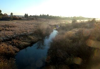
The Wilge River (iKuthu) is a river in Mpumalanga and Gauteng provinces, South Africa. It is a tributary of the Olifants River.
Bothasig is a suburban area of the City of Cape Town in Western Cape, South Africa. It is located north of Edgemead and east of Milnerton. It is located approximately 15 km north-east of the Cape Town city centre.
Mqanduli is a town in OR Tambo District Municipality in the Eastern Cape province of South Africa.

Elsburg is a town in Ekurhuleni in the Gauteng province of South Africa. It is a town some 6 km south-east of Germiston.
Mbhashe River is one of the major rivers in the Eastern Cape Province, South Africa. It flows in a southeastern direction and has a catchment area of 6,030 km2. The river drains into the Indian Ocean through an estuary located near the lighthouse at Bashee, south of Mhlanganisweni.

Strandfontein is a seaside resort 8 km east of Muizenberg and just west of Michells Plain, on the northern shore of False Bay in the City of Cape Town municipality in the Western Cape province of South Africa.
Faure is a hamlet some 16 km south-west of Stellenbosch and 13 km north-west of Strand. Administratively it is a suburb of the City of Cape Town, and is in the Helderberg region. Nearby is the kramat or tomb of Sheik Yusuf (1626-1699), an Islamic expatriate priest. Faure is a common surname; it is uncertain after whom this place was named. It may have been named after Pieter Faure, the name of South Africa's first trawler which arrived in Table Bay in 1897.

Philadelphia is a village in the Western Cape province of South Africa.
The Sanlam Cape Town Marathon is a City Marathon (42.2 km) held in Cape Town, South Africa, first held in its current form in 2007. Available distances include the marathon, a 10K, a 5K, and two trail runs of length 22 km and 12 km. The marathon is held on a fast and flat course, starting and finishing in Green Point, near the Cape Town Stadium.
Maj. Sir Henry George Elliot, was a Canadian-born soldier and administrator, and Chief Magistrate of the Tembuland territories in South Africa from 1891 to 1902. He was a son of Maj. J. F. Elliot.
Talboton is a suburb of Johannesburg, South Africa, around 7 km northeast of City Hall.
Wanderers View is a suburb of Johannesburg, South Africa, about 1.2 km north of City Hall.
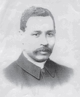
William Anderson Soga was the first black African to qualify with an MBCM in 1883 and the first black African medical doctor to practise in South Africa, as well as being the first black African to obtain a doctorate MD. His thesis titled "The ethnology of the Bomvanas of Bomvanaland, an aboriginal tribe in South East Africa, with observations upon the climate and diseases of the country, and the methods of treatment in use among the people" was completed at the University of Glasgow in 1895. He was also ordained as a minister in the United Presbyterian Church 1885 making him one of the first medical missionaries in South Africa. Soga was involved in the running of mission stations, building churches, diagnosis and treatment of patients, research and writing.


